
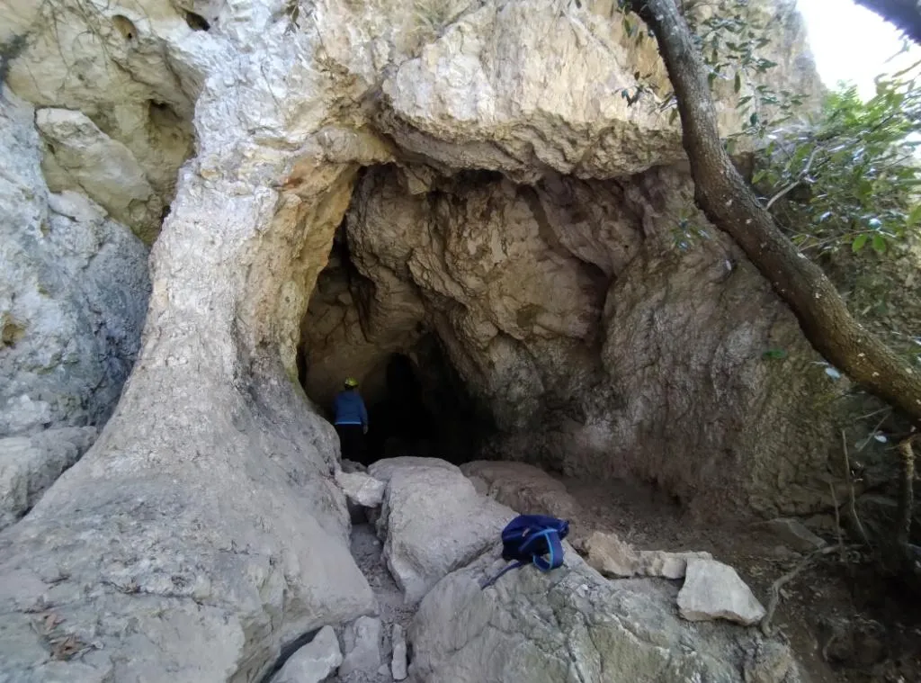
Grotta del Forello
Cave with a predominantly horizontal development on two sub-horizontal branches overlooking the right bank of the Fiume Tevere, with three entrances and one branch ending in a 7 m shaft toward the outside.
EspeleoWorld
Grotta del Forello
Cave with a predominantly horizontal development on two sub-horizontal branches overlooking the right bank of the Fiume Tevere, with three entrances and one branch ending in a 7 m shaft toward the outside.
Orvieto
Longueur: 80 m · Profondeur: 10 m
Fiche actualisée
https://espeleoworld.com/fr/c/grotta-del-forello-orvieto-terni
Les informations peuvent changer. Vérifiez toujours les coordonnées, l'accès, la météo et l'état de la cavité avant de partir.
Cave with a predominantly horizontal development on two sub-horizontal branches overlooking the right bank of the Fiume Tevere, with three entrances and one branch ending in a 7 m shaft toward the outside.
Photos

© Mauro Barbieri · LicenseRef-FUGS-media-per-item · Federazione Umbra Gruppi Speleologici (FUGS), Catasto Speleologico dell'Umbria · https://catasto.fugs.it/index.php?mod=caves&op=view&id=225
Description
Morphologie
Cave that develops in two sub-horizontal branches overlooking the right bank of the Fiume Tevere. One of the two branches ends with a 7 m shaft that leads to the outside. Trend: predominantly horizontal.
Geology: SAA Scaglia Rossa - Upper Cretaceous-Middle Eocene (Turonian-Lutetian); stratified micritic limestones; stratified; the cavity is developed along two systems of sub-parallel fractures oriented WSW and ENE along which percolation waters acted by corrosion and the waters of the Tevere by erosion. Because of this, the sections of the gallery and of the entrance halls are sub-elliptical and the floor is, in the entrance halls and generally in the lower part of the cavity, sandy and earthy. On the walls of the main entrance hall particular erosional forms can be observed: various rock blades are crossed by channel-like perforations with a sub-elliptical or circular section with a diameter of several centimetres. The shaft instead opened by collapse at rocks weathered by solution; thus the characteristic debris cone was formed, here transformed into a cone.
Spéléothèmes
Speleothems almost non-existent.
Hydrologie
The cave is absolutely dry.
Progression
Traversability: easy; recommended period all year. Rigging: other; presence of traverses and handrails that are tackled by hand. Progression difficulty: drops, slides, narrow passages, traverses. Hazards: dangerous access, landslides/collapses.
Autres détails
Of palethnological interest. Finds: palethnological.
Histoire
Archaeology and palethnology: two excavation works were carried out in the cave by the University of Florence, in the floor of the main entrance hall. The finds would consist of animal bones, worked flints, pottery of various types. Prof. Graziosi, invited by the Principi Corsini (the owner of the estate at the time), carried out the excavations; the material found is now in the possession of the aforementioned Principi (Passeri 1965).
Studies: palethnological.
Commentaires des utilisateurs (0)
Aucun commentaire pour le moment.
Soyez le premier à partager votre expérience !
Explorations enregistrées (0)
Aucune exploration enregistrée pour le moment.
Enregistrez votre visite dans cette cavité !
Grottes à proximité
Source : Catasto Cavità Umbria (Federazione Umbra Gruppi Speleologici, FUGS) (catasto.fugs.it), avec modifications. LicenseRef-FUGS-no-licence-stated Federazione Umbra Gruppi Speleologici (FUGS), Catasto Speleologico dell'Umbria · https://catasto.fugs.it/index.php?mod=caves&op=view&id=225 · données de 2025 · Source : Catasto Cavità Umbria (Federazione Umbra Gruppi Speleologici, FUGS) (catasto.fugs.it), avec modifications. LicenseRef-FUGS-media-per-item Federazione Umbra Gruppi Speleologici (FUGS), Catasto Speleologico dell'Umbria · données de 2025