
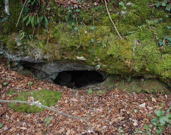
Buche del Vento
A cave with horizontal development and easy traversability, whose entrance is a fissure through which, descending a small drop, one enters the section cleared over the years by the Gruppo Speleologico Todi.
EspeleoWorld
Buche del Vento
A cave with horizontal development and easy traversability, whose entrance is a fissure through which, descending a small drop, one enters the section cleared over the years by the Gruppo Speleologico Todi.
Baschi
Longueur: 15 m · Profondeur: 4 m
Fiche actualisée
https://espeleoworld.com/fr/c/buche-del-vento-baschi-terni
Les informations peuvent changer. Vérifiez toujours les coordonnées, l'accès, la météo et l'état de la cavité avant de partir.
A cave with horizontal development and easy traversability, whose entrance is a fissure through which, descending a small drop, one enters the section cleared over the years by the Gruppo Speleologico Todi.
Photos

© Gruppo Speleologico Todi · LicenseRef-FUGS-media-per-item · Federazione Umbra Gruppi Speleologici (FUGS), Catasto Speleologico dell'Umbria · https://catasto.fugs.it/index.php?mod=caves&op=view&id=1023
Description
Morphologie
The entrance is a natural fissure; descending a small drop, one enters the internal route. Trend: horizontal.
Progression
From the narrow passage one descends a small drop and enters the section cleared over the years by the Gruppo Speleologico Todi. Traversability: easy; recommended period: all year.
Autres détails
The first clearing operations took place in the years 1979-1980 with the collaboration of two "clearing" speleologists from Sarteano. From the cavity, hence the name, a strong draft of air blows, channeled into small conduits.
Histoire
The place name, already present in IGM cartography, has always been known to the local inhabitants. The path was in fact frequented because it allowed one to reach the sanctuary of the Pasquarella.
Commentaires des utilisateurs (0)
Aucun commentaire pour le moment.
Soyez le premier à partager votre expérience !
Explorations enregistrées (0)
Aucune exploration enregistrée pour le moment.
Enregistrez votre visite dans cette cavité !
Grottes à proximité
Source : Catasto Cavità Umbria (Federazione Umbra Gruppi Speleologici, FUGS) (catasto.fugs.it), avec modifications. LicenseRef-FUGS-no-licence-stated Federazione Umbra Gruppi Speleologici (FUGS), Catasto Speleologico dell'Umbria · https://catasto.fugs.it/index.php?mod=caves&op=view&id=1023 · données de 2025 · Source : Catasto Cavità Umbria (Federazione Umbra Gruppi Speleologici, FUGS) (catasto.fugs.it), avec modifications. LicenseRef-FUGS-media-per-item Federazione Umbra Gruppi Speleologici (FUGS), Catasto Speleologico dell'Umbria · données de 2025