
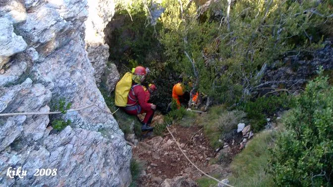
Grallera Gran del Corralot
A cavity 166 metres deep in the Montsec d'Ares, Sant Esteve de la Sarga, with two entrances, several routes and a rich history of explorations.
EspeleoWorld
Grallera Gran del Corralot
A cavity 166 metres deep in the Montsec d'Ares, Sant Esteve de la Sarga, with two entrances, several routes and a rich history of explorations.
Sant Esteve de la Sarga · Pallars Jussà
Length: 1977 m · Depth: 166 m
Updated record
https://espeleoworld.com/en/c/grallera-gran-del-corralot
Information can change. Always verify coordinates, access, weather, and cave conditions before setting out.
A cavity 166 metres deep in the Montsec d'Ares, Sant Esteve de la Sarga, with two entrances, several routes and a rich history of explorations.
Topographic
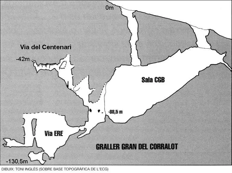

Espeleoindex · CC BY-NC 4.0, https://creativecommons.org/licenses/by-nc/4.0/ · Image © its author.
Photos

Espeleoindex · CC BY-NC 4.0, https://creativecommons.org/licenses/by-nc/4.0/ · Image © its author.
Description
Morphology
The Grallera has two entrances that give directly onto the Sala C.G.B. The upper mouth gives onto a 90 metre pitch, the final half of which is free-hanging. Through the lower mouth access is gained by means of a -33.5 metre pitch to the upper part of the room. The Sala CGB is located at -96.5 metres: at the base of the 33.5 metre pitch a steeply sloping ramp begins with accumulations of clay and guano; shortly after starting the ramp, on the left we find a passage with some large gours that ends after a few metres. Continuing down the ramp we come across the accesses to the different routes of the cavity, which except for the ERE route, the rest are located on the right; we also observe various stalagmitic massifs and large flows. The room has a floor area of 105X50 metres. The lowest point is located at -96.5 metres.
SAS route -137.5 metres: located to the N of the room, to the W and parallel to the gallery where the lower mouth is found and above the Primer Dia route. It begins with a large gallery 15X20 metres, with large blocks that come to form a small chamber below, located in the highest part and descending among rubble; the gallery seems to end in an ascending ramp obstructed by flows, but a little before a low passage allows access to a -10 metre pitch with a wide ledge in the middle. Another passage places us on a ramp with mud and unstable blocks that shortly reaches an 8 metre drop, placing us in a small room from which the last -16 metre pitch emerges that will take us to the final ramp.
Última route -104 metres: its start is to the W and a few metres from the SAS route, just past a large block. It begins with a steep slope that on finishing places us before a crawl; once passed we must climb a steep slope that ends in a chimney that communicates with the gallery through which we entered; a few metres before, the gallery continues through a descending stretch, where at the end there is a -8 metre drop that gives onto a small ledge with a pitch on each side; both communicate 10 metres further down, where a strong ramp begins interrupted by a 12 metre drop that will take us to the lowest point.
Primer Dia route -114 metres: located to the NW of the room, between the SAS route and the Llac route, it begins in a wide room in the form of a portico with the floor full of blocks and concretions. At the back and at 2 metres height we find a narrow passage among flows that leads us to another room full of gours and formations; the continuation is on the N side where we find an ascending ramp; halfway along it and on the left we find the access to a -10 metre pitch; at the base of this we find a new room with plenty of formation; on the NW side a gallery that descends steeply places us in a new room where we find a temporary lake. From its end two galleries emerge; the left one ends at 40 metres while the other will place us at the deepest point of the route after having climbed a strong ascending ramp that we will have to descend on the other side among a pile of blocks.
Llac route -166.5 metres: it is the deepest route of the cavity; it is located to the W of the room and some 15 metres below the Primer Dia route, in a relatively flat stretch and attached to the wall, with a ramp of blocks that must be climbed to reach the first pitch of the route of -10 metres vertical, which gives onto a ledge where on one side a 15 metre pitch opens and on the other a strong descending slope, although both are found further down; immediately afterwards we find a new drop of 10 metres that leads to a room 40 metres in diameter and with a steeply sloping floor; at the lowest point of the room and among blocks we will access a clastic chaos that will allow us to descend the rest of the route without equipment, seeking the appropriate passages, the last one quite narrow, which places us in a wide gallery with a strong stepped slope that will take us to the temporary lake, this being the lowest point of the cavity.
ERE route -130.5 metres: located at the back of the room, we must climb a ramp of blocks up to a narrow passage that precedes a -6 metre drop; there follows a gallery of some 20 metres that ends filled by sediments. A little before, we must traverse until reaching a passage among flows that gives onto a small corridor that widens considerably once a descending drop is passed. There follows a strong concretion-covered ramp; near its lowest point a short crawl opens that allows us to access a chamber with a lot of mud, where the maximum depth of the route is reached. If instead of passing the crawl we climb a ramp in an S direction, we will immediately be on a platform from which we will observe the continuation of the gallery above some flows; we will have to make a 5 metre climb to access it, placing ourselves at the top of an 8 metre drop; once at the base it is still possible to continue along a gallery for 35 metres where we find clear signs of water levels.
Centenari route -42 metres: the route begins at the very start of the ERE route, so we must position ourselves above the entrance drop (p-6). We ascend until we are on top of a rock bridge, where we must begin an opposing traverse, which leaves us on a second rock bridge. Here begins the really ascending part; there are three important drops, separated by quite steep and at times slippery ramps. Worth noting as a negative part is the Dani-ficat passage, to whose narrowness must be added a slippery surface and the impossibility of bridging comfortably. Once at the top we access a gallery of some twenty metres with plenty of formation that ends in an upper narrow passage. Before the end and on the right we find a descending branch of similar characteristics.
CDR route 18 metres: it begins at the start of the ERE route on an upper level, and just below the start of the Centenari route; it is a short gallery that ends up flowing into the ERE route on an upper level.
GEB route: to access it we must position ourselves on the E wall of the Sala Gran and climb up a fixed rope (if installed); if not we must climb some 10 metres, followed by fractioning along a flow, and a sandy wall that crumbles with some ease, and finally we must skirt another flow, keeping the Sala Gran at our back the whole time. Once here, a crawl goes into a very pretty white room, with a very shiny formation in the middle. Through a small gallery, among blocks, we reach another small room. The whole of this new route has a length of 350 metres.
Speleothems
In the Sala CGB various stalagmitic massifs and large flows are observed. In the Primer Dia route there is a room full of gours and formations, and another room with plenty of formation. The ERE route has a strong concretion-covered ramp and flows. The Centenari route has a gallery with plenty of formation. The GEB route has a very shiny formation in the middle of a white room.
Hydrology
In the Primer Dia route there is a temporary lake. The lowest point of the cavity is the temporary lake of the Llac route. In the ERE route, in a 35 metre gallery, clear signs of water levels are found.
Progression
The Grallera has two entrances that give directly onto the Sala C.G.B. The upper mouth gives onto a 90 metre pitch, the final half of which is free-hanging. Through the lower mouth access is gained by means of a -33.5 metre pitch to the upper part of the room. At the base of the 33.5 metre pitch a steeply sloping ramp begins with accumulations of clay and guano. Continuing down the ramp we reach the accesses of the different routes.
SAS route -137.5 metres: it begins with a large gallery 15X20 metres, with large blocks; descending among rubble, a low passage allows access to a -10 metre pitch with a wide ledge in the middle. Another passage places us on a ramp with mud and unstable blocks that reaches an 8 metre drop, and from there to a small room from which the last -16 metre pitch emerges that leads to the final ramp.
Última route -104 metres: it begins with a steep slope that ends before a crawl; once passed, we must climb a steep slope that ends in a chimney that communicates with the entrance gallery; a descending stretch leads to a -8 metre drop that gives onto a small ledge with a pitch on each side, which communicate 10 metres further down, where a strong ramp begins interrupted by a 12 metre drop to the lowest point.
Primer Dia route -114 metres: it begins in a wide room in the form of a portico; at the back and at 2 metres height a narrow passage among flows leads to another room; the continuation is on the N side with an ascending ramp; halfway along and on the left there is the access to a -10 metre pitch; at the base, a new room; on the NW side a gallery descends steeply to a room with a temporary lake; from the end two galleries emerge, the left one ends at 40 metres and the other leads to the deepest point of the route after climbing a strong ascending ramp that must be descended on the other side among blocks.
Llac route -166.5 metres: it is the deepest route; to the W of the room and some 15 metres below the Primer Dia route, with a ramp of blocks that must be climbed to reach the first -10 metre pitch, which gives onto a ledge where a 15 metre pitch opens and a strong descending slope; a new drop of 10 metres leads to a room 40 metres in diameter; at the lowest point, among blocks, a clastic chaos allows descending the rest of the route without equipment, the last passage quite narrow, to a wide gallery with a strong stepped slope that leads to the temporary lake, the lowest point of the cavity.
ERE route -130.5 metres: we must climb a ramp of blocks up to a narrow passage that precedes a -6 metre drop; there follows a gallery of some 20 metres filled by sediments; a little before we must traverse to a passage among flows that gives onto a small corridor that widens once a descending drop is passed; there follows a strong concretion-covered ramp; near the lowest point a short crawl opens that leads to a chamber with a lot of mud, the maximum depth of the route. If instead of passing the crawl we climb a ramp in an S direction, we reach a platform from which the continuation of the gallery can be seen above some flows; a 5 metre climb is needed to access it, placing ourselves at the top of an 8 metre drop; at the base it is possible to continue along a gallery for 35 metres with signs of water levels.
Centenari route -42 metres: it begins at the very start of the ERE route, we must position ourselves above the entrance drop (p-6). We ascend to a rock bridge, where we must begin an opposing traverse, which leaves us on a second rock bridge. Here begins the ascending part: three important drops, separated by quite steep and at times slippery ramps. The Dani-ficat passage is narrow, slippery and difficult to bridge. Once at the top we access a gallery of some twenty metres with plenty of formation that ends in an upper narrow passage. Before the end and on the right there is a descending branch of similar characteristics.
CDR route 18 metres: it begins at the start of the ERE route on an upper level, just below the start of the Centenari route; a short gallery that flows into the ERE route on an upper level.
GEB route: to access it we must position ourselves on the E wall of the Sala Gran and climb up a fixed rope (if installed); if not, we must climb some 10 metres, followed by fractioning along a flow, and a sandy wall that crumbles with some ease; finally we must skirt another flow, with the Sala Gran at our back. A crawl goes into a white room with a very shiny formation in the middle. Through a small gallery, among blocks, we reach another small room. This route has a length of 350 metres.
History
On 5 April 1958, within the 25th anniversary speleological campaign, five members of the Centre Gimnàstic Barcelonès (Fornielles, Caballeria, Mejías, Navarro and Graells), accompanied by Mr. Rosendo Saurí, from Moror and a great connoisseur of the Montsec, reached the mouth of the Graller Gran del Corralot; they also went to see various nearby cavities, but they left the exploration for later. On 18 July 1958, accompanied again by Mr. Rosendo and four donkeys to transport all the material, at 5 in the afternoon they began the descent into the cavity, from which they would emerge 12 hours later; during the exploration they reached the maximum known depth of the cavity -165 metres.
Strangely the cavity was not returned to until 1965, when a team from the ERE of the CEC located it on 4 January and the next day explored it to -100 metres.
That same year the ERE of the CEC organised a camp inside the cavity between 12 and 15 April (72 hours); as a result of these explorations they discovered the ERE route.
In August 1966 the SAS of the CGB, after gathering information from the first explorers, organised a camp between 16 and 21 August (120 hours) carrying out the topography of the cavity. They returned again on 31 October of the same year; during the exploration they placed an image of the virgin of Montserrat at the bottom of the Llac route. From here on the explorations followed one another by the various Catalan clubs; in 1968 the SIEP of the CE Poblet held a camp there between the end of August and the beginning of September where they stayed 192 hours; unfortunately today material remains of these stays are still preserved inside the room.
Between 1983 and 1984, the EC Gràcia carried out a new topography that appears in Exploracions no. 8 and later in the first volume of Grans Cavitat de Catalunya. In 1993 Joan Ferran Ferrer, Àngel Martin Furones and Jordi de Valles Tena published in the magazine Exploracions (16) an article that is a final degree project of the school of technical engineers in topography of the UPB, in which they present the survey and cubication of the room of the Grallera Gran del Corralot.
In the winter of 1996-97, the ERE of the CEC located at the start of the ERE route an upper ascending passage, the Centenari route, which reaches -42 metres.
On 11 and 12 January 2014, members of the GE Badalona completed a climb on the E wall of the Sala Gran, where they located various galleries totalling a length of 350 metres.
In 2018 members of the ERE of the CEC located and explored a new gallery at the start of the ERE route; this 18 metre gallery they named the CDR route; on 2 November 2019 they returned again to do the topography.
Bio
Coleoptera: Speonomus Zariquiey Jeann.
User Comments (0)
No comments yet.
Be the first to share your experience!
Registered Explorations (0)
No explorations registered yet.
Register your visit to this cave!
Bibliography
- Auroux, Luis.(1967).-”La fauna cavernícola del Montsec”. Cavernas (9):314-318. GE Badalona.
- Borràs,J.;Miñarro,JM.;Talavera,F.(1979).-”El Pallars Jussà”. Catàleg Espeleològic de Catalunya (Vol.3):1-211. Ed Políglota.Barcelona.
- Canet Valls, Llorenç; de Valles Tena, Jordi.(1984).-”Les Gralleres del Corralot”. Exploracions (8):95-110.EC Gràcia. Barcelona.
- Cardona i Oliván, Ferran.(1989).- Grans Cavitats de Catalunya (Primer Volum):1-198.EC Gràcia. Barcelona.
- Carreras Costa, Alejandro.(1967).-”El macizo karstico del Montsec” Cavernas (9):307-313. GE Badalona.
- Escolà, Oleguer (1970).-“Catálogo Espeleológico del Montsec” Espeleòleg (11-12):453-542, ERE - CE Catalunya, Barcelona.
- Ferran Ferrer, Joan; Martin Furones, Àngel; de Valles Tena, Jordi.(1993).-”Aixecament i cubicació de la sala de la Grallera Gran del Corralot”. Exploracions (16):97-101. Barcelona.
- Inglès,Toni.(2001).-”Nova via a la Grallera Gran del Corralot”. Espeleòleg (42):40-41. ERE – CE Catalunya.
- Sas Planas, Francisco.(1967).-”Graller Gran del Corralot”. Cavernas (9):286-304. GE Badalona.
- SAS-CGB.(1967).-”Catálogo de cavidades del macizo del Montsec”. Cavernas (9):319-338. GE Badalona.
- Croquis, dades, i fotos de Josep Colominas, extretes del web del GE Badalona (www.geb.cat) post del dia 17 de gener de 2014.
- Topografia i dades de la Via dels CDR, facilitades per Toni Inglés (ERE-CEC) el novembre de 2019.
Nearby caves
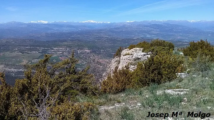
Grallera Petita del Corralot
0.2 km · E
Sant Esteve de la Sarga (Pallars Jussà)
2 topo.2 photos
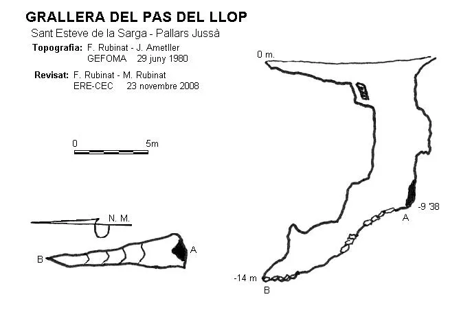
Grallera del Pas del Llop
0.3 km · SW
Sant Esteve de la Sarga (Pallars Jussà)
2 topo.

Grallera Mitjana del Corralot
0.3 km · SE
Sant Esteve de la Sarga (Pallars Jussà)
2 topo.8 photos
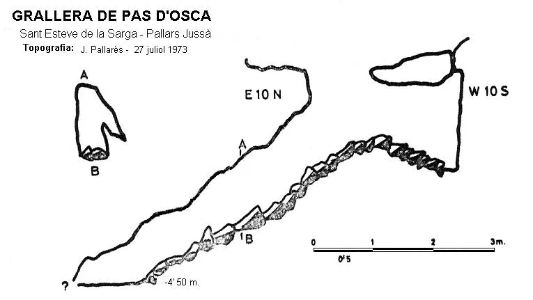
Grallera de Pas d'osca
1.0 km · E
Sant Esteve de la Sarga (Pallars Jussà)
1 topo.
Source: Espeleoindex (espeleoindex.com), modified. CC BY-NC 4.0, https://creativecommons.org/licenses/by-nc/4.0/