
Graller d'Escarlà
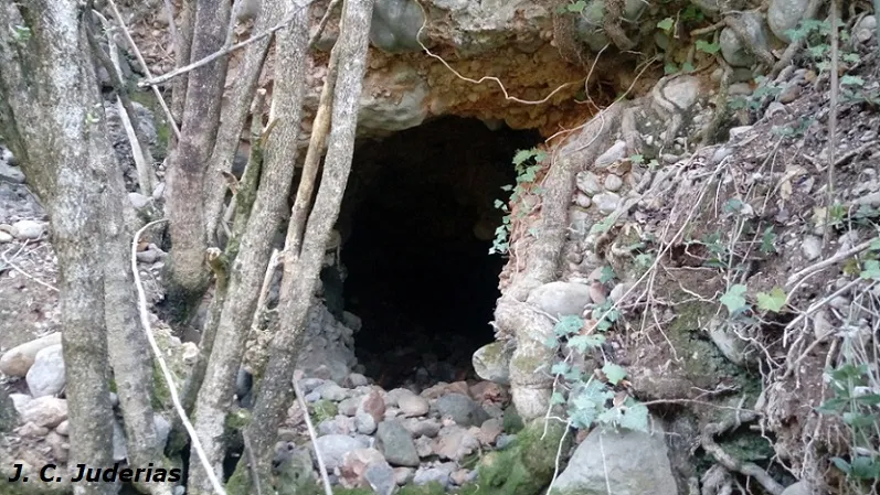
Small pit 12 m deep in the Serra de Lleràs, on the left bank of the barranc d'Escarlà, about 100 metres above the streambed and about 3 km from the houses of Escarlà.
EspeleoWorld
Graller d'Escarlà
Small pit 12 m deep in the Serra de Lleràs, on the left bank of the barranc d'Escarlà, about 100 metres above the streambed and about 3 km from the houses of Escarlà.
Tremp · Pallars Jussà
Length: 17 m · Depth: 12 m
Updated record
https://espeleoworld.com/en/c/graller-d-escarla
Information can change. Always verify coordinates, access, weather, and cave conditions before setting out.
Small pit 12 m deep in the Serra de Lleràs, on the left bank of the barranc d'Escarlà, about 100 metres above the streambed and about 3 km from the houses of Escarlà.
Topographic
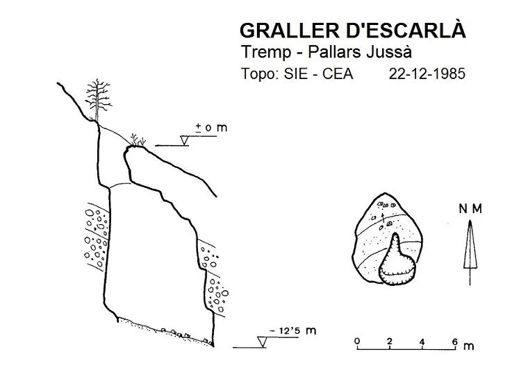
Espeleoindex · CC BY-NC 4.0, https://creativecommons.org/licenses/by-nc/4.0/ · Image © its author.
Description
Morphology
Formed by a single shaft of just over 10 metres, at the bottom of which a ramp 6 metres long and slightly descending begins, at the end of which a depth of 12.5 metres is reached.
History
Mentioned by a person from Areny de Noguera to members of the SIE around the middle of the 1970s. It was not until the end of 1985 and after two days of prospecting that it could be located and explored by the SIE – CEA.
User Comments (0)
No comments yet.
Be the first to share your experience!
Registered Explorations (0)
No explorations registered yet.
Register your visit to this cave!
Bibliography
- SIE (1986).- “Un nou avenc a la Serra de Lleràs”. EspeleoSie (28): 34. SIE – CE Àliga. Barcelona.
Nearby caves

Source: Espeleoindex (espeleoindex.com), modified. CC BY-NC 4.0, https://creativecommons.org/licenses/by-nc/4.0/