
Forat del Pere Pòstol
Interessant cova de 160 m. de recorregut al pla dels Motllats (Capafonts)
EspeleoWorld
Forat del Pere Pòstol
Interessant cova de 160 m. de recorregut al pla dels Motllats (Capafonts)
Capafonts · Baix Camp
Length: 160 m · Depth: 15 m
Updated record
https://espeleoworld.com/en/c/forat-del-pere-postol
Information can change. Always verify coordinates, access, weather, and cave conditions before setting out.
Cave with 160 m of passage on the pla dels Motllats (Capafonts), with an entrance hall, an upper gallery and a meandering lower gallery.
Topographic
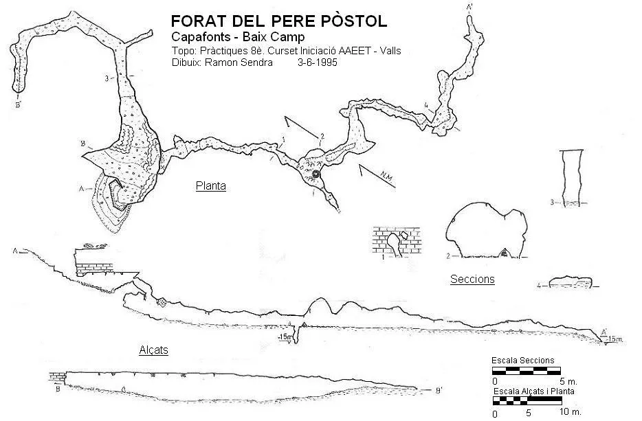
Espeleoindex · CC BY-NC 4.0, https://creativecommons.org/licenses/by-nc/4.0/ · Image © its author.
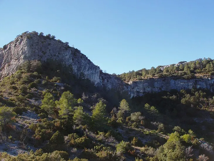
Photos
Espeleoindex · CC BY-NC 4.0, https://creativecommons.org/licenses/by-nc/4.0/ · Image © its author.
Description
Morphology
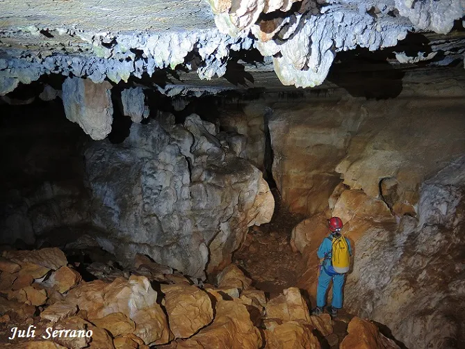
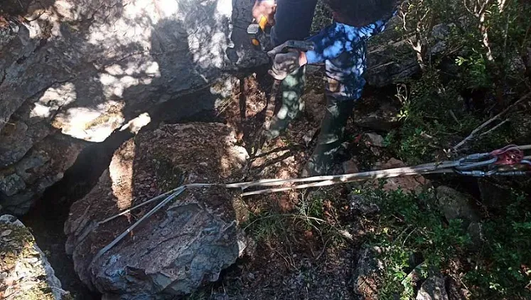
The entrance of the cavity is due to the collapse of the ceiling, forming a funnel-shaped depression; after descending 2 metres we go in through a cone of debris towards a hall of 10x15x2 metres, with a completely flat ceiling. At the end of the hall a gallery about 40 metres long and about 3 high emerges, making a first 90º turn to the left; about 10 metres later the gallery turns again 90º with the floor ascending until it becomes obstructed by sediments. This upper gallery presents a morphology interesting enough to recommend its visit, with forms such as those that can be observed in the details in the sections we attach.
In the right-hand part (SE) of the entrance hall there is a small hole above a stalagmitic flow, where a new gallery begins with a circular entrance that remains hanging; this small circular orifice is followed by a 2-metre step up, a ramp and a small pit of 3.6 metres. This gallery is narrower and more irregular than the upper one, presenting a meandering morphology with evident signs of water circulation. Its development exceeds 70 metres with a slightly descending tendency and with the floor covered by red clay (terra rossa) and with a couple of squeezes in the form of a cat flap that force us to crawl. The gallery ends in a last descending and narrower squeeze that becomes plugged by mud.
Speleothems
The entrance hall has a completely flat ceiling with the presence of some thick stalactites, while at the point of contact of the ceiling with the walls it provides a very characteristic rounded form, present in many places of the upper floor.
In the right-hand part (SE) of the entrance hall there is a small hole above a stalagmitic flow.
Hydrology
The lower gallery presents a meandering morphology with evident signs of water circulation.
Progression
In the right-hand part (SE) of the entrance hall there is a small hole above a stalagmitic flow, where a new gallery begins with a circular entrance that remains hanging; this small circular orifice is followed by a 2-metre step up, a ramp and a small pit of 3.6 metres where a precarious metal structure in the form of a ladder is arranged that allows us to descend into it.
Other details
Interesting cave with 160 m of passage on the pla dels Motllats (Capafonts).
History
The first information we know of is the citation by Josep Iglésies (1927) who speaks of the Forat del Pere Pòstol and says that they have not been able to explore it because the entrance funnel is deliberately covered by blocks. He also comments that people who had entered long ago spoke of a hall as big as a threshing floor and from there come out very long galleries.
We have no further news until many years later, nor do we know who carried out the clearing; it seems that towards the end of the 1960s speleologists from Reus and from Valls had visited it.
During the preparation of the Catàleg Espeleològic de Catalunya and from the data given by Iglésies in 1927, members of the SIEP – CE Poblet (Barcelona) explore it and make a first survey. That is when it is published as Forat d'en Pere Apòstol, incorrectly adding an 'A' to a proper name (our friend Joan Pallisé comments that there are even those who at some point have called it Forat de Sant Pere Apòstol). We also do not know who and when they named it Cova dels Cavalls.
A second survey (unpublished until now) is carried out as practical work of the 8th Curset d'Iniciació organised by the AAEET of Valls in 1995.
In recent years it has been visited repeatedly by members of the GIEM (Montblanc), carrying out different tasks of study and collection of fauna.
Bio
Our colleagues from the GIEM (Montblanc) have made different attempts to search for Troglocharinus, which so far have been unsuccessful.
Among the fauna collected it is worth mentioning 2 specimens of the Trechidae Duvalius berthae, quite frequent in these reliefs.
User Comments (0)
No comments yet.
Be the first to share your experience!
Registered Explorations (0)
No explorations registered yet.
Register your visit to this cave!
Bibliography
- Borrás, J.; Miñarro, J.M.; Talavera, F.(1984).-”El Baix Camp, el Priorat i la Ribera d'Ebre” Catàleg Espeleològic de Catalunya (Vol 7):1-283. Ed Políglota. Barcelona.
- Iglésies, Josep (1927).- “Catalogació d'avencs i coves de la vall del riu Brugent”. Revista del Centre de Lectura de Reus (173) : 212-226. Reus
- Talavera, F. (1982).- “Las cavidades del barranc de la Pixera (Motllats – Baix Camp)”. Boletín Espeleológico SIEP (14): 30-41. SIEP – CE Poblet. Barcelona.
- Topografia inèdita realitzada durant el 8è. Curset d'iniciació de l'AEET de Valls (1995) facilitada per Ramon Sendra (Montblanc).
- Coordenades i fotografia boca facilitades per Joan Pallisé (GIEM)
- Dades actualitzades el juny de 2018. Situació i fotografies facilitades per Juli Serrano, Montse Roca (SIE-CEA) i Francesc Rubinat (ERE-CEC)
Nearby caves


Source: Espeleoindex (espeleoindex.com), modified. CC BY-NC 4.0, https://creativecommons.org/licenses/by-nc/4.0/