
Esquerdes de Palomera
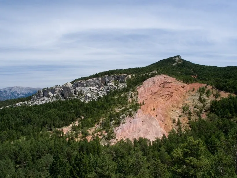
An important group of fissures near the Pleta de la Vila (Saldes), at the upper part of the Palomera crag, with a complex network of aerial and subterranean sections.
EspeleoWorld
Esquerdes de Palomera
An important group of fissures near the Pleta de la Vila (Saldes), at the upper part of the Palomera crag, with a complex network of aerial and subterranean sections.
Saldes · Berguedà
Length: 500 m · Depth: 65 m
Updated record
https://espeleoworld.com/en/c/esquerdes-de-palomera
Information can change. Always verify coordinates, access, weather, and cave conditions before setting out.
An important group of fissures near the Pleta de la Vila (Saldes), at the upper part of the Palomera crag, with a complex network of aerial and subterranean sections.
Topographic
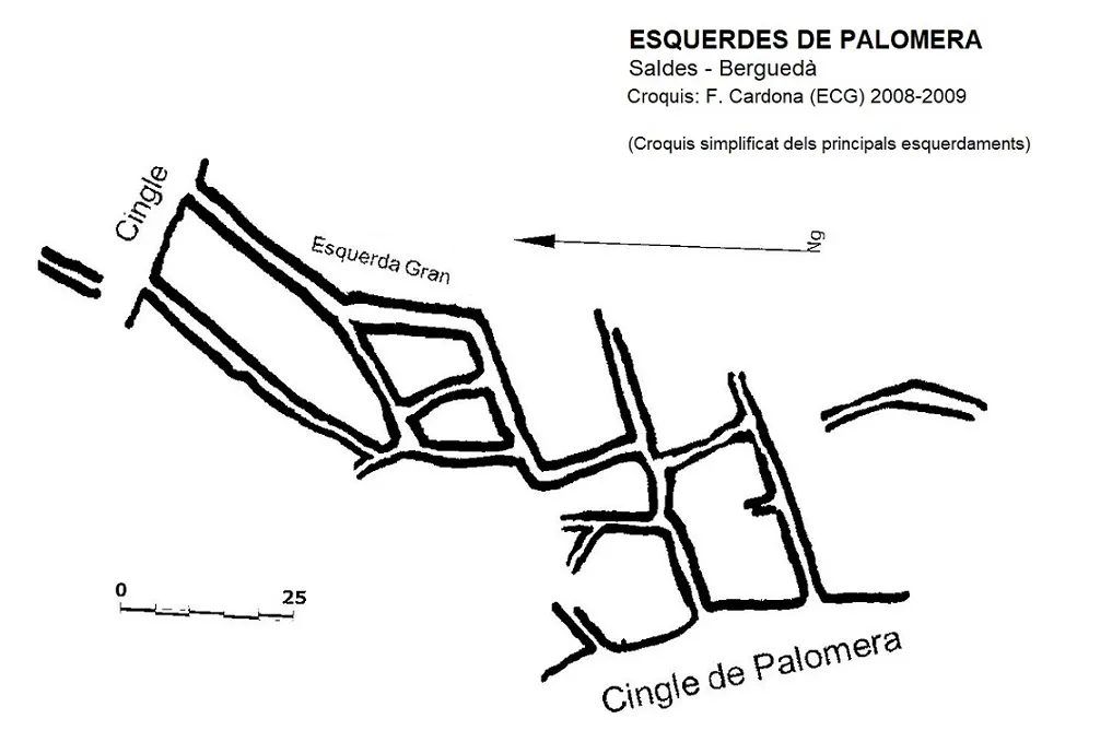
Espeleoindex · CC BY-NC 4.0, https://creativecommons.org/licenses/by-nc/4.0/ · Image © its author.
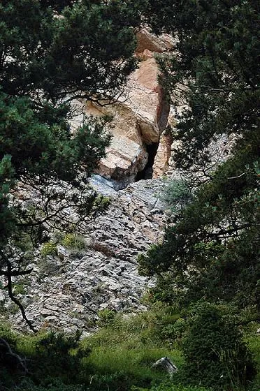
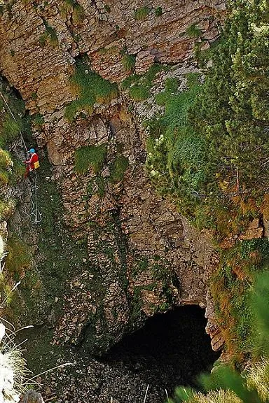
Photos
Espeleoindex · CC BY-NC 4.0, https://creativecommons.org/licenses/by-nc/4.0/ · Image © its author.
Description
Morphology
It is a complex network of fissures generated at the foot of the crag. There are fissures of different lengths and widths; some are isolated, but a good part of them connect with the other fissures of the network. Although a good part of the fissures are aerial, there are also many subterranean sections.
The accompanying sketch shows only the most visible fissures, but there are many more.
On the other hand, in the area there are many fissurings. We come across them as we follow the crag towards the east.
Progression
Movement inside the fissures is very complex: we find wedged blocks, as well as shafts, small shafts and narrow passages that make the exploration very athletic.
Other details
The speleometric data are estimated. The total route will exceed 500 m and the vertical drop is approximately 65 m. A complete exploration and topographic survey of the whole group remains pending.
History
The first known speleological reference is from the explorations carried out by members of the Espeleo Club de Gràcia and the Grup d'Espeleologia de Badalona during the years 2008-2009.
Ferran Cardona (ECG) provides a brief note that is published in the Catàleg Espeleològic de Catalunya (2009).
User Comments (0)
No comments yet.
Be the first to share your experience!
Registered Explorations (0)
No explorations registered yet.
Register your visit to this cave!
Bibliography
- Valles, J. de (2009).- Catàleg Espeleològic de Catalunya. Vol. 3: 381 pp. Espeleo Club de Gràcia / Federació Catalana d'Espeleologia. Barcelona.
- Fotos extretes del web: engarrista.com. Apunt del 21-7-2012
Nearby caves


Source: Espeleoindex (espeleoindex.com), modified. CC BY-NC 4.0, https://creativecommons.org/licenses/by-nc/4.0/