
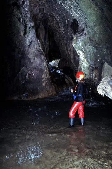
el Pont Cabradís
Túnel natural de 45 m. de recorregut al riu Aigua de Valls (Berguedà).
EspeleoWorld
el Pont Cabradís
Túnel natural de 45 m. de recorregut al riu Aigua de Valls (Berguedà).
Gósol · Berguedà
Length: 45 m · Depth: 2 m
Updated record
https://espeleoworld.com/en/c/el-pont-cabradis
Information can change. Always verify coordinates, access, weather, and cave conditions before setting out.
Natural tunnel of 45 m on the Aigua de Valls river (Berguedà), a gorge excavated in conglomerates and cemented by travertines.
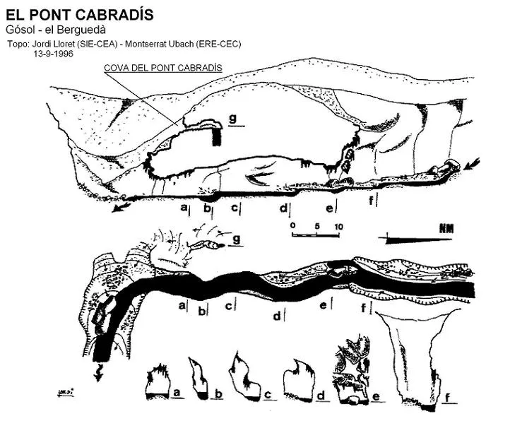
Topographic
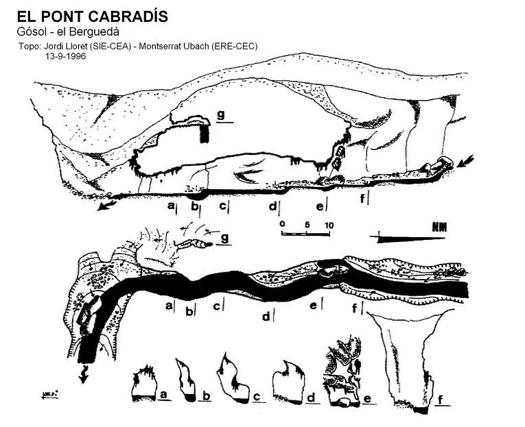
Espeleoindex · CC BY-NC 4.0, https://creativecommons.org/licenses/by-nc/4.0/ · Image © its author.
Photos
Espeleoindex · CC BY-NC 4.0, https://creativecommons.org/licenses/by-nc/4.0/ · Image © its author.
Description
Morphology
Parakarstic phenomenon formed in a gorge section of the Aigua de Valls river where a plug of conglomerate debris has accumulated, which has been excavated by the torrent and cemented by important travertine deposits. It is a tunnel with a maximum height and width of the order of 7 metres and a length of 45 metres, through which flow the waters of this river that rises in the Berguedà and empties into the Cardener (Solsonès). It follows a N-S orientation.
Hydrology
The entire floor of the tunnel is invaded by the water of the river, with a maximum depth close to 2 metres at the deepest point. Even in periods of low flow it is necessary to bathe from head to toe if one wishes to cross from side to side. On the outer part of the ceiling moss grows, where the infiltrated waters from the upper marshes trickle down.
History
Phenomenon known since time immemorial. It has been described in different hiking works, among which it is worth highlighting the formidable guide Alt Berguedà i Cardener, by Agustí Jolis and Mª Antònia Simó, published by the Centre Excursionista de Catalunya in 1965.
It is not, however, until 13 September 1996 that it is surveyed by Jordi Lloret (SIE) and Montserrat Ubach (ERE).
Toponymy: on some occasions this infrequent toponym of Cabradís has been translated as Quebradís (perhaps with the good intention, though perhaps unsuccessful, of giving a meaning similar to trencadís). Consulting the extraordinary work of Joan Coromines, Onomasticon Cataloniae, vol. III, it gives us the following etymology: “From the Latin CAPR-ARICIUM, which derives from CAPRA 'goat', with dissimilation, applied to a gorge where only goats pass”.
User Comments (0)
No comments yet.
Be the first to share your experience!
Registered Explorations (0)
No explorations registered yet.
Register your visit to this cave!
Bibliography
- Lloret, Jordi (2002).- “El Pont Cabradís i el Torrent Fondo. Un matí ben aprofitat a l'Aigua de Valls (Gósol, Berguedà).” EspeleoSie (34): 37-42. SIE – CE Àliga. Barcelona.
· Fotografies facilitades per Jordi Lloret (SIE del CEA)
Nearby caves
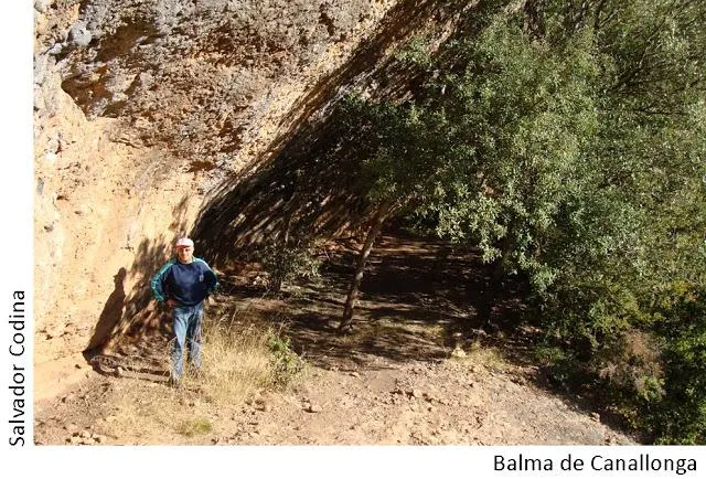


Source: Espeleoindex (espeleoindex.com), modified. CC BY-NC 4.0, https://creativecommons.org/licenses/by-nc/4.0/