
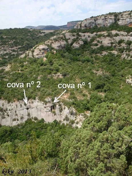
Cova Nº1 de la Font Freda
A 40-metre-long cave in the Barranc de la Font Freda, in Isona i Conca Dellà, with two entrances that converge inside.
EspeleoWorld
Cova Nº1 de la Font Freda
A 40-metre-long cave in the Barranc de la Font Freda, in Isona i Conca Dellà, with two entrances that converge inside.
Isona i Conca Dellà · Pallars Jussà
Length: 40 m · Depth: 4 m
Updated record
https://espeleoworld.com/en/c/cova-n-1-de-la-font-freda
Information can change. Always verify coordinates, access, weather, and cave conditions before setting out.
A 40-metre-long cave in the Barranc de la Font Freda, in Isona i Conca Dellà, with two entrances that converge inside.
Topographic
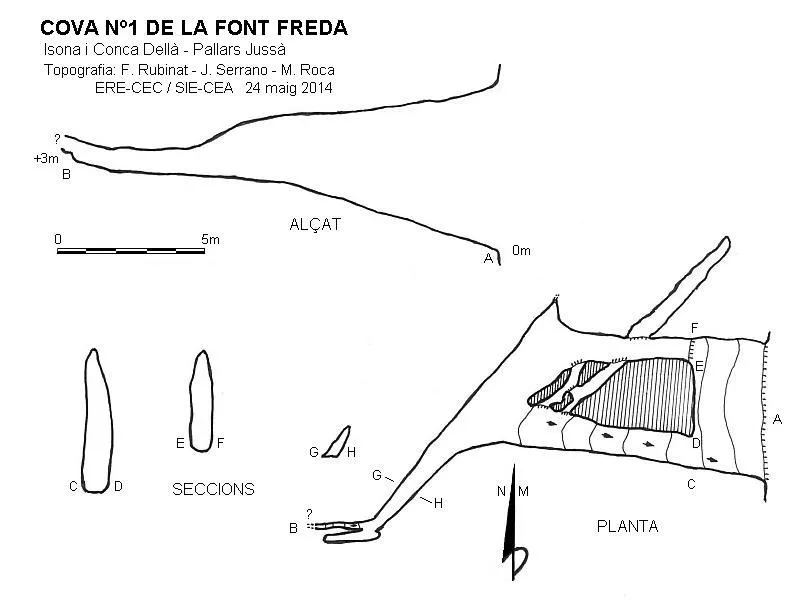

Espeleoindex · CC BY-NC 4.0, https://creativecommons.org/licenses/by-nc/4.0/ · Image © its author.
Photos

Espeleoindex · CC BY-NC 4.0, https://creativecommons.org/licenses/by-nc/4.0/ · Image © its author.
Description
Morphology
The cave opens with two entrances that converge inside after travelling about 7 metres on an ascending slope. Between both galleries we find a passage at about 2 metres in height (+4 metres with respect to the entrance), which also connects them; this passage crosses the gallery situated further to the N, continuing for about 5 metres until it becomes impassable. From the junction of the two entrance galleries, the cave continues in a SW direction for some metres, at the same time as its dimensions diminish, until a small ascending passage remains that is impassable and is situated at +3 metres in height with respect to the entrance.
Progression
Access: from the L-512 road from Artesa de Segre to Tremp, once past Montargull, about 1800 metres further on, on the left and at a bend, there is the turn-off to the masies de Tòrrec. After passing cal Sala, we will turn right towards cal Vansa; 125 metres before reaching the farmhouse, we will find a track on the left suitable for 4x4 vehicles. We will follow it for about 1700 metres, where we will find a junction; we will continue to the left for about 200 metres, where we will find a wide place to turn around and park. From here we will follow the track, which follows the Barranc de la Font Freda along its hydrographic left bank until reaching the ravine. We will descend along the ravine bed and in about 10 minutes of walking in the dry season we will reach a step in the ravine from where we will see the cave entrances; we will descend the step and climb up the right slope, where there is a small torrent, until reaching the base of a temporary waterfall of rainy periods. From here we will follow the base of the cliff in a S direction; in a few metres we will be situated below the cave entrance, which we will reach by means of a scramble. At the beginning there is a “parabolt” to facilitate the climb. At the entrance there is a plate installed with a “maillon” to facilitate the descent on a double rope.
History
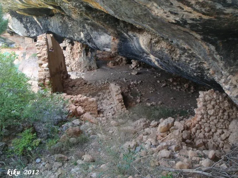
We do not know of any documentation or reference about this cavity. We have evidence that in the mid-90s of the last century, some climbers descended by rappel from the top of the cliff, but they did not enter it. We have also been able to confirm that the cave was known and used by the inhabitants of the area, since at the entrance there are the remains of a beehive made of cane. As for the name, that of Font Freda has been given, due to its proximity to this well-known and copious spring.
User Comments (0)
No comments yet.
Be the first to share your experience!
Registered Explorations (0)
No explorations registered yet.
Register your visit to this cave!
Bibliography
- Dades inèdites recopilades per l'equip d'EspeleoÍndex.
Nearby caves
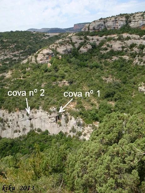
Cova Nº2 de la Font Freda
0.0 km · SW
Isona i Conca Dellà (Pallars Jussà)
1 topo.7 photos
Balmes de Gramenet
0.7 km · NE
Isona i Conca Dellà (Pallars Jussà)
1 topo.9 photos
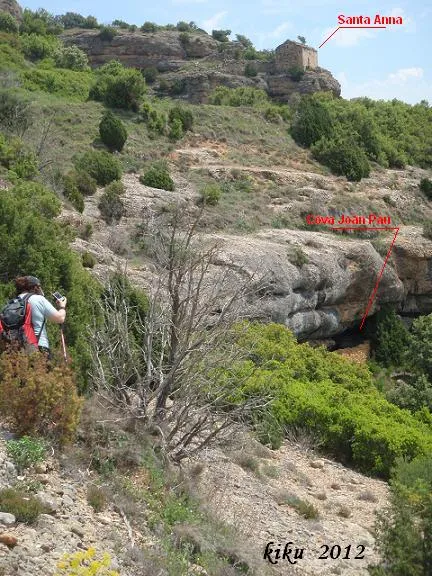
Cova de Joan Pau
1.0 km · N
Isona i Conca Dellà (Pallars Jussà)
1 topo.6 photos
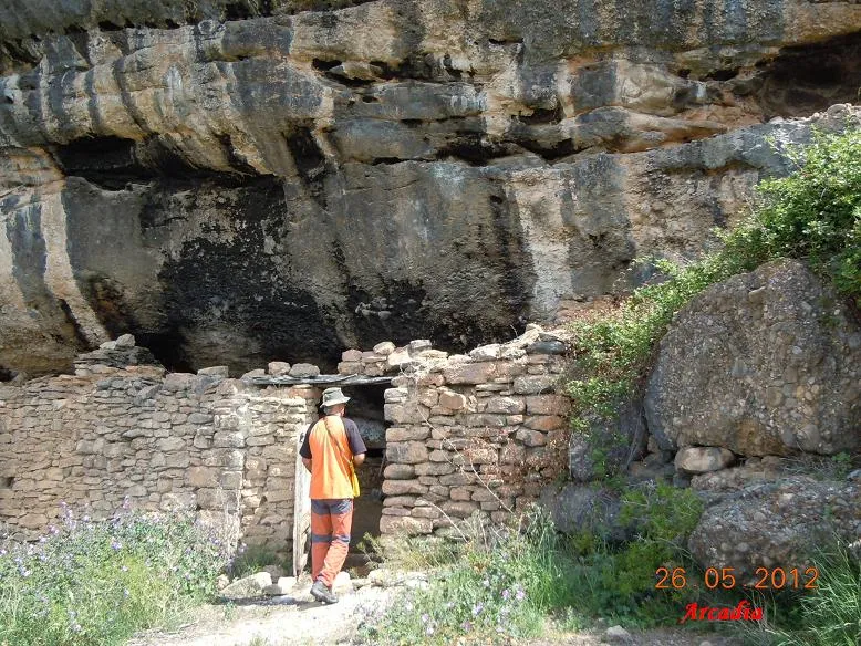
Cova de Montadó
1.0 km · N
Isona i Conca Dellà (Pallars Jussà)
1 topo.7 photos
Source: Espeleoindex (espeleoindex.com), modified. CC BY-NC 4.0, https://creativecommons.org/licenses/by-nc/4.0/