
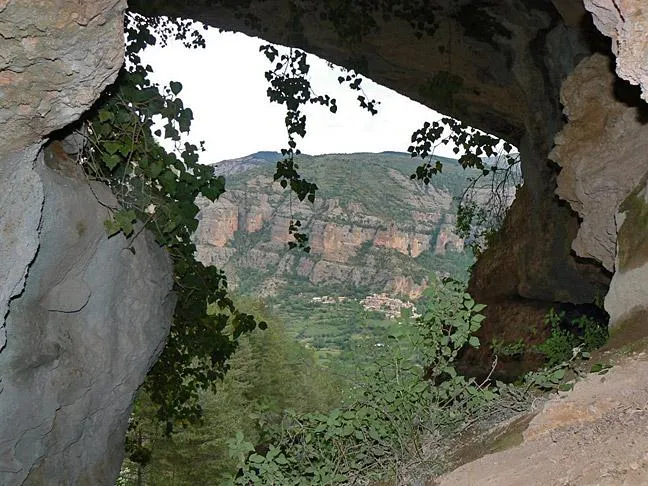
Cova de Toralla
A 276-metre-long cave near Toralla, in the Serra de Lleràs, with four entrances, two superimposed galleries and a meandering route.
EspeleoWorld
Cova de Toralla
A 276-metre-long cave near Toralla, in the Serra de Lleràs, with four entrances, two superimposed galleries and a meandering route.
Conca de Dalt · Pallars Jussà
Length: 276 m · Depth: 10 m
Updated record
https://espeleoworld.com/en/c/cova-de-toralla
Information can change. Always verify coordinates, access, weather, and cave conditions before setting out.
A 276-metre-long cave near Toralla, in the Serra de Lleràs, with four entrances, two superimposed galleries and a meandering route.
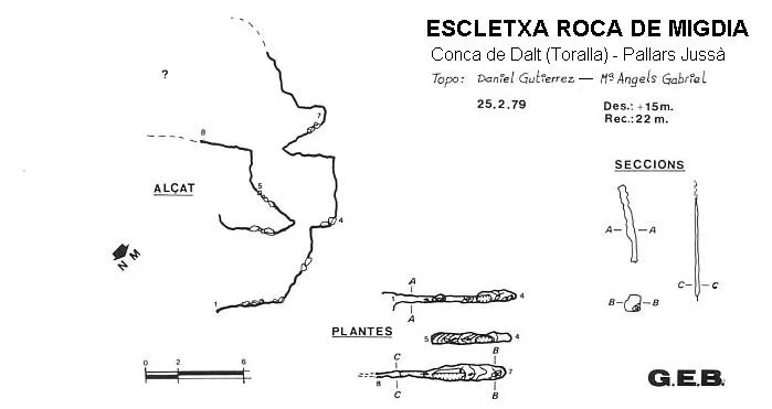
Topographic
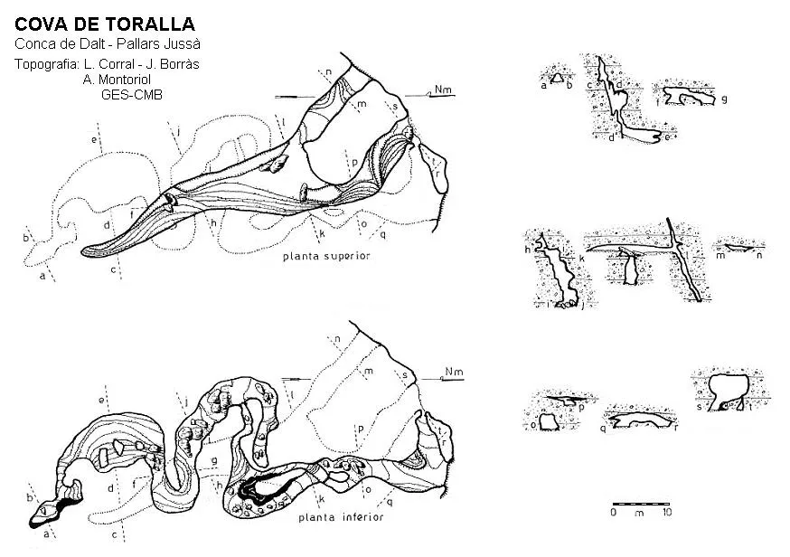
Espeleoindex · CC BY-NC 4.0, https://creativecommons.org/licenses/by-nc/4.0/ · Image © its author.
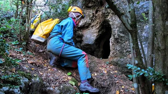
Photos
Espeleoindex · CC BY-NC 4.0, https://creativecommons.org/licenses/by-nc/4.0/ · Image © its author.
Description
Morphology
The cavity has four entrances to the outside, of which the two central ones are more accessible, since the others are hanging on the cliff. It is made up of two superimposed galleries linked at different points along the whole length of the route. The main entrance gives access to a gallery with strong channelling, which after 18 metres at the entrance to a chamber, is cut off by the top of a pit that connects it directly with the lower gallery.
Continuing along the upper level, this widens considerably, but the ceiling is very low, continuing thus in a general direction towards the SE, while progressively becoming narrower, ending at 66 metres from the entrance. From the aforementioned chamber, a low-ceilinged gallery runs in the direction of the upper entrance of the cave. The floor of this whole upper section is covered by a thin layer of dust, with clastic materials and reconstructive forms being practically non-existent.
At the foot of the main entrance there is a small opening that gives way to a descending gallery that after about 10 metres comes out again onto the cliff through the lowest entrance of the cavity. This gallery has a meandering route with different branches interconnected with each other. In the central part of this lower level one must pass through a narrow crawlway that connects with a second part of galleries, these are deeper, of larger dimensions and practically joined with the upper ones along this whole route. The meandering configuration in this new part of the cave is much more pronounced, until ending in a small elbow closed by some parietal flowstone.
Speleothems
The main entrance gives access to a gallery with strong channelling. The floor of the upper section is covered by a thin layer of dust, with clastic materials and reconstructive forms being practically non-existent. In the lower galleries a clastic and lithogenic morphology of relative importance is observed along their route.
Hydrology
These lower galleries are much wetter than the upper ones.
Progression
The main entrance gives access to a gallery with strong channelling, which after 18 metres at the entrance to a chamber, is cut off by the top of a pit that connects it directly with the lower gallery. Continuing along the upper level, this widens considerably, but the ceiling is very low, continuing thus in a general direction towards the SE, while progressively becoming narrower, ending at 66 metres from the entrance. From the aforementioned chamber, a low-ceilinged gallery runs in the direction of the upper entrance of the cave. At the foot of the main entrance there is a small opening that gives way to a descending gallery that after about 10 metres comes out again onto the cliff through the lowest entrance of the cavity. This gallery has a meandering route with different branches interconnected with each other. In the central part of this lower level one must pass through a narrow crawlway that connects with a second part of galleries, these are deeper, of larger dimensions and practically joined with the upper ones along this whole route. The meandering configuration in this new part of the cave is much more pronounced, until ending in a small elbow closed by some parietal flowstone.
History
On 27 August 1910, Racovitza, Jeannel, Faura and Rocafort arrive at Serradell. They visit: Forat Negre and Forat la Bou. They cite by references, but it does not seem that they visited them: Espluga de Sorta, l'Espluguell, l'Esplugallonga and el Barbuixell. The following day, 28 August, they visit the cova de Toralla.
Thomas Casajuana, in his, and possibly last speleological writing (2000), makes a brief reference to a campaign by members of the Club Muntanyenc Barcelonès (Llopis, Thomas and others) carried out in the Serradell area in the year 1946 and which had remained practically unpublished. Among the cavities explored and drawn, he mentions the cova Toralla; in 1949 Joan Maluquer publishes the results of the archaeological investigations carried out at the cova Toralla, attaching the topography made by Thomas and Llopis in 1946.
User Comments (0)
No comments yet.
Be the first to share your experience!
Registered Explorations (0)
No explorations registered yet.
Register your visit to this cave!
Bibliography
- Borràs, J; Miñarro, J.M.; Talavera, F.(1979).-Catàleg Espeleològic de Catalunya (Vol.3). ed. Políglota. Barcelona.
- GEB (1966).-”Resumen de las exploraciones espeleológicas efectuadas en el valle de Serradell; antes del campamento”. I campamento regional de espeleólogos pp:1-37. Comité Regional de Exploraciones Subterráneas.
- Faura i Sans, Mn.(1911).-”Excursiones espeleológicas realizadas durante el año 1910 en la región catalana”. Bol. Soc. Esp. de Historia Natural (6):355-377.
- Gràcia, Joaquim (1960).- "Espeleologia en el valle de Serradell" Montaña (60): 189-194. Centre Excursionista de Catalunya. Barcelona.
- Maluquer de Motes, Juan.(1949).-”Investigaciones Arqueológicas en el Pallars I. La cueva de Toralla” Monografias del Instituto de Estudios Pirenaicos. Consejo Superior de Investigaciones Científicas. Zaragoza.
- Thomas Casajuana, JM. (2000).- “La dècada 'pre-GES' vista per un dels seus protagonistes”. Sota Terra (8): 4-7. GES – CM Barcelonès
- Vega, Josep de la. (1981).-”Aplec de documents arqueològics de les coves del Montsec i llur projecció a les comarques i serres properes”. Mediterrània (12): 1-359.
- Coordenades fotos i situació extretes del blog 'Espeleobloc', post del dia 26-9-2012.
Nearby caves
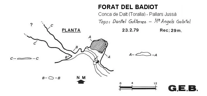
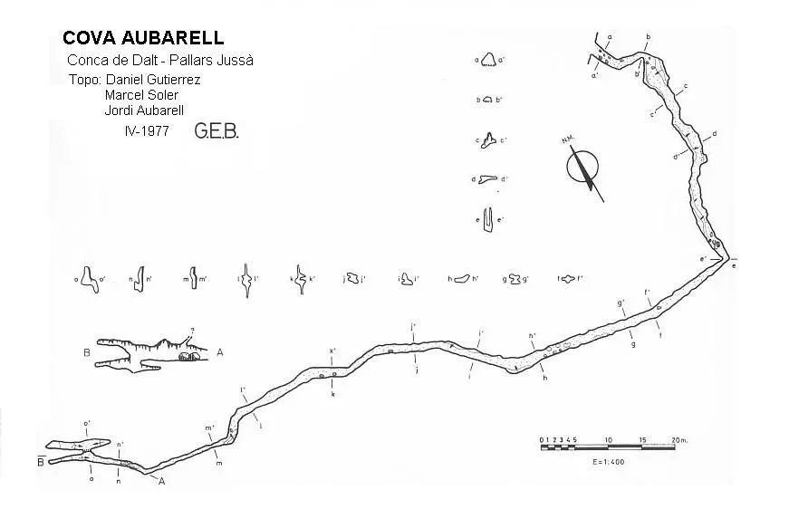


Source: Espeleoindex (espeleoindex.com), modified. CC BY-NC 4.0, https://creativecommons.org/licenses/by-nc/4.0/