
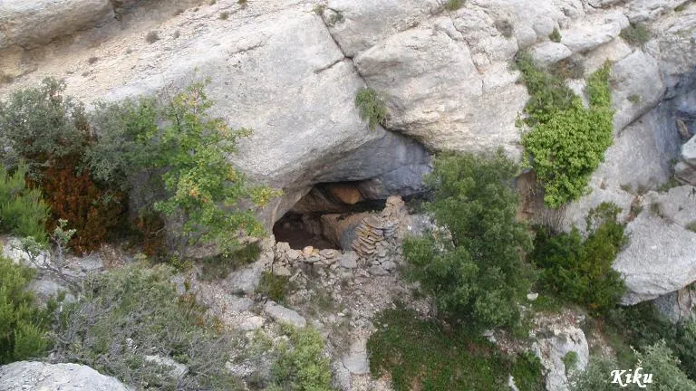
Cova de Tarrits
A cavity with 12 metres of passage in the municipality of Àger, known since ancient times and used as a sheepfold.
EspeleoWorld
Cova de Tarrits
A cavity with 12 metres of passage in the municipality of Àger, known since ancient times and used as a sheepfold.
Àger · Noguera
Length: 12 m
Updated record
https://espeleoworld.com/en/c/cova-de-tarrits
Information can change. Always verify coordinates, access, weather, and cave conditions before setting out.
A cavity with 12 metres of passage in the municipality of Àger, known since ancient times and used as a sheepfold.
Topographic
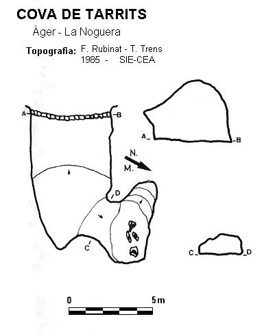
Espeleoindex · CC BY-NC 4.0, https://creativecommons.org/licenses/by-nc/4.0/ · Image © its author.
Photos
Espeleoindex · CC BY-NC 4.0, https://creativecommons.org/licenses/by-nc/4.0/ · Image © its author.
Description
Morphology
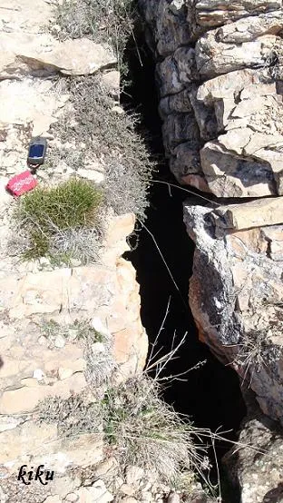
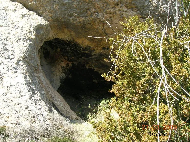
It is a cavity with 12 metres of passage, completely clear due to its wide entrance.
History
Known since ancient times and used as a sheepfold. It seems that it was visited by the Club Gimnàstic Barcelonès in the sixties, as the initials painted at the mouth corroborate this.
User Comments (0)
No comments yet.
Be the first to share your experience!
Registered Explorations (0)
No explorations registered yet.
Register your visit to this cave!
Bibliography
Rubinat Aumedes, Francesc (1986).- “Nota sobre tres cavidades del Montsec (La Noguera)” Espeleosie (28): 23-25. SIE- CE Àliga. Barcelona
Nearby caves


Source: Espeleoindex (espeleoindex.com), modified. CC BY-NC 4.0, https://creativecommons.org/licenses/by-nc/4.0/