
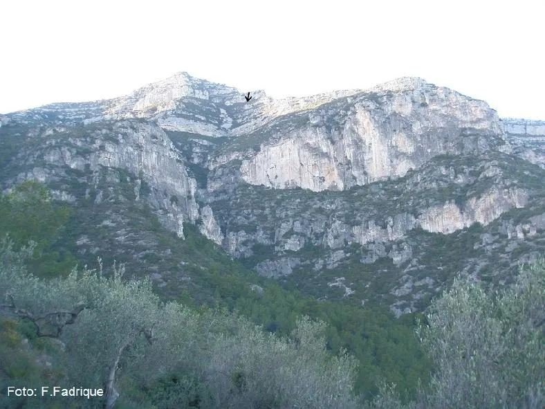
Cova Bonica
La cova més emblemàtica del massís del Montsià
EspeleoWorld
Cova Bonica
La cova més emblemàtica del massís del Montsià
Alcanar · Montsià
Length: 61 m · Depth: 7 m
Updated record
https://espeleoworld.com/en/c/cova-bonica-alcanar
Information can change. Always verify coordinates, access, weather, and cave conditions before setting out.
The most emblematic cave of the Montsià massif, with a narrow entrance hidden by a fig tree, damaged formations and graffiti, and a demanding approach.
Topographic
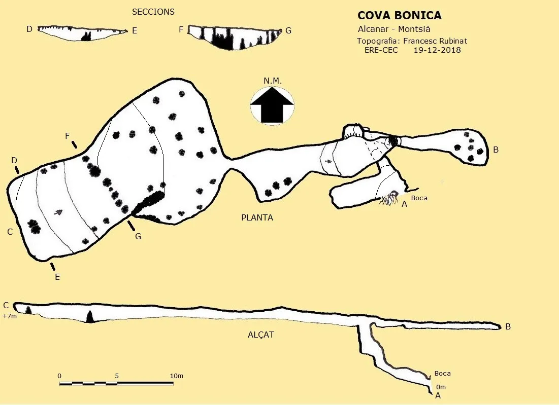
Espeleoindex · CC BY-NC 4.0, https://creativecommons.org/licenses/by-nc/4.0/ · Image © its author.
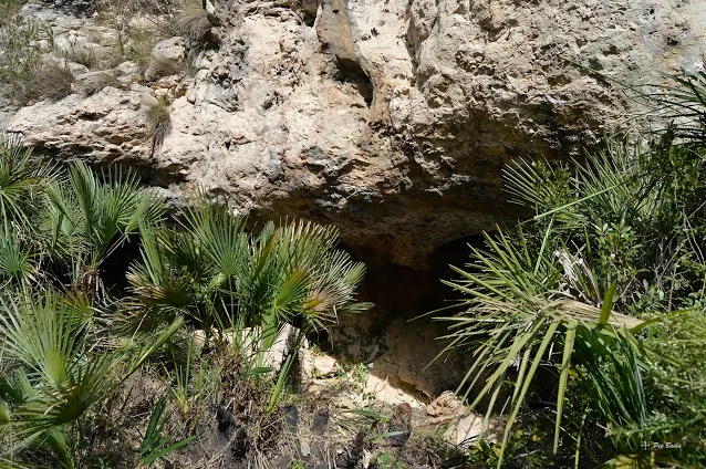
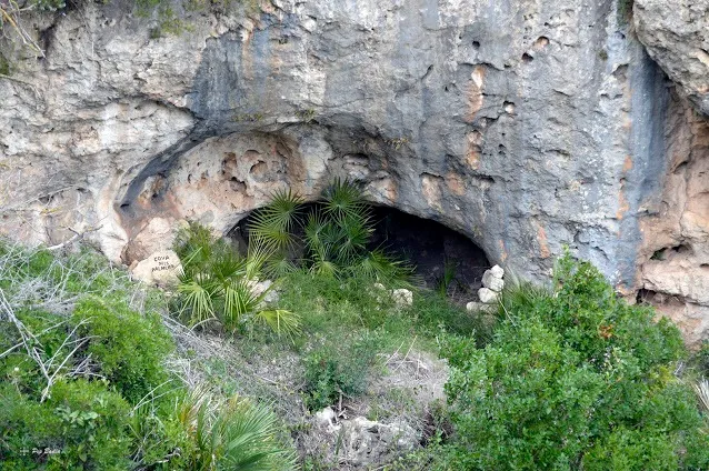
Photos
Espeleoindex · CC BY-NC 4.0, https://creativecommons.org/licenses/by-nc/4.0/ · Image © its author.
Description
Morphology
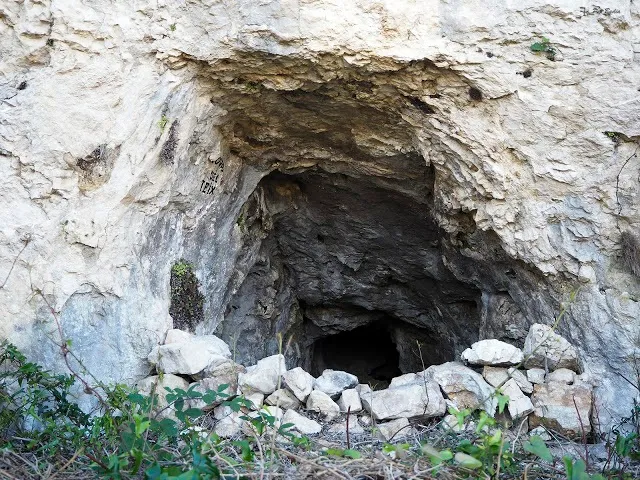
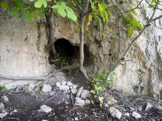
A couple of metres above the base of the cliff a narrow entrance opens, heavily hidden by a fig tree that takes root inside the cave.
Past the entrance, on the left a short gallery opens that ends after a few metres. Continuing straight on from the entrance, a narrow passage must be climbed amid a flowstone that will place us at the base of a 2.6 metre high pit, which can be overcome without difficulty. At the top we find a gallery on the left in an E direction, which after a very narrow passage gives access to a low-roofed gallery with plenty of formation; this gallery becomes narrower until it becomes impassable amid the formation.
Back at the head of the pit, the gallery continues to the right, in a W direction following a bedding plane.
Speleothems
The formations, some still active, form a network of low galleries: columns, small flags, small gours, flowstone, pearls...
Despite its demanding approach, it is possibly one of the most damaged caves in the range, with formations broken in a rough manner, and full of graffiti and inscriptions of all kinds that say a great deal about the hands that made them. One of the most beautiful caves in the range, turned into a rather sorry spectacle.
Progression
Past the entrance, on the left a short gallery opens that ends after a few metres. Continuing straight on from the entrance, a narrow passage must be climbed amid a flowstone that will place us at the base of a 2.6 metre high pit, which can be overcome without difficulty. At the top we find a gallery on the left in an E direction, which after a very narrow passage gives access to a low-roofed gallery with plenty of formation; this gallery becomes narrower until it becomes impassable amid the formation. Back at the head of the pit, the gallery continues to the right, in a W direction following a bedding plane.
History
The oldest reference we know of is found in the work of Enrique Bayarri: Historia de Tortosa y su comarca. Vol.II (1934). It wrongly states that it is located in the municipality of Ulldecona and that even then it enjoyed a good reputation for the beauties of its interior that gave it its name. It adds that it will be about 30 metres long and that it consists of three uneven levels where stalactites and stalagmites are abundant.
We have evidence of a visit made by members of the Agrupació Excursionista d'Amposta in 1957.
It is not until 1964 that the cavity begins to be known to speleologists following a campaign by members of the GIE – CE Gràcia (Isidre González-Urgellès and Armand Avalo) who, guided by Mr. J. Aguilar (la Ràpita), reach the cave in August of that year to continue the task of collecting cave fauna from the Montsià. The following month they return accompanied by Dr. Francesc Español and are able to collect 7 more specimens of a new subspecies of what was then called Anillochlamys, on this occasion Dr. Español studies it and dedicates it to its discoverer (González-Urgelles). Currently known as Paranillochlamys urgellesi.
In recent years the cave has been visited on various occasions by our friend Floren Fadrique who has had the luck to rediscover this beetle more than 40 years after its discovery. This subspecies, unique to the Montsià, has also been found by F. Fadrique in the Cova del Tendo and remains in the Avenc dels Castellets.
It is not until December 2018 that Espeleoíndex carries out the only known survey of this cavity.
Bio
Coleoptera:
- Paranillochlamys urgellesi
User Comments (0)
No comments yet.
Be the first to share your experience!
Registered Explorations (1)

Exploration date: March 14, 2021
Vam entrar tota la família sense pensar-ho. prou espectacular.
Bibliography
- Español, F. (1965).- “Contribución al conocimiento del género Anillochlamys (Col. Catopidae)”. Eos (40): 447-454.
- Dades descriptives, de situació, coordenades i fotografies extretes del blog: senderes.blogspot (de Pep Badia, la Ràpita).
- Dades biospeleològiques i altres fotografies facilitades per Floren Fadrique (SIE – CEA)
Nearby caves


Source: Espeleoindex (espeleoindex.com), modified. CC BY-NC 4.0, https://creativecommons.org/licenses/by-nc/4.0/