

Balma dels Llims
Spectacular rock shelter beside the Rupit stream, with la Cova de la Vella dels Llims at its southern end, among boulders.
EspeleoWorld
Balma dels Llims
Spectacular rock shelter beside the Rupit stream, with la Cova de la Vella dels Llims at its southern end, among boulders.
Rupit i Pruit · Osona
Length: 12 m · Depth: 3 m
Updated record
https://espeleoworld.com/en/c/balma-dels-llims
Information can change. Always verify coordinates, access, weather, and cave conditions before setting out.
Spectacular rock shelter beside the Rupit stream, with la Cova de la Vella dels Llims at its southern end, among boulders.
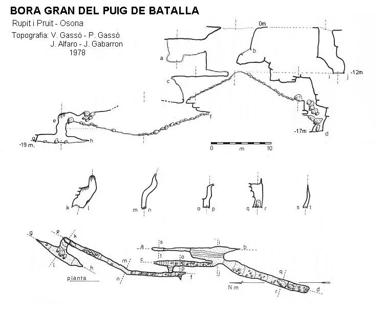
Topographic

Espeleoindex · CC BY-NC 4.0, https://creativecommons.org/licenses/by-nc/4.0/ · Image © its author.
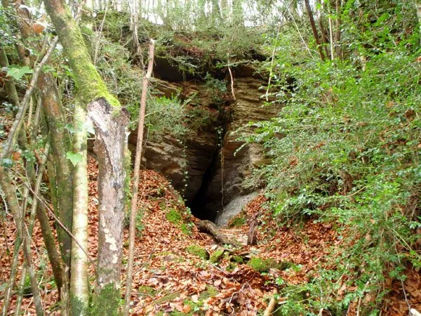
Photos
Espeleoindex · CC BY-NC 4.0, https://creativecommons.org/licenses/by-nc/4.0/ · Image © its author.
Description
Morphology
Large rock shelter 80 m wide, although the spectacular part is limited to the southern half. The maximum depth reaches 12 m and the height reaches 11 m. Curiously, just above it lies the Rupit neighbourhood, through which the road leading to Sant Joan de Fàbregues passes. At its southern end there is a large accumulation of boulders, some of them good-sized, the place where the entrance to la Cova de la Vella dels Llims also opens. The cave has a low ceiling. From the initial small chamber a narrow gallery begins and the terminal section shown on the 1981 survey is probably now choked. The rest of the rock shelter is very cosy, with a relatively flat floor.
Hydrology
Because of its location right beside the Rupit stream, the rock shelter can be affected by floods in times of exceptional rain. There is a round basin fed by a small flow of water that springs from the rock beside it.
Progression
At the start of the hanging bridge there are some stairs that give access to the stream bed. You only have to follow the path that runs along the right bank and very soon the rock shelter comes into view. la Cova de la Vella dels Llims is at the southern end of the rock shelter, inside it, above the jumble of boulders there. The cave has a low ceiling and is full of rubbish, which we suppose was washed in by the floods. From the initial small chamber a narrow gallery begins and the terminal section shown on the 1981 survey is probably now choked.
Other details
In more recent times, the rock shelter has been used as a recreation area, with a small table and some barbecues found there.
History
The rock shelter has been used by the people of the village since time immemorial. In fact, we can see some basins carved directly into the rock that were used in past times for washing hemp and possibly for washing wool by the cloth workers. As for la Cova de la Vella dels Llims, it was surveyed in 1981 by members of the Grup Espeleològic de Mollet during the work they carried out over several years in the Cabrerès area. They overlooked the large rock shelter and the cave was published in the speleological catalogues (1982 and 2010). It seems that the final metres of the cave are no longer passable.
User Comments (0)
No comments yet.
Be the first to share your experience!
Registered Explorations (0)
No explorations registered yet.
Register your visit to this cave!
Bibliography
- Borràs,J.; Miñarro, JM.;Talavera, F.(1982).-”el Baix Empordà, el Gironès, la Selva, l'Osona, el Vallès Oriental i el Maresme”. Catàleg Espeleològic de Catalunya (vol.6):1-292. Ed. Políglota. Barcelona.
- Valles, Jordi de (2010).-”Alt Empordà, Baix Empordà, Gironès, Osona, Pla de l'Estany, Selva”. Catàleg Espeleològic de Catalunya (4):1-397. EC Gràcia – FCE.
- Actualització de dades, topografia (2021) i fotografies extretes del web: geb.cat (del Grup d'Espeleologia de Badalona). Apunt del 14-2-2022. Dades: Ferran Cardona (ECMB), Josep Cuenca i Xavier Samarra (GEB).
Nearby caves




Source: Espeleoindex (espeleoindex.com), modified. CC BY-NC 4.0, https://creativecommons.org/licenses/by-nc/4.0/