
Avenc del Pèlec
Pit cave 97 metres long and 17 deep in Vallirana, with three artificial entrances and a small watercourse.
EspeleoWorld
Avenc del Pèlec
Pit cave 97 metres long and 17 deep in Vallirana, with three artificial entrances and a small watercourse.
Vallirana · Baix Llobregat
Length: 97 m · Depth: 17 m
Updated record
https://espeleoworld.com/en/c/avenc-del-pelac
Information can change. Always verify coordinates, access, weather, and cave conditions before setting out.
Pit cave 97 metres long and 17 deep in Vallirana, with three artificial entrances and a small watercourse.
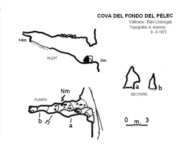
Topographic
Espeleoindex · CC BY-NC 4.0, https://creativecommons.org/licenses/by-nc/4.0/ · Image © its author.
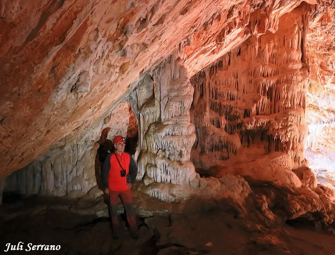
Photos
Espeleoindex · CC BY-NC 4.0, https://creativecommons.org/licenses/by-nc/4.0/ · Image © its author.
Description
Morphology
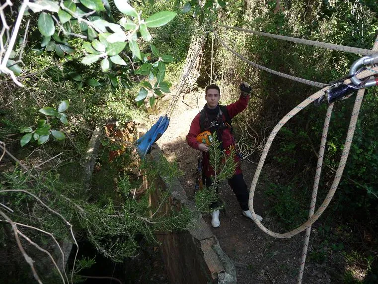
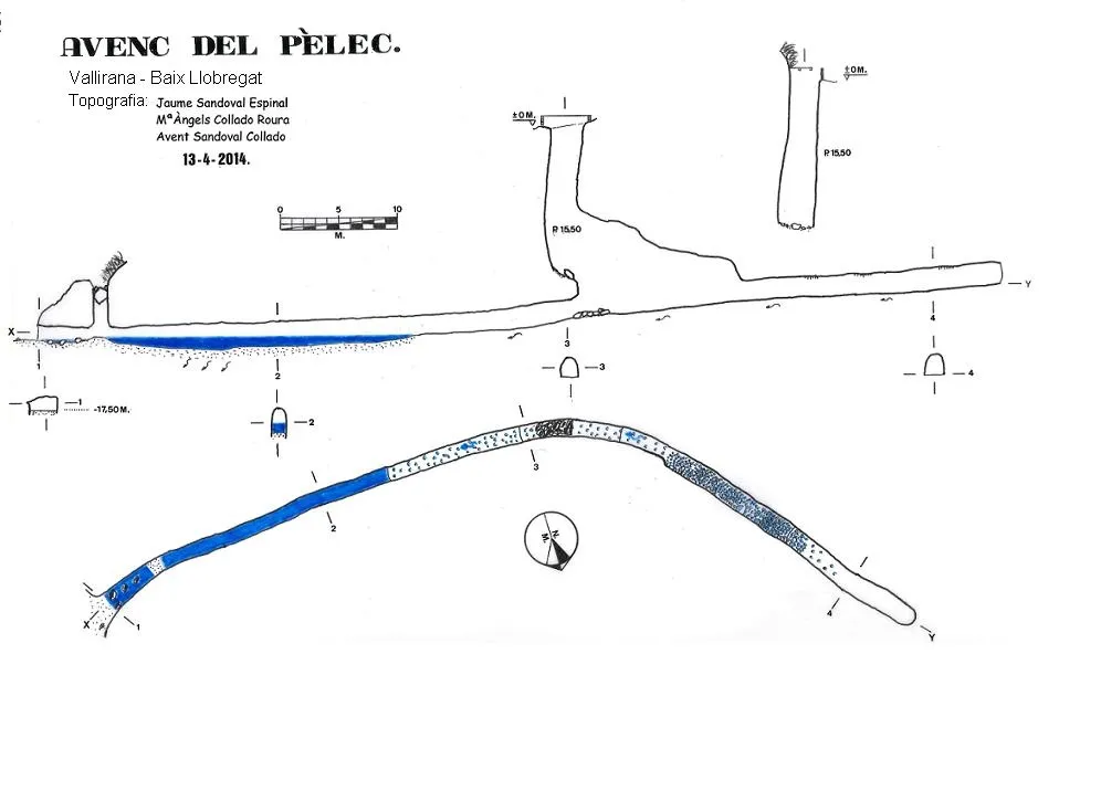
It presents three artificial entrances that intersect a partially natural section. The upper pit has a depth of -15.50 metres, and the mouth is partially covered by a cement roof; in the second entrance, the 5m pit is obstructed by blocks and part of the cement covering that covered it. The third entrance, this one horizontal, gives way to the flooded gallery known as Font del Pèlac. The total drop of the cavity is 17.50 metres, with a length of 97.60 metres.
Speleothems
In the small watercourse there is a large quantity of micro Gours.
Hydrology
There is a small watercourse. The third entrance, horizontal, gives way to the flooded gallery known as Font del Pèlac. At the access through the mine, the water was retained by a wall where there was a pipe that acted as a fountain; currently this wall is demolished.
History
This cavity has been known since ancient times; in fact, all the entrances are artificial and made in order to find water. The first data we have of its exploration, carried out by a Grup Espeleològic, date from around 1961 by the S.E.S. del Puigmal. When the mountain began to be urbanised, the vertical mouths were covered with cement slabs, but a few years later they had been collapsed.
User Comments (0)
No comments yet.
Be the first to share your experience!
Registered Explorations (0)
No explorations registered yet.
Register your visit to this cave!
Bibliography
Rubinat Aumedes, Francesc.(1984).-'Catàleg Espeleològic del Massís de Garraf-unitat Septentrional' Gours (10):19-73. GE Foment Martinenc. Barcelona.
Rubinat Aumedes, Francesc. (2004).-'Catàleg Espeleològic del Massís de l'Ordal'. EspeleoSie - Monogràfic pp:1-117. Barcelona.
Valles, Jordi de (2017).- Catàleg Espeleològic de Catalunya. Baix Llobregat. Vol. 6: 468 pp. Espeleo Club de Gràcia / Federació Catalana d'Espeleologia. Barcelona
Arxiu SES - CE Puigmal (Topografia 1961)
Topografia, fotos i dades actualitzades, facilitades per Jaume Sandoval Espinal. (2014)
Nearby caves


Source: Espeleoindex (espeleoindex.com), modified. CC BY-NC 4.0, https://creativecommons.org/licenses/by-nc/4.0/