
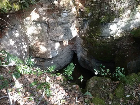
Avenc del Bloc
A 43 m deep pit in Sant Aniol de Finestres (la Garrotxa), known since time immemorial and explored from 1967 onwards.
EspeleoWorld
Avenc del Bloc
A 43 m deep pit in Sant Aniol de Finestres (la Garrotxa), known since time immemorial and explored from 1967 onwards.
Sant Aniol de Finestres · Garrotxa
Length: 211 m · Depth: 43 m
Updated record
https://espeleoworld.com/en/c/avenc-del-bloc
Information can change. Always verify coordinates, access, weather, and cave conditions before setting out.
A 43 m deep pit in Sant Aniol de Finestres (la Garrotxa), known since time immemorial and explored from 1967 onwards.
Topographic
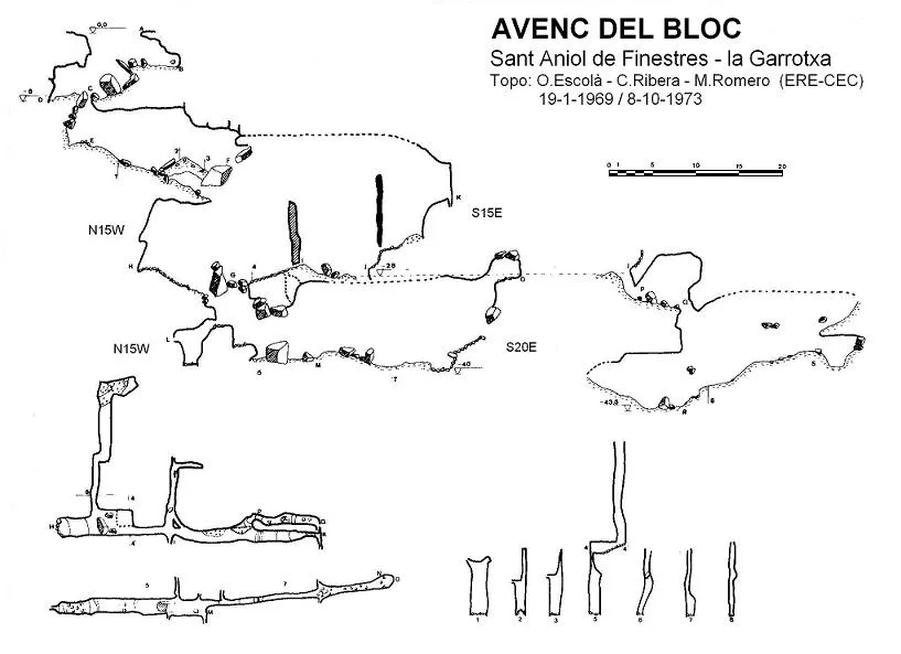

Espeleoindex · CC BY-NC 4.0, https://creativecommons.org/licenses/by-nc/4.0/ · Image © its author.
Photos

Espeleoindex · CC BY-NC 4.0, https://creativecommons.org/licenses/by-nc/4.0/ · Image © its author.
Description
Morphology
Located in the middle of the mountain slope, it presents a depression 10 metres long, 4.5 wide and 8 deep where, through a passage between blocks of 0.5 x 0.4 metres, the first shaft is reached, 5 metres vertical.
The floor of this shaft is made up of allochthonous materials, which form a debris cone that continues as a ramp following the main joint, with a direction of S20E, and reaches – 16 metres. At this point we find another perpendicular joint that gives access to the second shaft, 13 metres vertical. At its base we find the upper level of the joint (elevation – 29) made up of blocks of clastic origin and materials from the exterior.
The length of this gallery is 41 metres and it is crossed by several perpendicular joints, two of which have a length of 19 and 10 metres. The route of this level projected in plan is 70 metres and presents, at one of its ends, another smaller joint, also perpendicular to the main one.
Just at the base of the second shaft, a small gallery opens between blocks, through which the 8 metres of drop can be climbed down, allowing access to the second and last level of the joint, narrower than the previous one (maximum 2 metres wide) and with a length of 40 metres. At the end of this level there is a small chamber of 3.5 x 1.5 metres, with the ceiling made up of sandstones of very coarse and poorly consolidated grains.
On the upper level (elevation – 28), we find a narrow descending ramp, very steep at the beginning, which leads to a joint also very narrow and perpendicular to the main one, which gives access to another joint parallel to the main one, with a maximum width of 0.7 metres and a length of 32 metres, where the deepest point of the cavity is reached at – 43.5 metres.
Cavity of structural tectogenetic type, located in a three-dimensional jointing that affects the sandstones of the Ilerdian, very possibly due to the accumulation of tectonic stresses of the Alpine movement.
Progression
Through a passage between blocks of 0.5 x 0.4 metres, the first shaft is reached, 5 metres vertical. The floor of this shaft continues as a ramp following the main joint and reaches – 16 metres, where another perpendicular joint gives access to the second shaft, 13 metres vertical. Just at the base of the second shaft, a small gallery opens between blocks, through which the 8 metres of drop can be climbed down, allowing access to the second and last level of the joint. On the upper level (elevation – 28), a narrow descending ramp leads to a very narrow joint perpendicular to the main one, which gives access to another joint parallel to the main one, where the deepest point of the cavity is reached at – 43.5 metres.
History
Known since time immemorial by people of the region, some of whom used it as a hiding place during the Civil War, installing a wooden ladder at the first shaft and covering the entrance with a block.
Through references from some summer visitors, members of the ERE-CEC managed to have a person accompany them in 1967, thus beginning the exploration. Two more trips (1969 and 1973) served to complete the full study of the cavity.
Bio
Scorpions: Belisarius xambeui (19-1-1969: Escolà, Ribera i Ubach)
Coleoptera: Speonomus delarouzeei (19-1-1969 / 18-7-1970 / 7-10-1973: Escolà, Ribera, Ubach, Romero)
Orthoptera: Dolicopoda linderi (19-1-1969: Escolà, Ribera, Ubach)
Araneids: Meta bourneti (Simon) (19-1-1969 / 18-7-1970 / 7-10-1973: Escolà, Ribera, Ubach, Romero)
User Comments (0)
No comments yet.
Be the first to share your experience!
Registered Explorations (0)
No explorations registered yet.
Register your visit to this cave!
Bibliography
- Ribera, C. i Romero, D. (1974).- “Avenc del Bloc”. Espeleòleg (19): 999-1007. ERE-CEC. Barcelona.
- Valles, Jordi de (2009).-”Berguedà, Cerdanya, Garrotxa, Ripollès”. Catàleg Espeleològic de Catalunya (vol.3):216-217. ECG-FCE.
- Fitxa actualitzada el setembre de 2018 amb fotografies facilitades per Rafael Silvestre.
- Fitxa actualitzada el març de 2021, coordenades i fotografies del camí i boca facilitades per Toni Raga.
Nearby caves
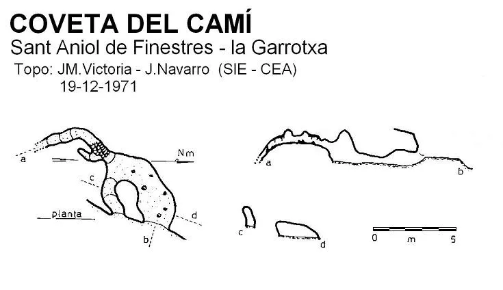
Coveta del Camí
0.3 km · W
Sant Aniol de Finestres (Garrotxa)
1 topo.
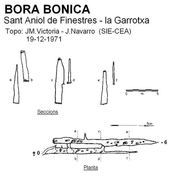
Bora Bonica
0.7 km · NE
Sant Aniol de Finestres (Garrotxa)
1 topo.
Cova dels Carlins
1.8 km · NW
Sant Aniol de Finestres (Garrotxa)
1 topo.3 photos
Cova dels Trabucaires
2.3 km · W
Sant Aniol de Finestres (Garrotxa)
1 topo.3 photos
Source: Espeleoindex (espeleoindex.com), modified. CC BY-NC 4.0, https://creativecommons.org/licenses/by-nc/4.0/