
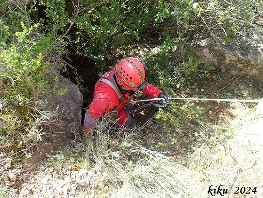
Avenc de Sant Urbà
Avenc de 57 metres de fondària a Les Avellanes i Santa Linya.
EspeleoWorld
Avenc de Sant Urbà
Avenc de 57 metres de fondària a Les Avellanes i Santa Linya.
Avellanes i Santa Linya, Les · Noguera
Length: 129 m · Depth: 57 m
Updated record
https://espeleoworld.com/en/c/avenc-de-sant-urba
Information can change. Always verify coordinates, access, weather, and cave conditions before setting out.
A 57-metre-deep pit in Les Avellanes i Santa Linya, with a 17-metre entrance shaft, equipped with M8 stainless steel parabolt.
Topographic
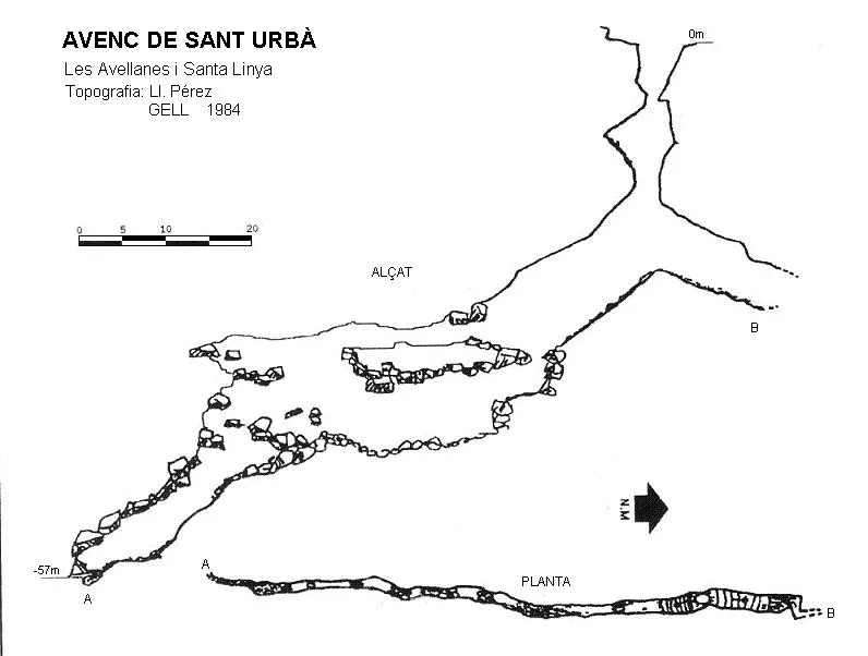

Espeleoindex · CC BY-NC 4.0, https://creativecommons.org/licenses/by-nc/4.0/ · Image © its author.
Photos

Espeleoindex · CC BY-NC 4.0, https://creativecommons.org/licenses/by-nc/4.0/ · Image © its author.
Description
Morphology
The 2x1 metre entrance gives access to a 17-metre shaft; in the first two metres of this shaft we find a platform of blocks; we exit on the wider side and, halfway down the shaft, we gain a foothold on a steep ramp that leads us down to the final part of the shaft, which is quite wide throughout. The base is a ramp full of debris and a multitude of bones of the dead animals that in the 70s and early 80s of the last century the farmers threw into the interior of the pit; after 40 years only the bones remain.
Along the upper part of the ramp, it turns towards the west and, after a short distance, turns again towards the N and ends.
Along the lower part of the ramp we find that the fissure subdivides into different levels separated by blocks that form false ceilings, with some passages with a drop of up to 5 metres where a safety rope must be used. In some places these blocks are quite unstable.
The cavity is equipped with M8 stainless steel parabolt.
Note: The depth given of -57 metres we find rather exaggerated; we have measured the entrance shaft and it is 17 metres deep, a difference of 6 metres with respect to the 23 that were attributed to it, and not at the upper part of the ramp as was indicated, but rather already down a stretch of it, which is where the rope coming from the entrance shaft leaves us.
History
The first exploration was carried out by the GELL around 1975, but all trace of it was lost, and it was not rediscovered until 1984, when a resident of Santa Linya accompanied some members of the GELL to the cavity. Information about this cavity reached us through the GELL itself in 1984, when it appeared cited in the book El Montsec i muntanyes veïnes, but they give it a depth of 80 metres in a single shaft and place it right next to the track. In the same year, 1984, in the magazine Grallera nº1, the same authors give a new description and a new location that also does not correspond to the geographical coordinates they provide, since these place it within the Sant Urbà depression when this is not the case. It seems that the cavity was known to the shepherds of the area, who used it to get rid of dead animals. At present (2024) it seems that they have abandoned this bad practice, since we only find remains of bones. The data regarding the depth is somewhat exaggerated.
User Comments (0)
No comments yet.
Be the first to share your experience!
Registered Explorations (0)
No explorations registered yet.
Register your visit to this cave!
Bibliography
- GELL. (1984).-”Fitxer de cavitats”. Grallera (1):45-61.GELL – CE Lleida.
- Cortés i Ribelles, Manuel.(1984).-El Montsec i muntanyes veïnes.
- pp:1-375.CE Lleida.
- Gàzquez i Pons, Josep Lluis, (1995).-”Catàleg Espeleològic de la Noguera”. Grallera (3-4):1-90. GE Lleidatà. Lleida.
- Valles, Jordi de (2009).-”Alt Urgell, Noguera, Pla d'Urgell,Segarra, Solsonès,Urgell”. Catàleg Espeleològic de Catalunya (vol.2):1-384. EC Gràcia/FCE.
- Dades, coordenades i fotografies facilitades per Juli Serrano (SIE-CEA) i Francesc Rubinat (ERE-CEC).
Nearby caves

Cova de Sant Urbà
0.6 km · E
Avellanes i Santa Linya, Les (Noguera)
1 topo.7 photos
Forat del Balconet
3.1 km · SE
Avellanes i Santa Linya, Les (Noguera)
2 topo.14 photos
Forat del Coscoll
3.7 km · SE
Camarasa (Noguera)
1 topo.4 photos
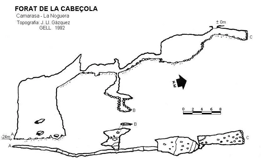
Forat de la Cabeçola
3.7 km · E
Camarasa (Noguera)
1 topo.
Source: Espeleoindex (espeleoindex.com), modified. CC BY-NC 4.0, https://creativecommons.org/licenses/by-nc/4.0/