
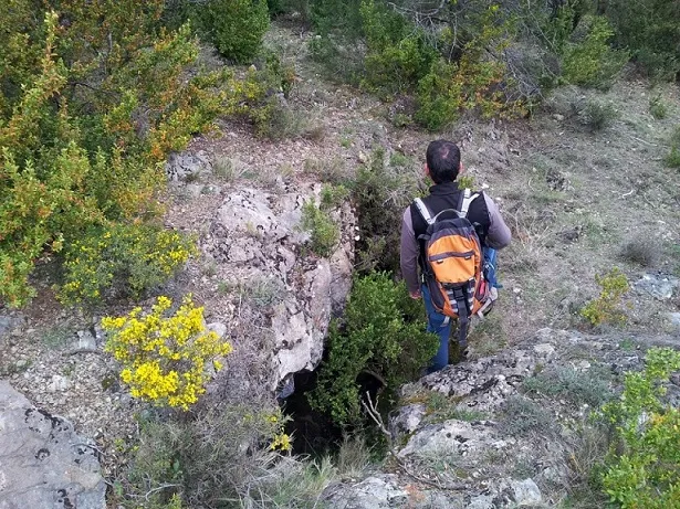
Avenc de les Ribes
A 19 m deep pothole in Baén, Baix Pallars.
EspeleoWorld
Avenc de les Ribes
A 19 m deep pothole in Baén, Baix Pallars.
Baix Pallars · Pallars Sobirà
Length: 25 m · Depth: 19 m
Updated record
https://espeleoworld.com/en/c/avenc-de-les-ribes
Information can change. Always verify coordinates, access, weather, and cave conditions before setting out.
A 19 m deep pothole in Baén, Baix Pallars.
Topographic
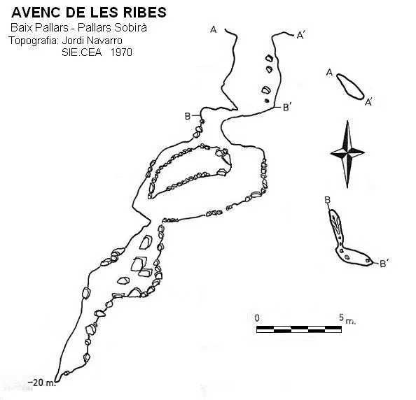
Espeleoindex · CC BY-NC 4.0, https://creativecommons.org/licenses/by-nc/4.0/ · Image © its author.
Photos
Espeleoindex · CC BY-NC 4.0, https://creativecommons.org/licenses/by-nc/4.0/ · Image © its author.
Description
Morphology
The entrance has three mouths, two of which are completely impenetrable. The first shaft is 4 metres. There is the start of two crawls, one of no importance, only 4 metres; the other leads to the second shaft. This is entirely a chaos of blocks.
Speleothems
At the bottom there is a flowstone and various formations.
Progression
We descend the 4 metres of the first shaft. The blocks of the second shaft must be dodged in order to be able to reach the bottom. No kind of equipment is needed for the descent.
History
The first exploration was carried out by members of the SIE-CEA on 1 March 1970.
User Comments (0)
No comments yet.
Be the first to share your experience!
Registered Explorations (0)
No explorations registered yet.
Register your visit to this cave!
Bibliography
Amenós, A.- Inglès, A. (1977).-'La Cova de Porredons'. Espeleòleg (25):323-332. ERE-CEC. Barcelona
Valles, Jordi de (2008).-'Alta Ribagorça, Pallar Jussà, Pallars Sobirà i Val d'Aran'. Catàleg Espeleològic de Catalunya (vol.1): 1-319. EC Gràcia/FCE.
Coordenades i fotografies extretes de Wikiloc, autor Murisec, post del dia 24-04-2016.
Nearby caves
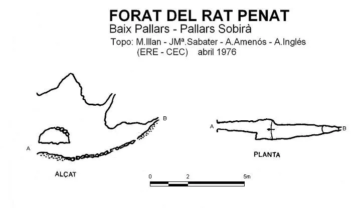


Source: Espeleoindex (espeleoindex.com), modified. CC BY-NC 4.0, https://creativecommons.org/licenses/by-nc/4.0/