Avenc de la Roca Tiraval

Avenc de la Roca Tiraval

A 27-metre-deep pit in Bagà, explored in 1979 by the SIE del CE Àliga.

Bagà • Berguedà 29m 24m

A 27-metre-deep pit in Bagà, explored in 1979 by the SIE del CE Àliga.

Characteristics

Location

To reach it, follow a route that crosses the bridge over the river, passes by a recreation area and goes up the paved track until it meets another one. On the other side of the track there are some signs and a path that heads uphill, starting with a steep climb and crossing an area of gullies. The path gains perspective over Bagà; after a first steeper section the slope eases. A small hill is gained and you continue over open terrain, seeing the Roca Tiraval in the distance. The path comes out onto a track, near Can Matallops; follow the track to the right for approximately a hundred metres and a faint path heads off to the left, making a turn of more than 90º. The path climbs through the forest up to the ermita de Santa Fe de Quer, which has no roof. Past the ruined church there are views of the Roca Tiraval, with its diagonal cliff, and opposite the house of Can Quer, which is reached by a track. Pass the house and follow the track, which soon becomes a path; you gain slope and enter the torrent de Turbians, in damp and shady terrain, a mixed forest of pines and beeches with a lot of undergrowth. You pass by the base of the walls of the cliff and the path climbs steeply following the torrent. At one point you must leave the path and turn completely to the right onto a faint path that climbs directly to the summit; it does not appear on maps and you must not pass it by. As a reference there is a red mark on a box tree, some cairns and signs of some hiking. The first section is the easiest to follow; as the vegetation disappears it becomes hard to find the right trail. You must follow the cliff in a slight leftward direction, following the shape of the terrain. Shortly before reaching the Roca Tiraval, the path passes beside the mouth of the avenc de la Roca Tiraval. The total route is 3 kilometres. Very approximate coordinates.

Map

Entrances

Always verify coordinates and access conditions before setting out.

  1. Avenc de la Roca Tiraval

    Elevation: 1403 m

    42.247237, 1.837903
    UTM 31T (ED 50) 404223 4678085
Download all entrances as GPX

Photos

Avenc de la Roca Tiraval - Photo, Bagà, BerguedàView image
Click to enlarge

Espeleoindex · CC BY-NC 4.0, https://creativecommons.org/licenses/by-nc/4.0/ · Image © its author.

Image 1 of 1

Description

Morphology

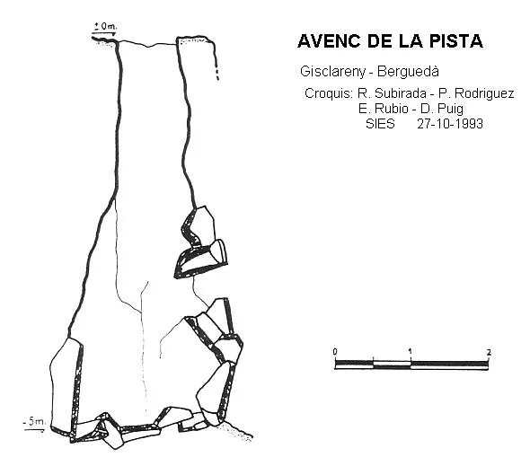
Beside some blocks you enter a pit of irregular section that widens a few metres into the descent. At the base, a short descending ramp places you at -24 metres depth. The pit is 27 metres deep.

History

The first exploration was carried out in 1979 by the SIE del CE Àliga.

User Comments (0)

No comments yet.

Be the first to share your experience!

Registered Explorations (0)

No explorations registered yet.

Register your visit to this cave!

Bibliography

  1. Borràs, J.; Miñarro, JM.; Talavera, F. (1980).- Catàleg Espeleològic de Catalunya. (Urgell,el Solsonès, la Segarra i el Berguedà). Vol. 5: 234 pp. Políglota. Barcelona.
  • Situació, fotografia i coordenades facilitades pel blog “Engarrista”de Marc Solé, www.engarrista.com/content/view/314/74/ post del dia 4/1/2011.

Source: Espeleoindex (espeleoindex.com), modified. CC BY-NC 4.0, https://creativecommons.org/licenses/by-nc/4.0/