

Veledahöhle
South of Velmede, in an elongated cliff belt of Middle Devonian Sparganophyllum limestone, lies the entrance to the Veleda Höhle.
EspeleoWorld
Veledahöhle
South of Velmede, in an elongated cliff belt of Middle Devonian Sparganophyllum limestone, lies the entrance to the Veleda Höhle.
Bestwig
الطول: 243 m
السجل المحدّث
https://espeleoworld.com/ar/c/veledahoehle-bestwig
قد تتغير المعلومات. تحقق دائمًا من الإحداثيات والوصول والطقس وظروف الكهف قبل الانطلاق.
South of Velmede, in an elongated cliff belt of Middle Devonian Sparganophyllum limestone, lies the entrance to the Veleda Höhle.
الصور
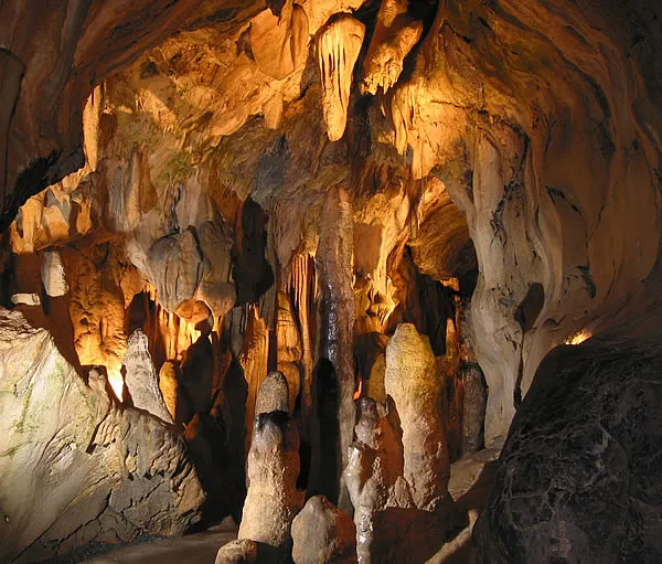
© DonGatley · CC BY-SA 3.0, https://creativecommons.org/licenses/by-sa/3.0/ · Wikimedia Commons · https://commons.wikimedia.org/wiki/File:Veleda-H%C3%B6hle_westlicher_Eingang.JPG
الوصف
تفاصيل أخرى
In the western part of the cliff belt, the limestones were formerly quarried, but the excavation has been backfilled. At the westernmost point, next to the road, there was formerly a lime kiln, parts of which are still preserved today.
تعليقات المستخدمين (0)
لا توجد تعليقات بعد.
كن أول من يشارك تجربته!
الاستكشافات المسجلة (0)
لا توجد استكشافات مسجلة بعد.
سجل زيارتك لهذا الكهف!
الكهوف القريبة


المصدر: Geotopkataster Nordrhein-Westfalen (Geologischer Dienst NRW) (ogc-api.nrw.de)، مع تعديلات. Data licence Germany – attribution – version 2.0 (dl-de/by-2-0), https://www.govdata.de/dl-de/by-2-0 Geowissenschaftliche Daten: INSP-GeotopeinNRW @ Geologischer Dienst NRW · بيانات عام 2026 · يحتوي على معلومات من Grottocenter (Wikicaves)، grottocenter.org، متاحة بموجب رخصة قاعدة البيانات المفتوحة (Open Database License، ODbL 1.0, https://opendatacommons.org/licenses/odbl/1-0/)، مع تعديلات. · الطول · تم الحصول عليها في 2026-11-13 · https://grottocenter.org/ui/entrances/23707 · بيانات عام 2026 · بيانات الموقع: © OpenStreetMap contributors، ODbL 1.0, https://opendatacommons.org/licenses/odbl/1-0/. · https://www.openstreetmap.org/node/418797628 · البيانات المشتقة متاحة عند الطلب بموجب ODbL: [email protected]