
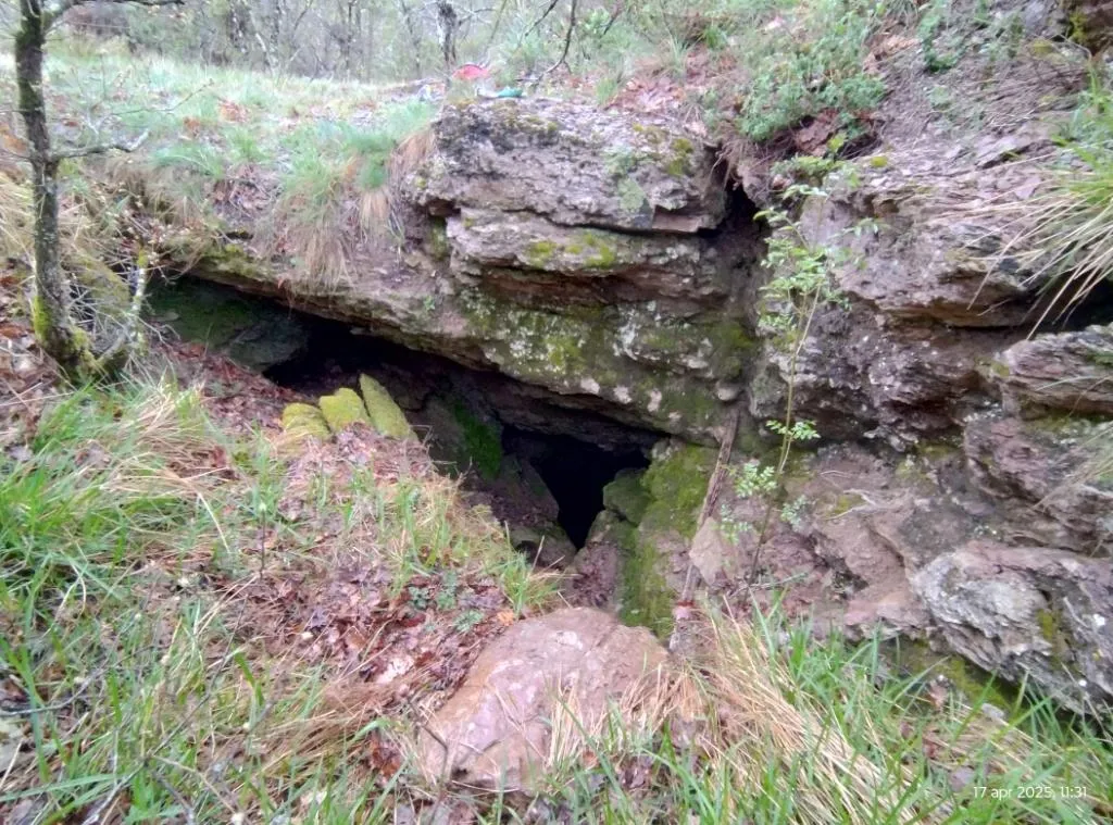
Grotta di Fontana Miella
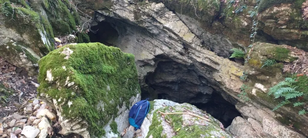
Cave that opens with a wide swallow hole about 2x2 m in a landslide gully and continues with an 18 m pit, from the bottom of which a system of fissures and wide galleries is reached.
EspeleoWorld
Grotta di Fontana Miella
Cave that opens with a wide swallow hole about 2x2 m in a landslide gully and continues with an 18 m pit, from the bottom of which a system of fissures and wide galleries is reached.
San Venanzo
Длина: 77 m · Глубина: 33 m
Актуальная запись
https://espeleoworld.com/ru/c/grotta-di-fontana-miella-san-venanzo-terni
Информация может меняться. Перед выходом всегда проверяйте координаты, доступ, погоду и состояние пещеры.
Cave that opens with a wide swallow hole about 2x2 m in a landslide gully and continues with an 18 m pit, from the bottom of which a system of fissures and wide galleries is reached.
Топография
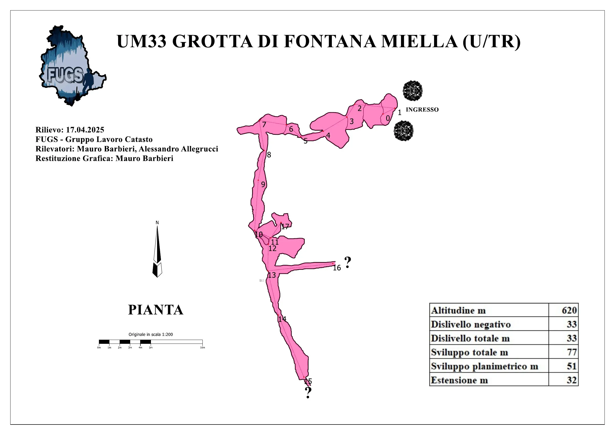
© Mauro Barbieri · CC BY-SA 4.0, https://creativecommons.org/licenses/by-sa/4.0/ · Federazione Umbra Gruppi Speleologici (FUGS), Catasto Speleologico dell'Umbria · https://catasto.fugs.it/index.php?mod=caves&op=view&id=33
Фотографии
© Mauro Barbieri · LicenseRef-FUGS-media-per-item · Federazione Umbra Gruppi Speleologici (FUGS), Catasto Speleologico dell'Umbria · https://catasto.fugs.it/index.php?mod=caves&op=view&id=33
Описание
Морфология
Entrance: wide swallow hole inside a landslide gully, about 2x2 m in size. 18 m pit, from the bottom of which a system of fissures and wide galleries is reached. Trend: mixed.
Гидрология
Water difficulties: waterfalls.
Прохождение
Passability: experts only; recommended period all year round. Rigging: fixed. Hazards: dangerous access, landslides/collapses.
Другие сведения
Geology: VAS Scaglia Variegata - Eocene Med.Sup. (Lutetian-Priabonian); marls; stratified.
История
Notes on the name: it presumably takes its name from a gully near the Fosso di Ospedaletto close to the entrance.
Комментарии пользователей (0)
Комментариев пока нет.
Станьте первым, кто поделится своим опытом!
Зарегистрированные исследования (0)
Зарегистрированных исследований пока нет.
Зарегистрируйте свое посещение этой пещеры!
Библиография
LEMMI G. & COLETTI G. (1961) Elenco catastale delle grotte dell'Umbria ANONIMO (1962) Attività del Gruppo Grotte dell'Istituto di Geologia dell'Università di Perugia COCCHI C. (1962) La Grotta di Fontana Miella MARTINI A. (1962) Alcune considerazioni preliminari sulla microflora delle caveme ANONIMO (1972) Il 1971 per Io Speleo Club di Orvieto
Ближайшие пещеры


Источник: Catasto Cavità Umbria (Federazione Umbra Gruppi Speleologici, FUGS) (catasto.fugs.it), с изменениями. LicenseRef-FUGS-no-licence-stated Federazione Umbra Gruppi Speleologici (FUGS), Catasto Speleologico dell'Umbria · https://catasto.fugs.it/index.php?mod=caves&op=view&id=33 · данные на 2025 г. · Источник: Catasto Cavità Umbria (Federazione Umbra Gruppi Speleologici, FUGS) (catasto.fugs.it), с изменениями. LicenseRef-FUGS-media-per-item Federazione Umbra Gruppi Speleologici (FUGS), Catasto Speleologico dell'Umbria · данные на 2025 г.