
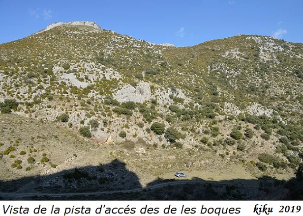
Mina Superior de la Canal
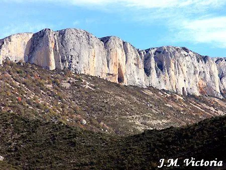
Semi-artificial cave in Llastarri (Tremp), at the Roca de la Canal, with two entrances of the Mines de la Canal.
EspeleoWorld
Mina Superior de la Canal
Semi-artificial cave in Llastarri (Tremp), at the Roca de la Canal, with two entrances of the Mines de la Canal.
Tremp · Pallars Jussà
Sviluppo: 25 m · Profondità: 2 m
Scheda aggiornata
https://espeleoworld.com/it/c/mina-superior-de-la-canal
Le informazioni possono cambiare. Verifica sempre coordinate, accesso, meteo e condizioni della cavità prima di partire.
Semi-artificial cave in Llastarri (Tremp), at the Roca de la Canal, with two entrances of the Mines de la Canal.
Topografia
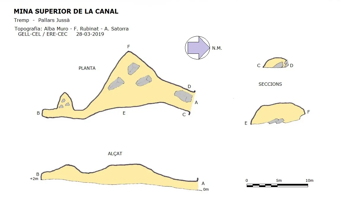
Espeleoindex · CC BY-NC 4.0, https://creativecommons.org/licenses/by-nc/4.0/ · Immagine © del suo autore.
Foto
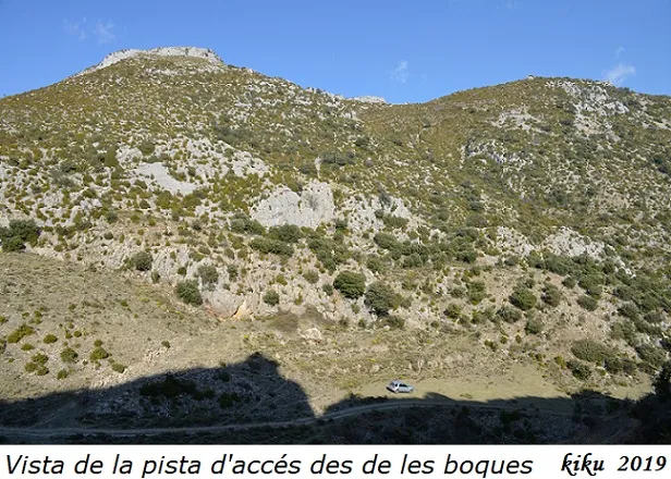
Espeleoindex · CC BY-NC 4.0, https://creativecommons.org/licenses/by-nc/4.0/ · Immagine © del suo autore.
Descrizione
Morfologia
The entrance, 3.49x1.61 metres and hidden by vegetation, opens on a bedding plane; the original passage has been considerably altered by mining extraction, affecting above all the western wall of the gallery. It is a passage 25.3 metres long and slightly ascending; halfway along it we find a large chamber of 9x9x3 metres.
Storia
In August 1910 Faura i Sans accompanied the biospeleologists Jeannel and Racovitza during their excursions to the Conca de Tremp. Faura recorded an oral account of a cavity at Llastarri that they call Forat Negre.
The following year, specifically on 18 June 1911, Jeannel and Racovitza reached Llastarri and visited the Mines de la Canal, where they made an important collection of fauna.
For many years, until 1979, there was no news of these mines, and even now we do not know of the existence of the Forat Negre. This relocation of the cavity was carried out by the biospeleologists Oleguer Escolà and Jordi Comas, in search of the fauna collected by Jeannel and Racovitza. Subsequently many more visits followed, especially by J. Fresneda, all with biospeleological purposes.
On 27 March 2019 a team made up of members of the GELL – CE Lleida and the ERE – CEC visited the cavities while carrying out the relevant cataloguing work.
Note biospeleologiche
Collembola
- Pseudosinella sexoculata Schött, 1902
Coleoptera
- Choleva cisteloides Frölich, 1799
- Stygiophyes sanctigervasi Jeannel, 1911 (previously cited as Speonomus sanctigervasi)
- Stygiophyes latebricola elongatus Jeannel 1911 (previously cited as Speonomus latebricola elongatus)
Isopoda
- Spelaeonethes novus Arcangeli 1935
Opiliones
- Nemastoma manicatum Simon
Commenti degli utenti (0)
Nessun commento ancora.
Sii il primo a condividere la tua esperienza!
Esplorazioni registrate (0)
Nessuna esplorazione registrata.
Registra la tua visita a questa grotta!
Bibliografia
- Borràs, J.; Miñarro, JM.; Talavera, F. (1979).- Catàleg Espeleològic de Catalunya (el Pallars Jussà). Vol. 3: 211 pp. (Notes biospeleològiques, per Xavier Bellés). Ed. Políglota. Barcelona.
- Fresneda, J & Escolà, O. (2000).-”Distribución del género Stygiophyes Fresneda, 1998 y descripción de Stygiophyes aldomi allmorphus ssp.n (coleoptera, Cholevidae, Leptodirinae). Miscel·lània Zoològica 23.2:55-68. Museu d'Història Natural. Barcelona
- Jeannel,R. et Racovitza,E.-G.(1912).- “Enumération des grottes visitées” 4e sér. Archives de Zoologie Expérimentale et Générale(5e sér.): 572- 576. Paris
- Coordenades, situació, dades, topografia i fotografies aportades per Antoni Satorra, Alba Muro (GELL del CEL) i Francesc Rubinat (ERE del CEC).
Grotte vicine
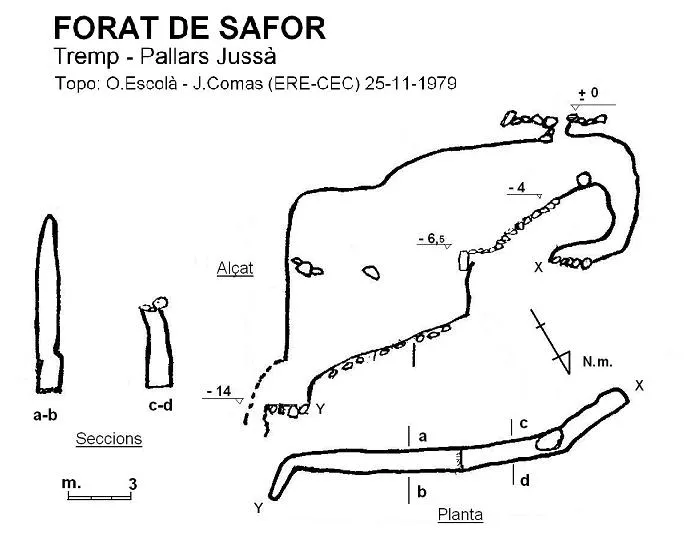



Fonte: Espeleoindex (espeleoindex.com), modificato. CC BY-NC 4.0, https://creativecommons.org/licenses/by-nc/4.0/