
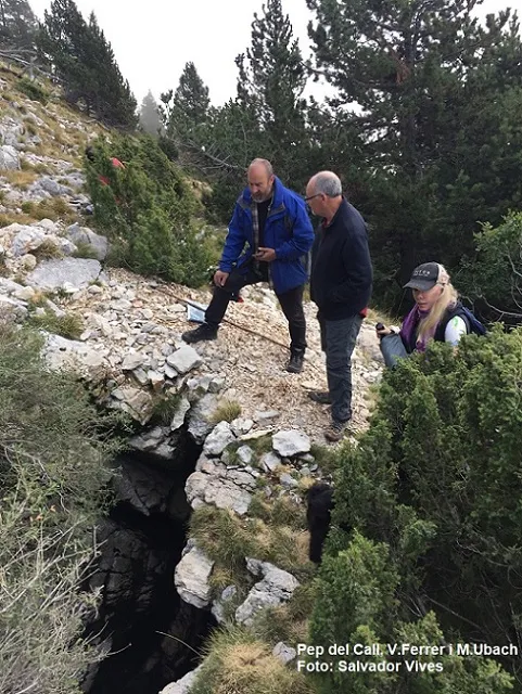
la Grallera d'odèn
A 54 m deep pit in the upper part of the Serra d'Odèn, known as la Grallera d'Odèn, with jackdaw guano and two surveys from 1963 and 1978.
EspeleoWorld
la Grallera d'odèn
A 54 m deep pit in the upper part of the Serra d'Odèn, known as la Grallera d'Odèn, with jackdaw guano and two surveys from 1963 and 1978.
Odèn · Solsonès
Sviluppo: 63 m · Profondità: 54 m
Scheda aggiornata
https://espeleoworld.com/it/c/la-grallera-d-oden
Le informazioni possono cambiare. Verifica sempre coordinate, accesso, meteo e condizioni della cavità prima di partire.
A 54 m deep pit in the upper part of the Serra d'Odèn, known as la Grallera d'Odèn, with jackdaw guano and two surveys from 1963 and 1978.
Topografia
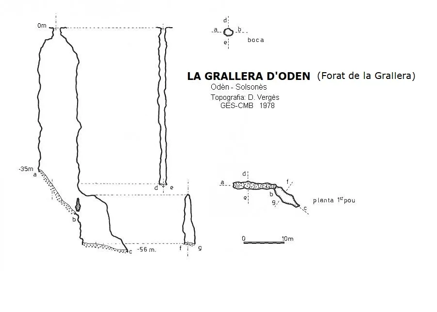

Espeleoindex · CC BY-NC 4.0, https://creativecommons.org/licenses/by-nc/4.0/ · Immagine © del suo autore.
Foto

Espeleoindex · CC BY-NC 4.0, https://creativecommons.org/licenses/by-nc/4.0/ · Immagine © del suo autore.
Descrizione
Morfologia
An elongated entrance leads to a shaft of good dimensions that descends vertically a little more than 40 metres to reach a very inclined level that quickly connects with a small shaft of about 8 metres, at the bottom of which the cavity ends. The depth is 54 metres on one survey and 56 metres on the other. The two existing surveys show considerable differences, especially in the final section: one (1963) shows the ramp at the -40 level as very short and appears as a single shaft, and the other (1978) shows the ramp as much longer and claims to show two shafts.
Progressione
The descent was made with a re-rig to descend the last shaft, according to F. Fadrique, who made the descent on 23-9-2017. In 1963 Montserrat Ubach made a partial descent with the 20 metres of ladder they carried.
Altri dettagli
The walls show a strong presence of jackdaw guano and, both on the ramp and at the base, there is also a lot of guano and an accumulation of decomposing organic material. In Odèn it is known simply as la Grallera, and no other is known there; given the number of cavities named this way, it was decided to keep the name given by Salvador Codina as la Grallera d'Odèn.
Storia
Known for a long time by the shepherds of the area, it was pointed out to Montserrat Ubach who, together with her parents (C. Tarrès and J. Ubach), located it during the days 14 to 19 April 1963 and she made a partial descent with the 20 metres of ladder they carried. During those same days they also located another pit, the one that shortly afterwards would be named Avenc Montserrat Ubach. From here the Operació Solsonès began and in the first days of June of the same year a team made up of J. Subils, J. Senent, E. Sabaté and M. Ubach carried out the exploration of the cavity, naming it Avenc de les Gralles, which they published the following year in the CEC magazine: Montaña no. 90.
No further news of the pit was heard, but in 1978, Daniel Vergés (EPR) of the GES-CMB explored a grallera in the Odèn area, naming it Forat de la Grallera, and passed the references to the team compiling the Catàleg Espeleològic de Catalunya (1980), but the location data are erroneous or the editors did not know how to interpret them, since it is placed below the Puig Sobirà, on the other slope of the riu d'Odèn. The two surveys have significant differences, although the depth is almost the same.
Many years had to pass, specifically until 2007, when S. Codina of the CE del Solsonès referred to the cavity and named it Grallera d'Odèn, thinking that it was the cavity described by Vergés (Corriol no. 147), giving a fairly correct location, which is also reflected in the Catàleg Espeleològic de Catalunya (2009) by Jordi de Vallès.
Ten years later, on 23 September 2017, members of the 'Comissió per a la protecció de l'avenc Montserrat Ubach' within the Projecte Francesc Español for biospeleological research, accompanied by Pep del Call and with the directions given by Joan Sabata Irla, a former shepherd who knew the pit, managed to locate it and carry out a quick exploration (Floren Fadrique and Eduard Badiella) for biospeleological purposes.
With all these data the conclusion is reached that the Avenc de les Gralles (1963) and the Forat de la Grallera (1978) are the same cavity.
Commenti degli utenti (0)
Nessun commento ancora.
Sii il primo a condividere la tua esperienza!
Esplorazioni registrate (0)
Nessuna esplorazione registrata.
Registra la tua visita a questa grotta!
Bibliografia
- Borràs,J; Miñarro,J.M; Talavera,F.(1980).-”l'Urgell, el Solsonès, la Segarra i el Berguedà”. Catàleg Espeleològic de Catalunya (vol 5):1-233. Ed. Políglota. Barcelona.
- Codina, S. (2007).- “La Grallera d'Odèn” Corriol (147): 10-11. Centre Excursionista del Solsonès. Solsona.
- Subils, J.; Senent, J.; Escolà, O.(1964).-”Operació Solsonès”. Montaña (90):47-55. Centre Excursionista Catalunya.
- Ubach, Montserrat; Escolà, Oleguer.(1968).-”Operació Solsonès – campanyes 1962 a 1965 (primera etapa). Espeleòleg (5):158-162. ERE-Centre Excursionista de Catalunya.
- Valles, J. de (2009).- Catàleg Espeleològic de Catalunya. Vol. 2: 384 pp. Espeleo Club de Gràcia/Federació Catalana d'Espeleologia. Barcelona.
- Dades de situació, coordenades i fotografies facilitades per Montserrat Ubach (Sarawak). També es pot consultar el blog: avencmontserratubach.blogspot. Apunt dins la secció: Projecte Francesc Español (28-9-2017)
Grotte vicine
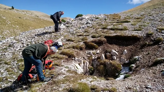
Grallera de la Comtessa
2.1 km · NE
Odèn (Solsonès)
1 topo.9 foto
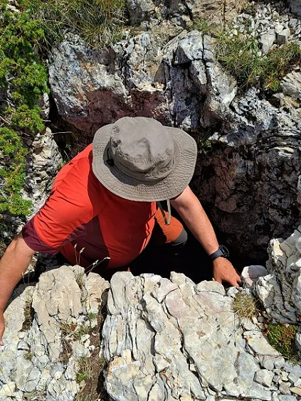
Grallera Petita de Prat Rodó
2.5 km · NE
Fígols i Alinyà (Alt Urgell)
1 topo.1 foto
Grallera de Prat Rodó
2.5 km · NE
Fígols i Alinyà (Alt Urgell)
1 topo.4 foto
Bòfia del Port del Comte
3.5 km · E
Coma i la Pedra, La (Solsonès)
1 topo.6 foto
Fonte: Espeleoindex (espeleoindex.com), modificato. CC BY-NC 4.0, https://creativecommons.org/licenses/by-nc/4.0/