
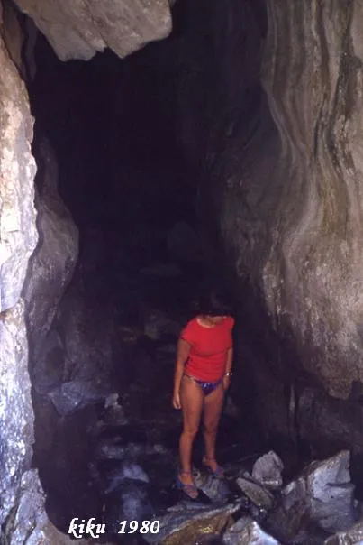
Horat Deth Bo
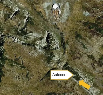
A 250 m underground passage of the Malo river, in the Vall d'Aran, SE of the Plan de Beret, near the lower station of the Horat deth Bo chairlift.
EspeleoWorld
Horat Deth Bo
A 250 m underground passage of the Malo river, in the Vall d'Aran, SE of the Plan de Beret, near the lower station of the Horat deth Bo chairlift.
Naut Aran · Val d'Aran
Sviluppo: 250 m · Profondità: 5 m
Scheda aggiornata
https://espeleoworld.com/it/c/horat-deth-bo
Le informazioni possono cambiare. Verifica sempre coordinate, accesso, meteo e condizioni della cavità prima di partire.
A 250 m underground passage of the Malo river, in the Vall d'Aran, SE of the Plan de Beret, near the lower station of the Horat deth Bo chairlift.
Topografia
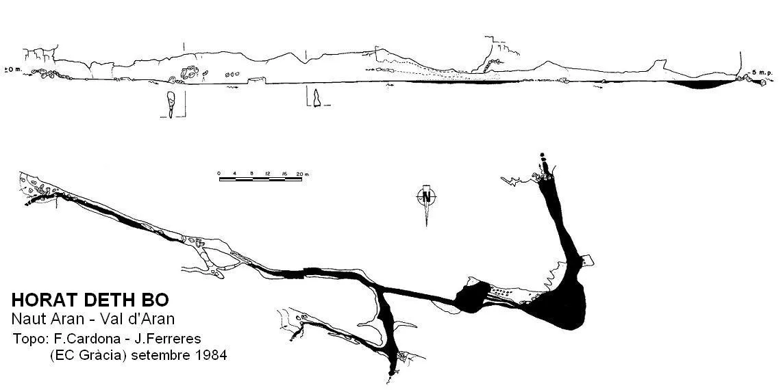
Espeleoindex · CC BY-NC 4.0, https://creativecommons.org/licenses/by-nc/4.0/ · Immagine © del suo autore.
Foto
Espeleoindex · CC BY-NC 4.0, https://creativecommons.org/licenses/by-nc/4.0/ · Immagine © del suo autore.
Descrizione
Morfologia
The Horat deth Bo is the largest cavity in a group of residual cavities related to one another that, in the past, formed a single underground unit, today half dismantled. The cavity has 4 entrances; one that acts as a spring and three that are pits, one of them with awkward access. The main pit is the upper entrance, located to the E (Cova Mari Carmen Moreno), through which the waters coming from a nearby area of scree penetrate. The middle entrance swallows the waters carried by the bed of the Malo river during periods of storms or thaw, since it is generally dry because the pits located some 250 metres further up mean that no water reaches it, except in times of flooding. Although this middle entrance should remain inactive for most of the year, works within the ski slopes have channelled a stream, whose water enters through this entrance. The cavity has roomy dimensions with sections taller than they are wide, except for the stretch closest to the exit where it widens as the river describes a meander. The morphology of the whole cavity is erosional, with a floor full of cobbles and gravel over which the river flows. The walls and the ceiling, of a very white colour, are full of very clearly marked current imprints and of a size ranging between 3 and 5 centimetres, which show us a not very distant period of pressurised flow in a turbulent regime.
Idrologia
The whole cavity is an active course that carries a considerable flow even in summer. During floods, the flow can increase considerably, dragging trunks and other objects that remain hanging from the ceiling.
Storia
In his Catàleg (1897), Font i Sagué already mentions the cavity, which he calls Avenc de riu Malo, and gives the references taken from a study (1895) on the Vall d'Aran made by the forest engineer Josep Reig. Faura i Sans carries this information into some of his works, but without adding any further data. It is not until August 1967 that three members of the SIE – CEA carry out what we believe to be the first complete exploration of the cavity.
Commenti degli utenti (0)
Nessun commento ancora.
Sii il primo a condividere la tua esperienza!
Esplorazioni registrate (0)
Nessuna esplorazione registrata.
Registra la tua visita a questa grotta!
Bibliografia
- Besset, Y. (1977).- “Spéléologie au Val d'Aran (Espagne)” Ouarnède (9): 57-76. GS des Pyrénées. Toulouse.
- Cardona, F. (1984).- “El Forat del Bo i el karst del riu Malo” Exploracions (8): 83-89. EC de Gràcia. Barcelona.
- Victoria, R. (1968).- “La zona kárstica del rio Malo” EspeleoSie (2): 31-32. SIE – CE Àliga. Barcelona.
Grotte vicine




Fonte: Espeleoindex (espeleoindex.com), modificato. CC BY-NC 4.0, https://creativecommons.org/licenses/by-nc/4.0/