

Es Arcs Deth Arriu Malo
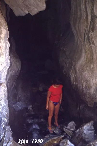
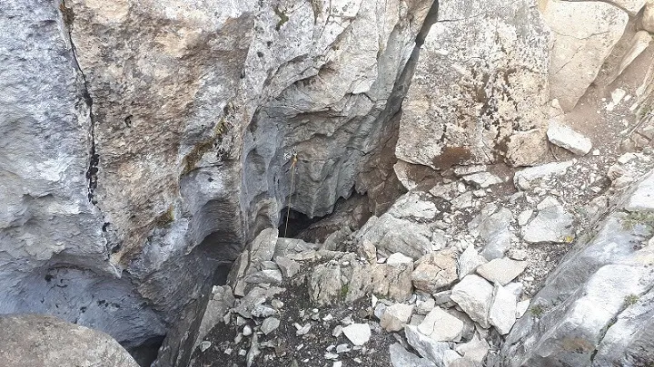
Remains of the ancient subterranean course of the Malo river, in the Vall d'Aran, with large high-vaulted natural bridges.
EspeleoWorld
Es Arcs Deth Arriu Malo
Remains of the ancient subterranean course of the Malo river, in the Vall d'Aran, with large high-vaulted natural bridges.
Naut Aran · Val d'Aran
Sviluppo: 36 m · Profondità: 2 m
Scheda aggiornata
https://espeleoworld.com/it/c/es-arcs-deth-arriu-malo
Le informazioni possono cambiare. Verifica sempre coordinate, accesso, meteo e condizioni della cavità prima di partire.
Remains of the ancient subterranean course of the Malo river, in the Vall d'Aran, with large high-vaulted natural bridges.
Topografia

Espeleoindex · CC BY-NC 4.0, https://creativecommons.org/licenses/by-nc/4.0/ · Immagine © del suo autore.
Foto
Espeleoindex · CC BY-NC 4.0, https://creativecommons.org/licenses/by-nc/4.0/ · Immagine © del suo autore.
Descrizione
Morfologia
Long high-vaulted natural bridges, vestiges of an ancient cavern system, between which the river flows. From East to West and from the upper part to the lower, we find a first arch 9 metres high, then the second one, 36 metres long, which is the largest, with heights of up to 12 metres, and with a small side gallery; this stretch is the only one we could consider a cave, and finally we find a last arch 9 metres high. The course of the whole complex is 70 metres.
Storia
Although they would be fairly well-known phenomena in the area, we know of no reference until the publication of the work by Ferran Cardona (ECG) on the karst of the Malo river. We have no reference to the existence of any survey of this karst phenomenon, until in August 2015 Montserrat Ubach and Jordi Lloret surveyed it.
Commenti degli utenti (0)
Nessun commento ancora.
Sii il primo a condividere la tua esperienza!
Esplorazioni registrate (0)
Nessuna esplorazione registrata.
Registra la tua visita a questa grotta!
Bibliografia
- Cardona, F. (1984).- “El Forat del Bo i el karst del riu Malo” Exploracions (8): 83-89. EC de Gràcia. Barcelona.
- Fotografies facilitades per Jordi Lloret i Prieto.
- Topografia extreta del blog (sarawakexploracions.blogspot.com.es)
Grotte vicine



Fonte: Espeleoindex (espeleoindex.com), modificato. CC BY-NC 4.0, https://creativecommons.org/licenses/by-nc/4.0/