
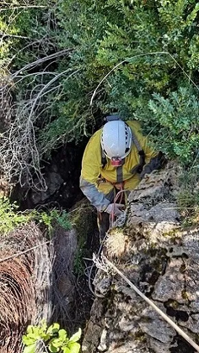
Grallera de Catllarí
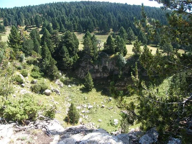
A pit 18 metres deep in the Rasos de Peguera (Fígols), with a single shaft inside an elongated doline.
EspeleoWorld
Grallera de Catllarí
A pit 18 metres deep in the Rasos de Peguera (Fígols), with a single shaft inside an elongated doline.
Fígols · Berguedà
Sviluppo: 27 m · Profondità: 18 m
Scheda aggiornata
https://espeleoworld.com/it/c/grallera-de-catllari
Le informazioni possono cambiare. Verifica sempre coordinate, accesso, meteo e condizioni della cavità prima di partire.
A pit 18 metres deep in the Rasos de Peguera (Fígols), with a single shaft inside an elongated doline.
Topografia
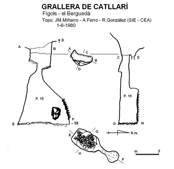
Espeleoindex · CC BY-NC 4.0, https://creativecommons.org/licenses/by-nc/4.0/ · Immagine © del suo autore.
Foto
Espeleoindex · CC BY-NC 4.0, https://creativecommons.org/licenses/by-nc/4.0/ · Immagine © del suo autore.
Descrizione
Morfologia
In the very middle of an elongated doline opens the single shaft that forms the cavity; a few metres into its descent, the NE wall veers in that direction, giving it a certain bell-like shape. At the bottom of the 15-metre vertical drop there is a pile of rubble, and at the NE end, through a low passage formed by a series of fitted and cemented blocks, one can enter a small chamber with a flat floor.
Storia
The first exploration was carried out by the ERE of the CEC in the mid-1960s.
In June 1980 a team from the SIE-CEA located it and produced the only survey we know of.
Finally, on 26-8-2022 it was relocated by Josep Guarro and Joan C. Juderías with the help of a LIDAR map.
Commenti degli utenti (0)
Nessun commento ancora.
Sii il primo a condividere la tua esperienza!
Esplorazioni registrate (0)
Nessuna esplorazione registrata.
Registra la tua visita a questa grotta!
Bibliografia
- Borràs,J; Miñarro,J.M; Talavera,F.(1980).-”l'Urgell, el Solsonès, la Segarra i el Berguedà”. Catàleg Espeleològic de Catalunya (vol 5):1-233. Ed. Políglota. Barcelona.
- Valles, Jordi de (2009).-”Berguedà, Cerdanya, Garrotxa, Ripollès” Catàleg Espeleològic de Catalunya (Vol.3):1-381. EC Gràcia/FCE.
- Revisió de coordenades, situació i fotografies facilitades per Josep Guarro i Joan C. Juderías (agost 2022)
Grotte vicine


Fonte: Espeleoindex (espeleoindex.com), modificato. CC BY-NC 4.0, https://creativecommons.org/licenses/by-nc/4.0/