
Graller d'Espills
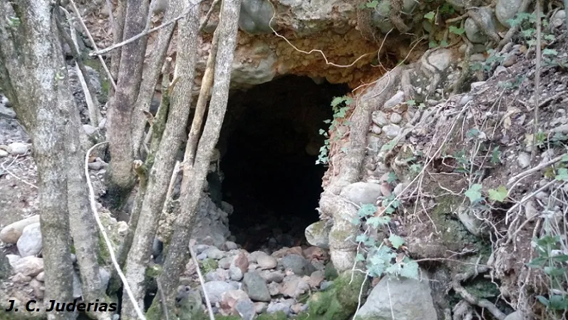
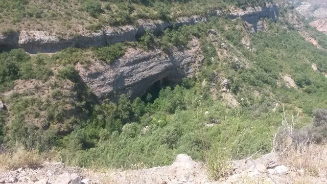
A 61-metre-deep pit in the Serra de Lleràs (Tremp), with a large entrance about 5x3 metres, a 40-metre shaft and an ascending gallery.
EspeleoWorld
Graller d'Espills
A 61-metre-deep pit in the Serra de Lleràs (Tremp), with a large entrance about 5x3 metres, a 40-metre shaft and an ascending gallery.
Tremp · Pallars Jussà
Sviluppo: 76 m · Profondità: 61 m
Scheda aggiornata
https://espeleoworld.com/it/c/graller-d-espills
Le informazioni possono cambiare. Verifica sempre coordinate, accesso, meteo e condizioni della cavità prima di partire.
A 61-metre-deep pit in the Serra de Lleràs (Tremp), with a large entrance about 5x3 metres, a 40-metre shaft and an ascending gallery.
Topografia
Espeleoindex · CC BY-NC 4.0, https://creativecommons.org/licenses/by-nc/4.0/ · Immagine © del suo autore.
Foto
Espeleoindex · CC BY-NC 4.0, https://creativecommons.org/licenses/by-nc/4.0/ · Immagine © del suo autore.
Descrizione
Morfologia
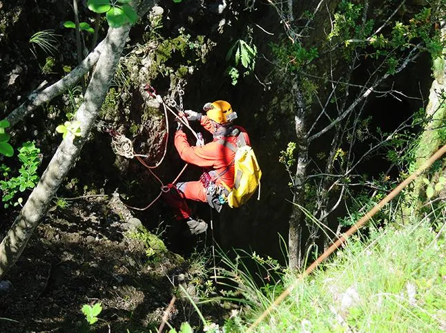
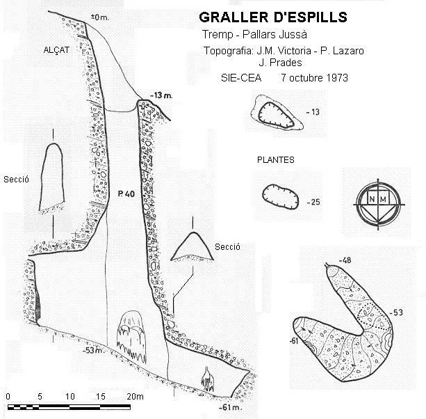
It is a large entrance, about 5x3 metres. From the access funnel, which has a drop of -13 metres between its lips, one reaches a fine 40-metre-deep shaft with an average section of 5x3 metres, which increases from -20 metres of descent onwards. At the base of the shaft (-53 metres) there is an ascending gallery 15 metres long by 4 wide and 13 metres high. At the upper end of the ramp, hanging at about 10 metres of height, a conduit one metre in diameter can be seen. In the descending direction the gallery turns about 90º and 10 metres further on it turns another 90º, recovering the NW-SE direction parallel to the gallery of the entrance shaft.
Concrezioni
From the conduit one metre in diameter hanging at about 10 metres of height, a showy flowstone descends.
Progressione
A 20-metre rope is rigged to a tree to make the approach to the rigging that descends the 40-metre shaft. This rope is essential, since descending without belaying is very dangerous because the ground is sandy as well as damp and slippery.
Storia
The first exploration was carried out by members of the Grup Espeleològic Pedraforca (Barcelona) in 1966, although it remained practically unpublished until 1973, when it was relocated by the SIE - CEA during the campaigns that were being carried out at that time in the Serra de Lleràs.
Commenti degli utenti (0)
Nessun commento ancora.
Sii il primo a condividere la tua esperienza!
Esplorazioni registrate (0)
Nessuna esplorazione registrata.
Registra la tua visita a questa grotta!
Bibliografia
- Victoria, J.M.;Iñigo, G;Rovira, J.(1974).-”Karstificación en los conglomerados del margen derecho de la Conca de Tremp.(Lérida). Espeleosie (16):71-120. SIE-CE Àliga. Barcelona.
- Situació, coordenades i fotografies extretes del blog: espeleobloc.blogspot (apunt del 22-7-2016). Text i fotografies de Montse Roca i Julio Serrano (SIE - CEA) que van localitzar la cavitat gràcies a les coordenades facilitades per Jordi Pasqual (GESAM, Tremp)
Grotte vicine


Fonte: Espeleoindex (espeleoindex.com), modificato. CC BY-NC 4.0, https://creativecommons.org/licenses/by-nc/4.0/