
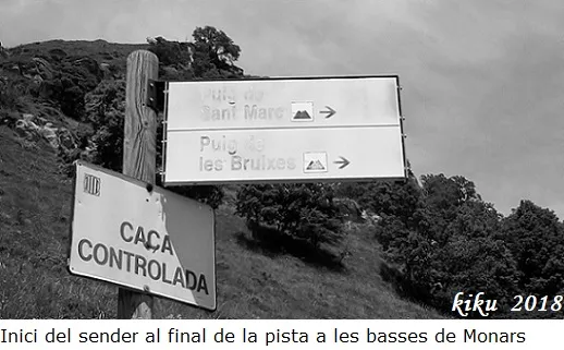
Forat del Puig de les Bruixes
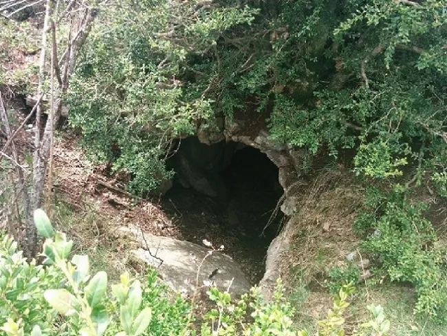
A pit with a 39-metre vertical drop in the municipality of Montagut i Oix, with an entrance of 2.5 x 1.5 metres, a 15-metre shaft and a chamber of 23.5 x 17 metres.
EspeleoWorld
Forat del Puig de les Bruixes
A pit with a 39-metre vertical drop in the municipality of Montagut i Oix, with an entrance of 2.5 x 1.5 metres, a 15-metre shaft and a chamber of 23.5 x 17 metres.
Montagut i Oix · Garrotxa
Sviluppo: 87 m · Profondità: 39 m
Scheda aggiornata
https://espeleoworld.com/it/c/forat-del-puig-de-les-bruixes
Le informazioni possono cambiare. Verifica sempre coordinate, accesso, meteo e condizioni della cavità prima di partire.
A pit with a 39-metre vertical drop in the municipality of Montagut i Oix, with an entrance of 2.5 x 1.5 metres, a 15-metre shaft and a chamber of 23.5 x 17 metres.
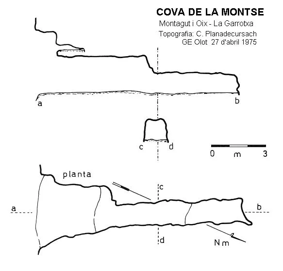
Topografia

Espeleoindex · CC BY-NC 4.0, https://creativecommons.org/licenses/by-nc/4.0/ · Immagine © del suo autore.
Foto
Espeleoindex · CC BY-NC 4.0, https://creativecommons.org/licenses/by-nc/4.0/ · Immagine © del suo autore.
Descrizione
Morfologia
An entrance of 2.5 x 1.5 metres that begins a steep slope of more than 35º in a spacious gallery, between 3 and 5 metres wide and 2.5 to 5 metres high. As the gallery descends, the gradient gradually eases while it changes direction, first towards the east and then towards the west. This leads to a small step at the top of the shaft where there is a block 2 metres high. From here the 15-metre-deep shaft lands in a chamber of 23.5 x 17 metres containing some large blocks.
Concrezioni
In the chamber there are several areas with lithogenic formations.
Altri dettagli
Toponymy: with regard to the name avenc del Pic de les Bruixes, we consider the toponym used by our colleagues of the GEB, Forat del Puig de les Bruixes, to be more correct, since the gazetteer of toponymy of Catalonia lists the name of the nearby Puig in this way.
Storia
The first written record of this cavity is the one provided by O. Escolà, who explored and surveyed it on 2-7-1972 together with other members of the ERE-CEC, accompanied by three members of the CE Olot, among them J. Puigmal. However, the result of this exploration was not published until 1980. It should be noted that in 1969, while carrying out explorations at Beget, they were already told about this cavity, which the same author also mentions in an article published in 1977 in the magazine SIS no. 5.
In 1983, during an exploration carried out by the GEB, after reaching the bottom of the cavity, they found inside a rusty tin a piece of paper that fell apart in their hands, on which was written “J.M. COROMINAS-MEDICO-BAÑOLAS. El dia 18 de julio de 1955 los miembros del Centro Excursionista de Bañoles, Octavi...., Joaquin...” the rest was illegible.
Commenti degli utenti (0)
Nessun commento ancora.
Sii il primo a condividere la tua esperienza!
Esplorazioni registrate (0)
Nessuna esplorazione registrata.
Registra la tua visita a questa grotta!
Bibliografia
- Escolà, O.(1977).-”Resultats espeleològics d'una excursió a Beget” SIS (5):33-40. CE Terrassa.
- Escolà, Oleguer (1980).- “L'Avenc del Pic de les Bruixes (la garrotxa)” Muntanya (707-febrer) 18-19. Centre Excursionista de Catalunya. Barcelona.
- Miret, Francesc; García, Martí.(1999).-Coves de l'Alta Garrotxa (1-108) GE Badalona.
- Valles, Jordi de(2009).-”Berguedà, Cerdanya, Garrotxa, Ripollès”. Catàleg Espeleològic de Catalunya (vol.3):268-269. ECG/FCE.
- Fitxa actualitzada el juny de 2018. Situació, dades, coordenades i fotografies facilitades per Juli Serrano (SIE-CEA) i Francesc Rubinat (ERE-CEC).
Grotte vicine


Fonte: Espeleoindex (espeleoindex.com), modificato. CC BY-NC 4.0, https://creativecommons.org/licenses/by-nc/4.0/