
Cova S'Espasa
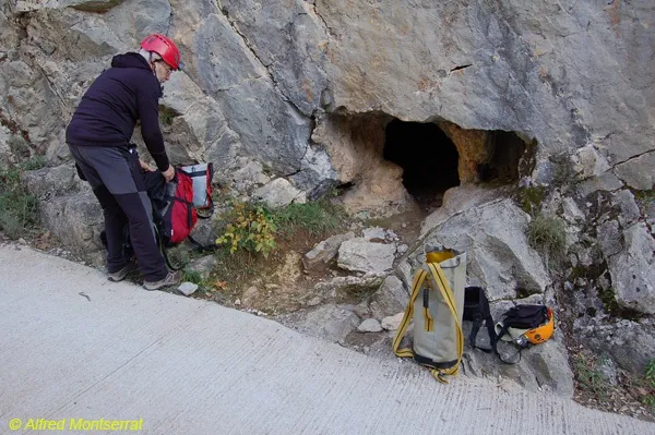
A 34-metre-long cave in Montagut i Oix, northwest of Sadernes, on a cliff above the riera d'Escales.
EspeleoWorld
Cova S'Espasa
A 34-metre-long cave in Montagut i Oix, northwest of Sadernes, on a cliff above the riera d'Escales.
Montagut i Oix · Garrotxa
Sviluppo: 34 m · Profondità: 5 m
Scheda aggiornata
https://espeleoworld.com/it/c/cova-s-espasa
Le informazioni possono cambiare. Verifica sempre coordinate, accesso, meteo e condizioni della cavità prima di partire.
A 34-metre-long cave in Montagut i Oix, northwest of Sadernes, on a cliff above the riera d'Escales.
Topografia
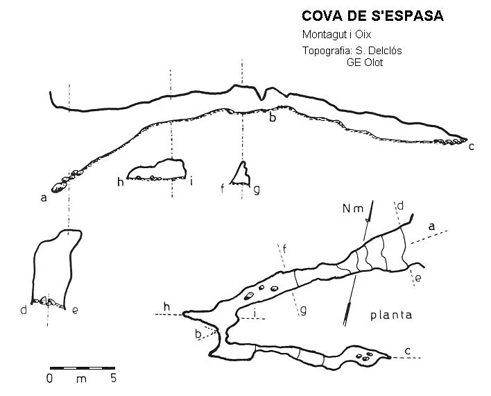
Espeleoindex · CC BY-NC 4.0, https://creativecommons.org/licenses/by-nc/4.0/ · Immagine © del suo autore.
Descrizione
Morfologia
Through an entrance a little more than 5 metres high, one enters an ascending gallery that quickly loses height until it becomes a passage of small dimensions and almost horizontal. A few metres further on it makes a bend, gaining width and a little height, but it narrows again and the gallery turns almost 180º, continuing narrow and slightly descending until it is choked by sediments.
Progressione
To reach the cave it is necessary to descend by rappel from the upper part.
Storia
Explored by the GE Olot in the first half of the 70s of the last century.
Commenti degli utenti (0)
Nessun commento ancora.
Sii il primo a condividere la tua esperienza!
Esplorazioni registrate (0)
Nessuna esplorazione registrata.
Registra la tua visita a questa grotta!
Bibliografia
- Borràs,J;Miñarro,JM;Talavera,F.(1980).-”el ripollès, la garrotxa i l'alt empordà” Catàleg Espeleològic de Catalunya (vol.4):1-296. ed. Políglota. Barcelona.
Grotte vicine

Fonte: Espeleoindex (espeleoindex.com), modificato. CC BY-NC 4.0, https://creativecommons.org/licenses/by-nc/4.0/