
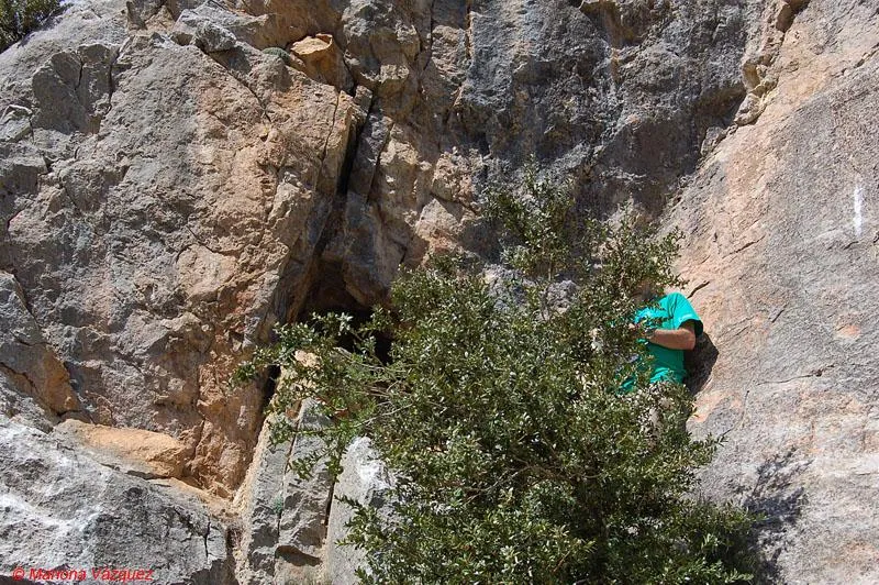
Cova E d'Olopte
Small cave with a 15 m passage near Olopte (Isòvol), with an entrance divided into two galleries that converge and remain filled by sediments.
EspeleoWorld
Cova E d'Olopte
Small cave with a 15 m passage near Olopte (Isòvol), with an entrance divided into two galleries that converge and remain filled by sediments.
Isòvol · Cerdanya
Sviluppo: 15 m · Profondità: 2 m
Scheda aggiornata
https://espeleoworld.com/it/c/cova-e-d-olopte
Le informazioni possono cambiare. Verifica sempre coordinate, accesso, meteo e condizioni della cavità prima di partire.
Small cave with a 15 m passage near Olopte (Isòvol), with an entrance divided into two galleries that converge and remain filled by sediments.
Topografia
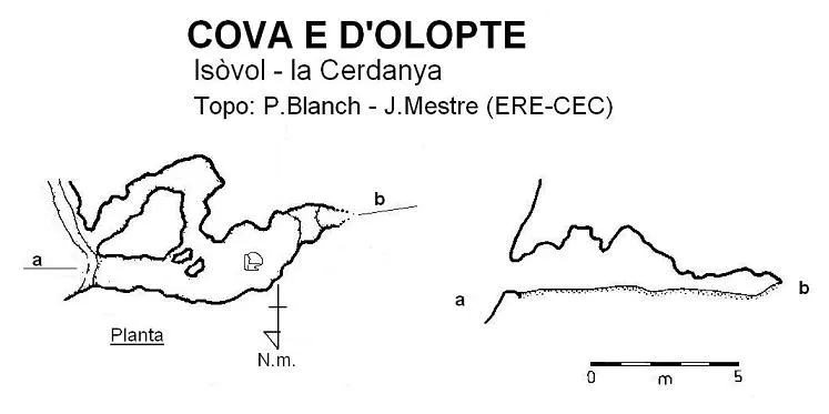
Espeleoindex · CC BY-NC 4.0, https://creativecommons.org/licenses/by-nc/4.0/ · Immagine © del suo autore.
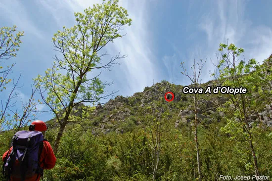
Foto
Espeleoindex · CC BY-NC 4.0, https://creativecommons.org/licenses/by-nc/4.0/ · Immagine © del suo autore.
Descrizione
Morfologia
It presents an access entrance divided into two galleries that, a few metres from the entrance, converge into a single one; a few metres further on it remains filled by sediments.
Storia
The group of the caves of Olopte catalogued from the letter “E” to “I” were explored and surveyed by members of the ERE-CEC around 1966, although they remained unpublished until 1978, when the colleague Josep Castell (epr) provided them for the first volume of the Catàleg Espeleològic de Catalunya (1978).
Commenti degli utenti (0)
Nessun commento ancora.
Sii il primo a condividere la tua esperienza!
Esplorazioni registrate (0)
Nessuna esplorazione registrata.
Registra la tua visita a questa grotta!
Bibliografia
- Borràs, J.; Miñarro,JM.; Talavera, F: (1978).-Catàleg espeleològic de Catalunya. Vol. 1 (l'Alt Urgell i la Cerdanya): 166. Ed. Políglota. Barcelona.
- Valles, Jordi de (2009).-”Berguedà, Cerdanya, Garrotxa, Ripollès”. Catàleg Espeleològic de Catalunya (vol.3):1-381. EC Gràcia/FCE.
- Revisió de coordenades i fotografies facilitades per Alfred Montserrat i Mariona Vázquez (ERE – CEC).
- Situació, revisió coordenades i altres fotos facilitades per Juli Serrano (SIE-CEA) i Francesc Rubinat (ERE-CEC). Actualització octubre de 2021.
Grotte vicine

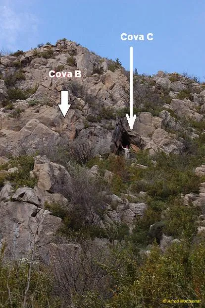
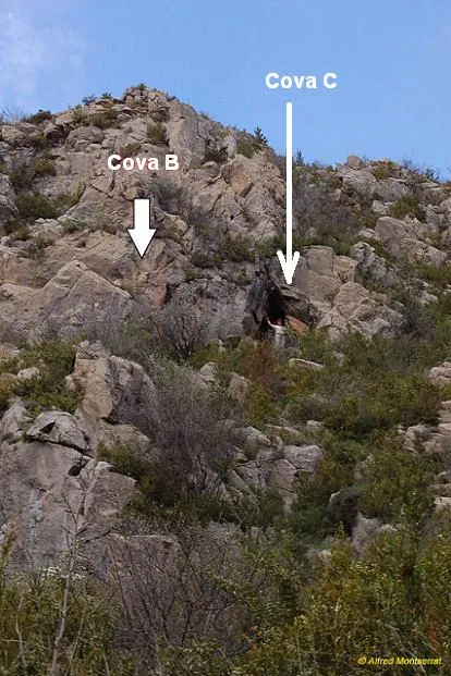


Fonte: Espeleoindex (espeleoindex.com), modificato. CC BY-NC 4.0, https://creativecommons.org/licenses/by-nc/4.0/