

Cova del Grèvol
Cova del Grèvol, in Capafonts (Muntanyes de Prades), just over a hundred metres long, an old spring of the waters of the pla dels Motllats.
EspeleoWorld
Cova del Grèvol
Cova del Grèvol, in Capafonts (Muntanyes de Prades), just over a hundred metres long, an old spring of the waters of the pla dels Motllats.
Capafonts · Baix Camp
Sviluppo: 107 m · Profondità: 15 m
Scheda aggiornata
https://espeleoworld.com/it/c/cova-del-grevol
Le informazioni possono cambiare. Verifica sempre coordinate, accesso, meteo e condizioni della cavità prima di partire.
Cova del Grèvol, in Capafonts (Muntanyes de Prades), just over a hundred metres long, an old spring of the waters of the pla dels Motllats.
Topografia

Espeleoindex · CC BY-NC 4.0, https://creativecommons.org/licenses/by-nc/4.0/ · Immagine © del suo autore.
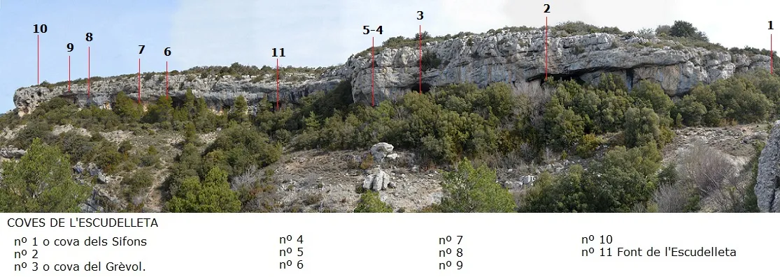
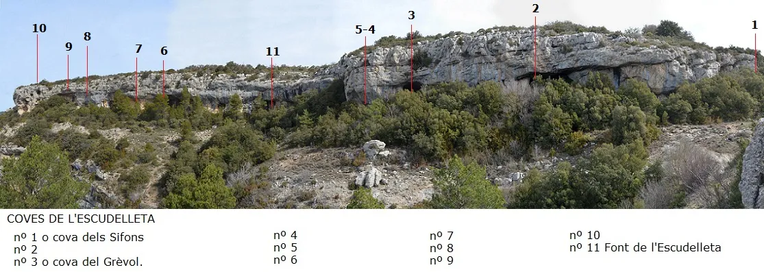
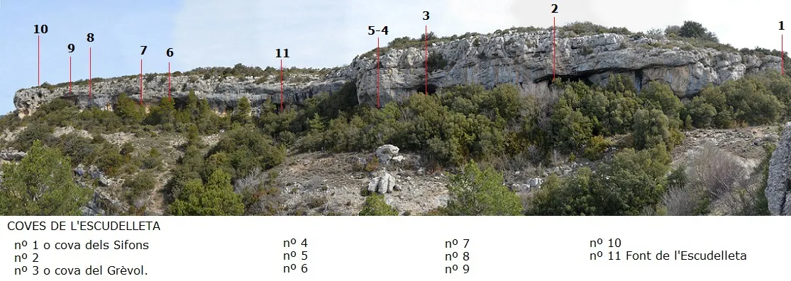
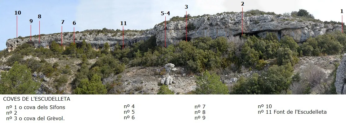
Foto
Espeleoindex · CC BY-NC 4.0, https://creativecommons.org/licenses/by-nc/4.0/ · Immagine © del suo autore.
Descrizione
Morfologia
A wide mouth 15 metres wide by 10 high gives access to two galleries. One, on the left and hanging about 7 metres above the floor, has an ascending route of 20 metres. Back at the mouth and on the right is the other gallery, with a steep ascending slope and a route of 36 metres. At its end, on the right, a crawlway leads us to a narrow ascending gallery that climbs up to the level + 15 m relative to the entrance mouth and with a further route of 36 metres. In the last part of this gallery many roots can be seen, revealing its proximity to the surface.
Idrologia
An old spring of the waters of the pla dels Motllats.
Altri dettagli
The survey carried out in 1972 by the GIEM has slight differences from that of the GGG and places the point of maximum drop at + 10.3 m and the total route at 122 m.
Storia
Despite being known since distant times by the people of the area, the first mention we find is due to J. Ferraté (1918), who mentions the group of caves, calling them Coves de l'Escudelleta.
J. Iglésies and J. Santasusagna (1930), in their hiking guide to the Muntanyes de Prades, also mention them, but specify that the most important of all of them is the one called Cova del Grèvol.
In 1968 and 1969, members of the Grup Geogràfic de Gràcia (later EC de Gràcia) visit it and survey it, calling it Cova de l'Escudelleta.
Shortly afterwards, in March 1972, it is surveyed by members of the GIEM (Montblanc), a survey unpublished until now, and they already recover the place name Cova del Grèvol, which is what the cavity is normally known as.
Even later, in 1981 and 1982, members of the SIEP – CE Poblet de Barcelona carry out a compilation work of the whole set of cavities and number them (1 to 10), but they call them del Barranc de la Pixera, although it would have been more correct to do so as Coves de l'Escudelleta.
Commenti degli utenti (0)
Nessun commento ancora.
Sii il primo a condividere la tua esperienza!
Esplorazioni registrate (0)
Nessuna esplorazione registrata.
Registra la tua visita a questa grotta!
Bibliografia
- Borràs, J.; Miñarro,J.M.; Talavera, F. (1984).-”el baix camp, el priorat i la ribera d'ebre”. Catàleg Espeleològic de Catalunya (vol.7):59-60 Ed Políglota.
- Ferraté, J.(1918).-Espeleologia a les Comarques Tarragonines.134 pp. Reus.
- Iglesies, J.(1929).-Les muntanyes de Prades, el Montsant i la serra de la Llena. 366 pàg. Agrupació Excursionista de Reus.
- Iglesies, J.; en col.laboració amb Santasusagna, J. (1930).- Les muntanyes de Prades, el Montsant i la serra de la Llena. 2ª edició. 366 pàg. Agrupació Excursionista de Reus.
- Talavera, Ferran (1982).-”Las cavidades del barranc de la Pixera (Motllat-Baix Camp)”. Boletín Espeleoógico SIEP (14):30-41. SIEP – CE Poblet.
- Vidal, M.; Ferreres, J. (1978).- “ Cova de l'Escudelleta, Capafonts (Tarragona)”. Exploracions (2): 69-71. Grup Geogràfic de Gràcia – Orfeó Gracienc. Barcelona.
- Coordenades, fotografies i dades actualitzades, aportades per l'equip d'EspeleoÍndex.
Grotte vicine


Fonte: Espeleoindex (espeleoindex.com), modificato. CC BY-NC 4.0, https://creativecommons.org/licenses/by-nc/4.0/