
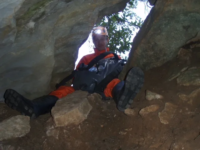
Cova del Conill
Cave of about 300 m of passage with an underground river in Horta de Sant Joan, with a flooded shaft and a terminal sump. Access by track from the T-330 road, within private property.
EspeleoWorld
Cova del Conill
Cave of about 300 m of passage with an underground river in Horta de Sant Joan, with a flooded shaft and a terminal sump. Access by track from the T-330 road, within private property.
Horta de Sant Joan · Terra Alta
Sviluppo: 260 m · Profondità: 29 m
Scheda aggiornata
https://espeleoworld.com/it/c/cova-del-conill-horta-de-sant-joan
Le informazioni possono cambiare. Verifica sempre coordinate, accesso, meteo e condizioni della cavità prima di partire.
Cave of about 300 m of passage with an underground river in Horta de Sant Joan, with a flooded shaft and a terminal sump. Access by track from the T-330 road, within private property.
Topografia
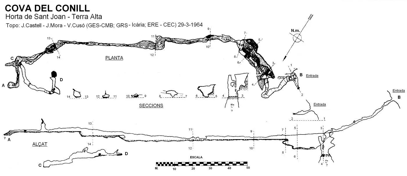
Espeleoindex · CC BY-NC 4.0, https://creativecommons.org/licenses/by-nc/4.0/ · Immagine © del suo autore.
Foto
Espeleoindex · CC BY-NC 4.0, https://creativecommons.org/licenses/by-nc/4.0/ · Immagine © del suo autore.
Descrizione
Morfologia
Through a small mouth one enters a descending passage, slightly winding and with some low-roofed section, leading out into the highest part of a chamber of notable dimensions. Before arriving, however, on the left of the entrance gallery, there is a flooded shaft formed by a limestone barrier that separates it from the rest of the cavity and that connects by means of a joint through which the waters of the small stream coming from the interior seep.
This flooded shaft has dimensions of about 5 metres long by 8 wide and a depth that varies according to the time of year. The first explorers, who made a free-diving dive, calculated a depth of 15 metres. More recently (October 2009) GRAE firefighters, assisted by members of the Espeleo Club Tortosa, made an underwater reconnaissance, without finding any continuation and calculating the water depth at about 9 metres. It should also be mentioned that on the opposite wall of the flooded shaft, members of the Espeleo Club Tortosa, in the low-water season, located a passage 1 metre wide by 1.5 high that they were able to follow for about 50 or 60 metres (without survey). This passage seems to be the main drain for the water and is only accessible when the level of the flooded shaft is very low.
Returning again to the end of the entrance gallery, by a muddy ramp and a step, one reaches the main hall of the cavity, about 27 metres long by 10 wide and about 8 high.
At the opposite end of the hall and about 3 metres above its base, there is a window through which the water of the small stream descends, creating a beautiful waterfall. Once past it, one enters a gallery through which the water flows at different levels (from 15 to 60 centimetres deep). The route presents abrupt changes of direction. A little more than about 80 metres from its start one must overcome a small raised step beneath which the water slides, and about 20 metres further on there is a new waterfall, also about 3 metres high but less difficult to overcome than the first. The height of the gallery is very variable; there are points that barely reach 1 metre and at others one can walk comfortably thanks to the 2 metres of height, and in some small chambers it even reaches 4 metres.
About 130 metres from the start of the gallery a hall forms, about 4 metres in diameter and a little more than 4 in height, from which two dry galleries lead off: the right one is only about 5 metres long and the left one 32, presenting in a corner a small chimney and ending in a small room full of pebbles.
From the previous hall, the flooded gallery continues straight for a few more metres and the depth of the water level rises until reaching a narrow sump where it has not been possible to continue for the moment.
To the speleometric data given for the survey: 260 metres, one must add the 50 more metres (not surveyed) of the overflow of the flooded shaft, with which it will exceed 300 metres of total passage.
Idrologia
A small underground river runs longitudinally through the main hall, obstructed by numerous blocks until it drains into the flooded shaft. The water of the small stream descends through a window, creating a beautiful waterfall. The flooded shaft connects by means of a joint through which the waters of the small stream coming from the interior seep. The passage on the opposite wall seems to be the main drain for the water and is only accessible when the level of the flooded shaft is very low.
Progressione
The first explorers made a free-diving dive in the flooded shaft. More recently (October 2009) GRAE firefighters, assisted by members of the Espeleo Club Tortosa, made an underwater reconnaissance. Members of the Espeleo Club Tortosa, in the low-water season, located a passage 1 metre wide by 1.5 high that they were able to follow for about 50 or 60 metres (without survey). En Ricard Ramos (ERE-CEC) made a free-diving dive in the flooded shaft. At the end of June of the same year l'Esteve Petit (ERE-CEC) attempted to overcome the terminal sump of the cavity, but the narrowness of the passage made him give up.
Storia
The first news about this cave is given by Joan Ferraté in 1918, where he explains that a few years earlier, a hunter from Horta, while following a rabbit, had it escape into a hole. Curious, the hunter entered a few metres until he became frightened. On returning to the village he told his adventure to his friends and they decided to explore the cave. From the description that Ferraté gives it seems that they only reached the main hall and it is not clear whether the account he gives is the product of a later visit by himself or of what the neighbours of Horta told him.
The cave remained forgotten until on 12 and 13 October 1963 members of a Barcelona interclub (GES-CMB; ERE-CEC; GIE-CE Gràcia; GRS-AE Icària) rediscovered it and made the total exploration. They themselves returned at Easter 1964 and made the only survey that we know of.
Much more recently, members of the Espeleo Club Tortosa, who are those who visit the cavity most regularly, found the water level of the flooded shaft much lower than usual and on the opposite wall found a passage, normally flooded, which is the main overflow for the waters, exploring it over about 50 or 60 metres (not surveyed).
Commenti degli utenti (0)
Nessun commento ancora.
Sii il primo a condividere la tua esperienza!
Esplorazioni registrate (0)
Nessuna esplorazione registrata.
Registra la tua visita a questa grotta!
Bibliografia
- Cusó, V.; Pascual, N. (1964).- “La Cova del Conill. Segundo rio subterráneo de Catalunya” Montaña (94): 223-226. Centre Excursionista de Catalunya. Barcelona.
- Escolà, O. (1964).- “Datos para el estudio geoespeleológico de la Cova del Conill” Montaña (94): 227-230. Centre Excursionista de Catalunya. Barcelona.
- Ferraté, J. (1918).- Espeleologia de les comarques tarragonines: 133 pp. Agrupació Excursionista de Reus.
- Pascual, N.; Cusó, V. (1964).- “La Cova d'el Conill o Cova d'el Closset” Geo y Bio Karst (1): 12-13. J.M.Armengou, editor. Barcelona.
· Coordenades, fotografies i altres dades facilitades per l'Espeleo Club Tortosa.
Grotte vicine
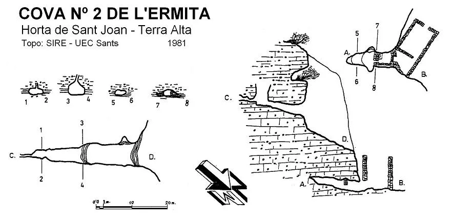


Fonte: Espeleoindex (espeleoindex.com), modificato. CC BY-NC 4.0, https://creativecommons.org/licenses/by-nc/4.0/