
Cova del Camí de la Riba
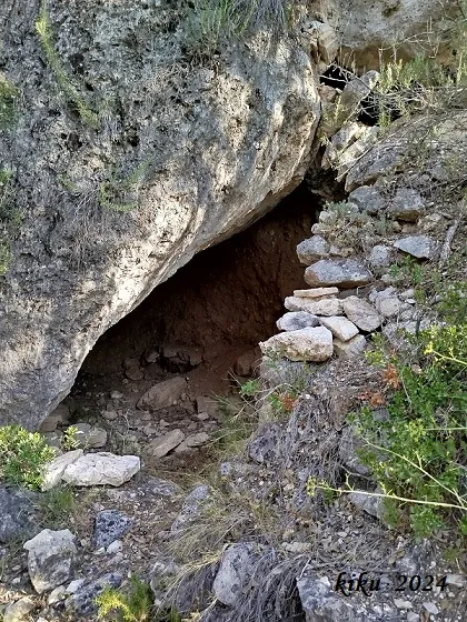
Small shelter in the lower area of the Penya Roja, Vilaverd, just over 6 metres long, 2.5 metres average width and just over 2 metres high.
EspeleoWorld
Cova del Camí de la Riba
Small shelter in the lower area of the Penya Roja, Vilaverd, just over 6 metres long, 2.5 metres average width and just over 2 metres high.
Vilaverd · Conca de Barberà
Sviluppo: 6 m
Scheda aggiornata
https://espeleoworld.com/it/c/cova-del-cami-de-la-riba
Le informazioni possono cambiare. Verifica sempre coordinate, accesso, meteo e condizioni della cavità prima di partire.
Small shelter in the lower area of the Penya Roja, Vilaverd, just over 6 metres long, 2.5 metres average width and just over 2 metres high.
Topografia
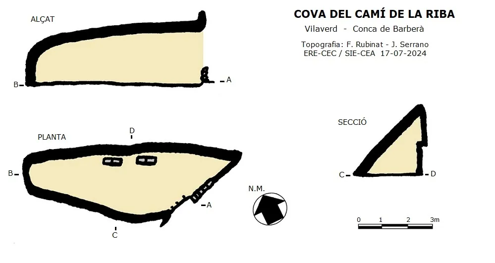
Espeleoindex · CC BY-NC 4.0, https://creativecommons.org/licenses/by-nc/4.0/ · Immagine © del suo autore.
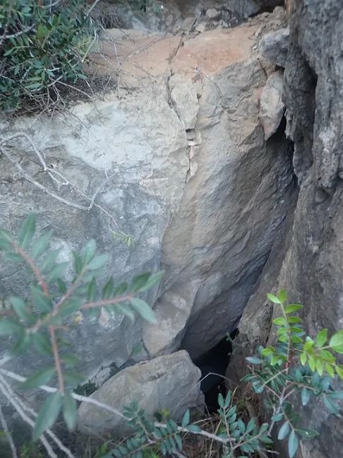
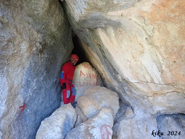
Foto
Espeleoindex · CC BY-NC 4.0, https://creativecommons.org/licenses/by-nc/4.0/ · Immagine © del suo autore.
Descrizione
Morfologia
It is a small cavity just over 6 metres long, 2.5 metres average width and just over 2 metres high. The cavity takes advantage of the space left by a large inclined block, inside which the right wall has been artificially excavated to gain space and at the entrance a small wall has been built.
Storia
Cavity unpublished speleologically, no publication has been found that refers to it. It is quite evident that it is known locally and by some hikers as well as used as a shelter by climbers. It was possibly already used as a hut by the old farmers who cultivated the terraces of the area, currently abandoned. Not having record of the name of the cavity, provisionally we cite it with the name of the path that passes by the mouth.
Commenti degli utenti (0)
Nessun commento ancora.
Sii il primo a condividere la tua esperienza!
Esplorazioni registrate (0)
Nessuna esplorazione registrata.
Registra la tua visita a questa grotta!
Bibliografia
- Totes les dades, coordenades, topografia i fotografies han estat facilitades per Juli Serrano (SIE-CEA) i Francesc Rubinat (ERE-CEC).
Grotte vicine


Fonte: Espeleoindex (espeleoindex.com), modificato. CC BY-NC 4.0, https://creativecommons.org/licenses/by-nc/4.0/