
Cova del Cagapaelles
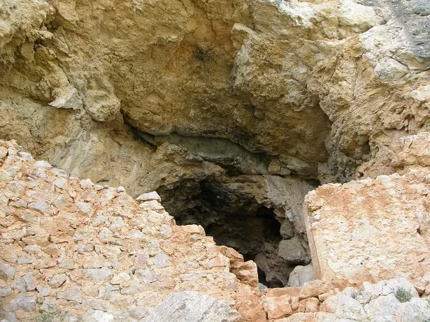
A conglomerate shelter in Gandesa, explored and surveyed by GERP in June 1987.
EspeleoWorld
Cova del Cagapaelles
A conglomerate shelter in Gandesa, explored and surveyed by GERP in June 1987.
Gandesa · Terra Alta
Sviluppo: 7 m
Scheda aggiornata
https://espeleoworld.com/it/c/cova-del-cagapaelles
Le informazioni possono cambiare. Verifica sempre coordinate, accesso, meteo e condizioni della cavità prima di partire.
A conglomerate shelter in Gandesa, explored and surveyed by GERP in June 1987.
Topografia
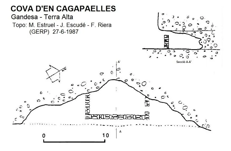
Espeleoindex · CC BY-NC 4.0, https://creativecommons.org/licenses/by-nc/4.0/ · Immagine © del suo autore.
Descrizione
Morfologia
Shelter 27 metres wide by about 3 high and about 7 metres long from the entrance overhang to the deepest point.
Altri dettagli
Inside it has a wall to enclose livestock.
Storia
The only known data are those given by the members of GERP (Sant Just Desvern) who explored and surveyed it in June 1987.
Commenti degli utenti (0)
Nessun commento ancora.
Sii il primo a condividere la tua esperienza!
Esplorazioni registrate (0)
Nessuna esplorazione registrata.
Registra la tua visita a questa grotta!
Bibliografia
- G.E. Rat-penats (1989).- “Contribució al catàleg espeleològic de la Terra Alta”. Exploracions (13): 39-50. EC de Gràcia. Barcelona.
Grotte vicine

Fonte: Espeleoindex (espeleoindex.com), modificato. CC BY-NC 4.0, https://creativecommons.org/licenses/by-nc/4.0/