
Cova de Montglòs
Small 15 m cave in the serra de l'Illa (la Cellera de Ter), speleologically undocumented and catalogued in May 2024.
EspeleoWorld
Cova de Montglòs
Small 15 m cave in the serra de l'Illa (la Cellera de Ter), speleologically undocumented and catalogued in May 2024.
Cellera de Ter, La · Selva
Sviluppo: 15 m
Scheda aggiornata
https://espeleoworld.com/it/c/cova-de-montglos
Le informazioni possono cambiare. Verifica sempre coordinate, accesso, meteo e condizioni della cavità prima di partire.
Small 15 m cave in the serra de l'Illa (la Cellera de Ter), speleologically undocumented and catalogued in May 2024.
Topografia
Espeleoindex · CC BY-NC 4.0, https://creativecommons.org/licenses/by-nc/4.0/ · Immagine © del suo autore.
Foto
Espeleoindex · CC BY-NC 4.0, https://creativecommons.org/licenses/by-nc/4.0/ · Immagine © del suo autore.
Descrizione
Morfologia
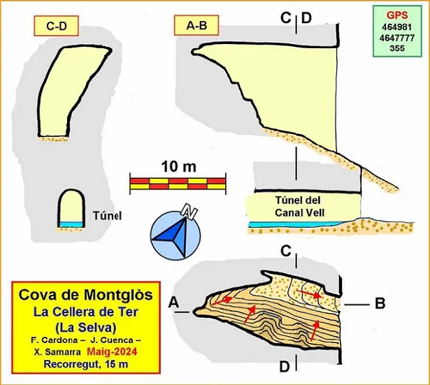
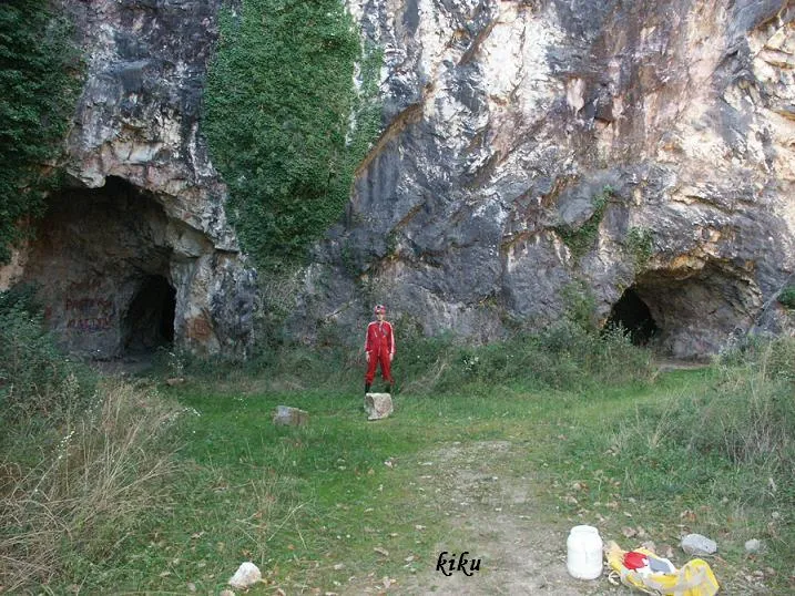
The cave is located just above the mouth of a tunnel that ends blind at 40 or 50 metres. In fact, the construction of the tunnel broke a good part of the slope that allows access to the cavity. This is of irregular configuration, with a large mouth that is 6 m wide by 12 high. The ceiling remains more or less level, but the floor is entirely ascending, especially in the final stretch, where we must climb if we want to reach the highest part. In general it is very rocky and only on the north side is there a sector with sediment, which is where the archaeologists carried out the excavations. Despite the size of the mouth, it is very covered by vegetation, which we also find inside the cavity since all of it is well lit.
Progressione
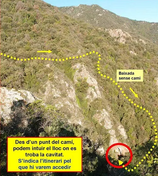
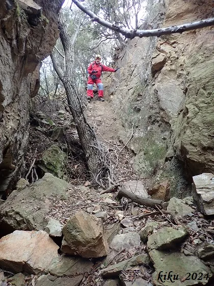
But, starting from the village of la Cellera de Ter, we will take a track that in about 5 km leaves us at a house called Plantadís. Once on foot, we must follow an old track that after a good walk ends in front of the roc de la bandera, so called because there is a pole where a flag used to be and which constitutes an excellent viewpoint towards the valley of the Ter and the tail of the el Pasteral reservoir. From the side of the rock a path is born that goes flanking the mountain towards the west and that we will have to follow for a good while. The path is easy to follow at first, but later it becomes faint and we will have to be attentive. Be that as it may, at a specific point, without any reference, we will have to leave the path and go down the mountain without a trail. It is a matter of descending a drop of about a hundred metres over difficult terrain, with a steep slope, wooded and with a lot of unstable stone. At the end of the descent we will find what looks like an old path, now very lost, which we will follow to the right until we reach the mouth of a tunnel (blind) of the canal Vell. The cave is located just above the tunnel, although the vegetation does not let us see it.
Storia
Speleologically undocumented cavity. The authors of the record had to dedicate several exhausting days in order to locate it, starting from an archaeological report from the year 1983 with many inaccuracies about its correct location. Finally, and thanks to a hiking itinerary where a point is mentioned from which the cave can be observed, in May 2024 they achieved their objective and were able to carry out the cataloguing work of the cavity.
Commenti degli utenti (0)
Nessun commento ancora.
Sii il primo a condividere la tua esperienza!
Esplorazioni registrate (0)
Nessuna esplorazione registrata.
Registra la tua visita a questa grotta!
Bibliografia
Totes les dades, topografia i fotografies han estat extretes del web: geb.cat (del Grup d'Espeleologia de Badalona). Apunt del 3-6-2024. Dades: Ferran Cardona (ECM Barcelonès), Josep Cuenca i Xavier Samarra (GE Badalona)
Grotte vicine


Fonte: Espeleoindex (espeleoindex.com), modificato. CC BY-NC 4.0, https://creativecommons.org/licenses/by-nc/4.0/