
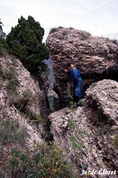
Avenc Nº1 del Capolatell
Important 115 m deep pit in the serra de Busa (Solsonès), at the Capolatell, with a 60 m entrance and a vertical route that reaches -115 m.
EspeleoWorld
Avenc Nº1 del Capolatell
Important 115 m deep pit in the serra de Busa (Solsonès), at the Capolatell, with a 60 m entrance and a vertical route that reaches -115 m.
Navès · Solsonès
Sviluppo: 420 m · Profondità: 115 m
Scheda aggiornata
https://espeleoworld.com/it/c/avenc-n-1-del-capolatell
Le informazioni possono cambiare. Verifica sempre coordinate, accesso, meteo e condizioni della cavità prima di partire.
Important 115 m deep pit in the serra de Busa (Solsonès), at the Capolatell, with a 60 m entrance and a vertical route that reaches -115 m.
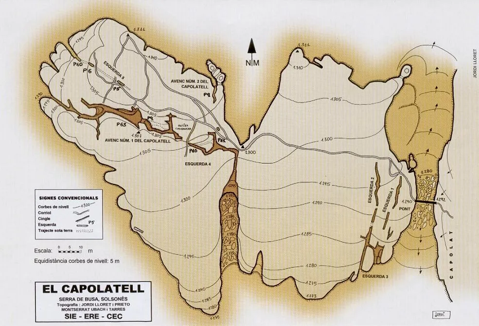
Topografia
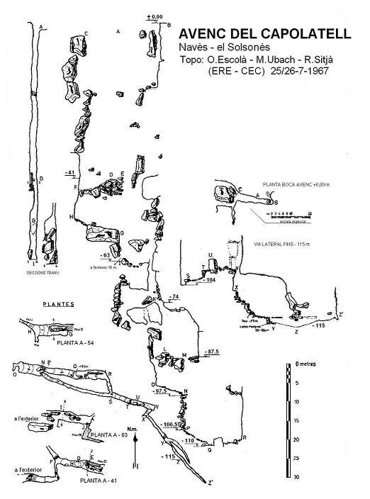
Espeleoindex · CC BY-NC 4.0, https://creativecommons.org/licenses/by-nc/4.0/ · Immagine © del suo autore.
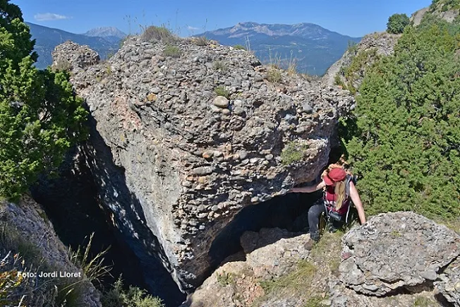
Foto
Espeleoindex · CC BY-NC 4.0, https://creativecommons.org/licenses/by-nc/4.0/ · Immagine © del suo autore.
Descrizione
Morfologia
Formed by a set of fissures structured between the O30N-E30S. Entrance of 60 metres elongated in this same direction, with maximum widths of 2 to 3 metres, presenting a drop that descends from 1307 to 1295 metres of altitude. Initial shaft of 63 metres with ledges formed by blocks wedged at -41 and -54. A narrow entrance gives way to a P-10 followed by a P-13 with the floor formed by rocks and sediments. From this point (level -87), the tectonic morphology is slightly masked by reconstructing processes. Lateral exits on the outer walls of the crag (levels -41, -63 and at the entrance itself). New vertical of 19 metres with an important intermediate ledge at the halfway point (-97.5), which reaches 106.5 and from where the fissure reaches 110 metres. Following a narrow lateral gallery towards the SE, where you must descend a small 5 metre pit, is the point of maximum depth of the cavity (-115).
Progressione
After crossing the fissure that isolates the two needles of the Capolatell by means of the 8 metre metal pole, pit no. 1 is located in the very middle of the westernmost needle, to the left of the main path that crosses the whole Capolatell from E to W. Inside, a narrow entrance gives way to a P-10 followed by a P-13. Further on, a new vertical of 19 metres with an important intermediate ledge at the halfway point (-97.5) reaches 106.5. Following a narrow lateral gallery towards the SE, you must descend a small 5 metre pit to the point of maximum depth of the cavity (-115).
Storia
The fissures of the Capolatell have been known since time immemorial. During the Peninsular War the isolated needle was used as a prison by removing the wooden pole, and during the civil war of 1936 it served as a hiding place for the inhabitants of Busa.
The first speleological reference about the Capolatell and the cavities appears in mid 1967 (EspeleoSie no. 1), when members of the SIE – CE Àliga visit the area in the month of April of that year and probe some of the fissures and claim to have reached about 100 metres of depth in one of them. They make no topography and do not even name any of the cavities.
In July of the same year, within the framework of the Operació Solsonès, members of the ERE – CEC make two reconnaissance visits and a third at the end of the same month of July, where the exploration and topography of what comes to be called avenc del Capolatell is completed, without making specific references to the other fissures.
Commenti degli utenti (0)
Nessun commento ancora.
Sii il primo a condividere la tua esperienza!
Esplorazioni registrate (0)
Nessuna esplorazione registrata.
Registra la tua visita a questa grotta!
Bibliografia
- Cardona, F. (1989).- “Grans cavitats de Catalunya” (Vol. 1: La Serralada Pirinenca). 198 pp. Espeleo Club de Gràcia. Barcelona.
- Escolà, O.; Ubach, M. (1967).- “Un nou avenc de 100 metres a Catalunya. Avenc del Capolatell (Serra de Busa, Solsonès)” Espeleòleg (4): 109-115. ERE del Centre Excursionista de Catalunya. Barcelona.
- Lloret, J. (2006).- “Espeleologia al Capolatell” Muntanya (868): 36-40 / Espeleòleg (44): 14-19. Centre Excursionista de Catalunya. Barcelona.
- Navarro, J. (1967).- “Exploraciones en la Sierra de Busa” EspeleoSie (1): 23-24. SIE – Centre Excursionista Àliga. Barcelona.
Fotografies aportades per Jordi Lloret.
Grotte vicine
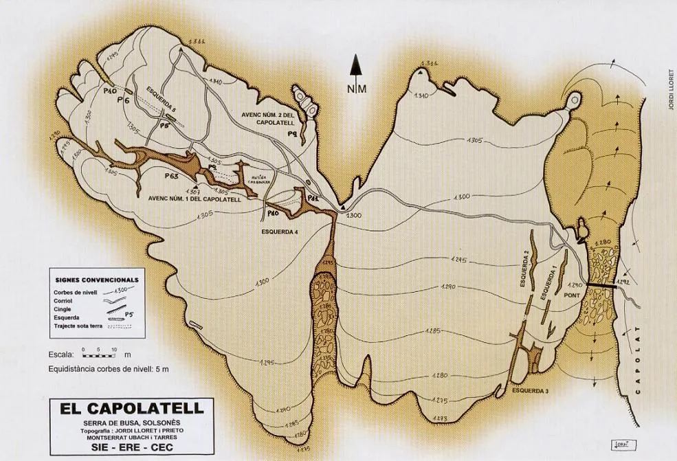
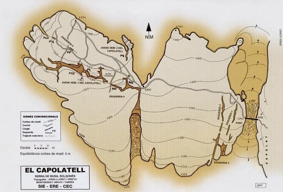


Fonte: Espeleoindex (espeleoindex.com), modificato. CC BY-NC 4.0, https://creativecommons.org/licenses/by-nc/4.0/