
Forat dels Pernils
Small pit 8 metres deep in Costafreda (Lladurs), first explored on 13 March 1966.
EspeleoWorld
Forat dels Pernils
Small pit 8 metres deep in Costafreda (Lladurs), first explored on 13 March 1966.
Lladurs · Solsonès
Length: 15 m · Depth: 8 m
Updated record
https://espeleoworld.com/en/c/forat-dels-pernils
Information can change. Always verify coordinates, access, weather, and cave conditions before setting out.
Small pit 8 metres deep in Costafreda (Lladurs), first explored on 13 March 1966.
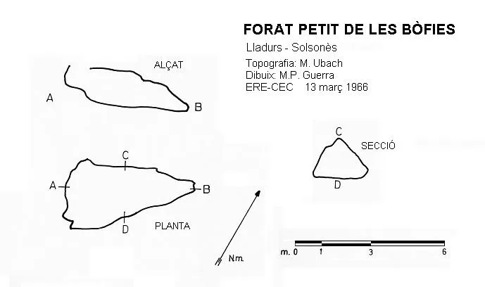
Topographic
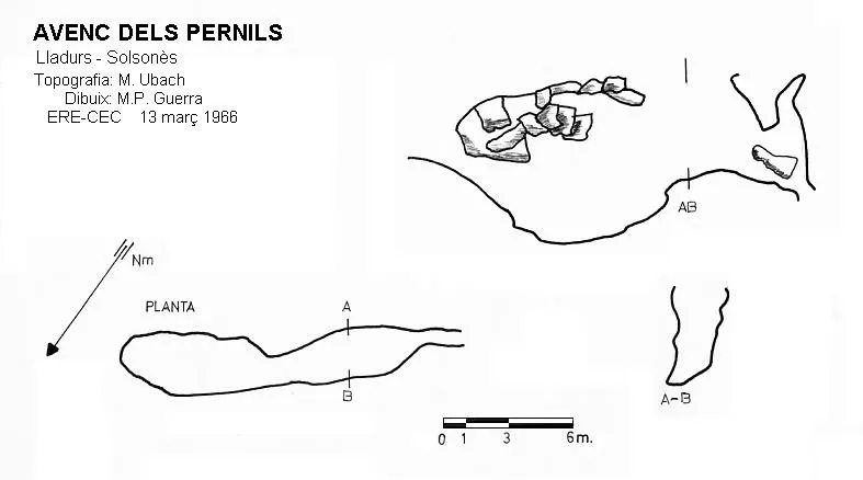
Espeleoindex · CC BY-NC 4.0, https://creativecommons.org/licenses/by-nc/4.0/ · Image © its author.
Description
Morphology
The pit is structured along a NE-SW joint and has a long entrance obstructed in its central part by blocks. The base, formed by clay and stones, with a slope towards its central point, is 2 to 3 metres wide.
History
The first exploration was carried out by Montserrat Ubach (ERE del CEC) on 13 March 1966.
User Comments (0)
No comments yet.
Be the first to share your experience!
Registered Explorations (0)
No explorations registered yet.
Register your visit to this cave!
Bibliography
- Borràs,J; Miñarro,J.M; Talavera,F.(1980).-”l'Urgell, el Solsonès, la Segarra i el Berguedà”. Catàleg Espeleològic de Catalunya (vol 5):1-233. Ed. Políglota. Barcelona.
Nearby caves

Source: Espeleoindex (espeleoindex.com), modified. CC BY-NC 4.0, https://creativecommons.org/licenses/by-nc/4.0/