
Forat de la Querata
A 51-metre-deep pit in Boumort, in the municipality of Baix Pallars, explored by the SIE del CEA in 1969.
EspeleoWorld
Forat de la Querata
A 51-metre-deep pit in Boumort, in the municipality of Baix Pallars, explored by the SIE del CEA in 1969.
Baix Pallars · Pallars Sobirà
Length: 150 m · Depth: 51 m
Updated record
https://espeleoworld.com/en/c/forat-de-la-querata
Information can change. Always verify coordinates, access, weather, and cave conditions before setting out.
A 51-metre-deep pit in Boumort, in the municipality of Baix Pallars, explored by the SIE del CEA in 1969.
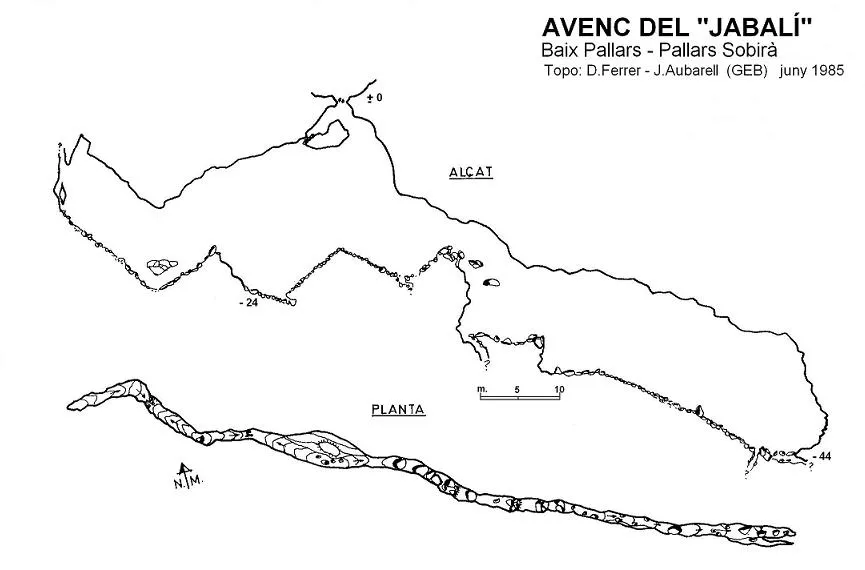
Topographic
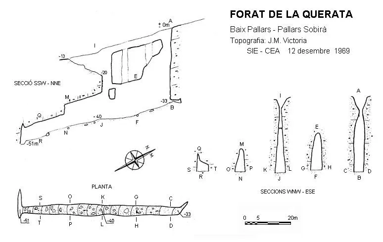
Espeleoindex · CC BY-NC 4.0, https://creativecommons.org/licenses/by-nc/4.0/ · Image © its author.
Description
Morphology
The entrance is structured in a diaclase 45 metres long by 5 metres wide; this forms a depression but only allows access to the cavity at its ends. Through the north-east end we access a pit 33 metres deep, while through the south-west end a ramp places us in front of a vertical drop of -20 metres; both verticals place us on the same sloping base, ending in a short perpendicular diaclase.
History
Explored by the SIE del CEA in 1969.
User Comments (0)
No comments yet.
Be the first to share your experience!
Registered Explorations (0)
No explorations registered yet.
Register your visit to this cave!
Bibliography
- Senent, J.; Victoria, JM.(1965).-“Datos para el conocimiento espeleológico del macizo del Boumort”. Montaña (100):269-281 Centre Excursionista de Catalunya. Barcelona.
- Borràs, J; Miñarro, J.M.; Talavera, F.(1979).-Catàleg Espeleològic de Catalunya (Vol.3). ed. Políglota. Barcelona.
- SIE-CEA. (1986).-XXV Aniversari SIE-CEA 1961-1986. (monogràfic):1-40. SIE-CE Àliga. Barcelona
Nearby caves

Source: Espeleoindex (espeleoindex.com), modified. CC BY-NC 4.0, https://creativecommons.org/licenses/by-nc/4.0/