
Cova M-14
Cova de 65 metres de recorregut a Montcortès, (Baix Pallars).
EspeleoWorld
Cova M-14
Cova de 65 metres de recorregut a Montcortès, (Baix Pallars).
Baix Pallars · Pallars Sobirà
Length: 65 m · Depth: 6 m
Updated record
https://espeleoworld.com/en/c/cova-m-14
Information can change. Always verify coordinates, access, weather, and cave conditions before setting out.
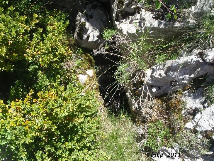
A 65-metre-long cave in Montcortès (Baix Pallars), with several exits to the outside due to its collapse structure and clastic process.
Topographic
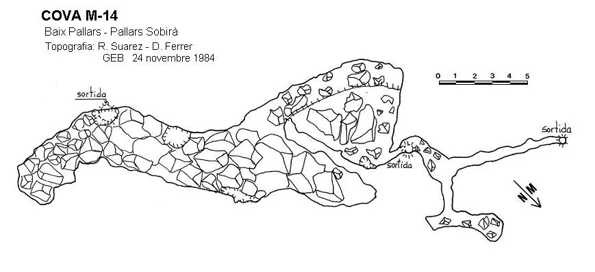
Espeleoindex · CC BY-NC 4.0, https://creativecommons.org/licenses/by-nc/4.0/ · Image © its author.
Description
Morphology
Cave 65.1 metres long with several exits to the outside due to its collapse structure and clastic process.
History
On 26 to 30 March 1970 a team from the SIE of the CEA explores the Forat de Montcortès (98 metres) and the Forat del Vicenç (-10 metres). Later, on 6 and 7 March 1976, another SIE team in which some of the members of the previous team take part, explore in the serra de Peracalç, between the estany de Montcortès and Peracalç, three cavities of (-30 metres, -11 metres and -7 metres) depth respectively, which they name Forats de la Grata no. 1, 2 and 3; this information remains in the SIE archives but nothing about it is ever published. Very probably they correspond to one of the many holes explored by the GEB in this sector.
In 1980 the GEB begins a series of explorations on this flat area that is to the N of the roca de Perauba and to the W of the dolmen de Perauba and that the GEB calls pla del campament because it is the spot where they set up camp during the explorations; these would last until 1988. Later they return in September 1994, in July 1995, when they accompany the archaeologists from the department of history of pre-capitalist societies and of social anthropology of the UAB, and they return again in November 1999. Over the course of these years, the forest mass has grown considerably, which also complicates the location of the cavities. This cavity in particular was explored on 24 November 1984.
User Comments (0)
No comments yet.
Be the first to share your experience!
Registered Explorations (0)
No explorations registered yet.
Register your visit to this cave!
Bibliography
- Porcel Caro,Enric.(1990).-”Exploracions a la Serra Magdalena ”. Cavernas (22):49-57. GE Badalona.
- Porcel Caro,Enric; Miret Pérez, Francesc.(2008).-”Cavernes d'interès arqueològic”. Cavernas (27):58-63. GE Badalona.
- Navarro,J.(1971).-”Relación cronológica de las exploraciones realizadas por miembros de la SIE en 1970”. EspeleoSie (10):75-87. SIE – CE Àliga. Barcelona.
- De Valles, Jordi.(2008).-Catàleg Espeleològic de Catalunya (Vol 1):245-246. ECG, FCE. Badalona.
Nearby caves

Source: Espeleoindex (espeleoindex.com), modified. CC BY-NC 4.0, https://creativecommons.org/licenses/by-nc/4.0/