
Cova dels Foresos
A 17-metre-long spring resurgence in Vimbodí, in the valley of the barranc de la Cova, with a 27-metre-wide rock shelter and an inner chamber of 15x9 metres.
EspeleoWorld
Cova dels Foresos
A 17-metre-long spring resurgence in Vimbodí, in the valley of the barranc de la Cova, with a 27-metre-wide rock shelter and an inner chamber of 15x9 metres.
Vimbodí i Poblet · Conca de Barberà
Length: 17 m · Depth: 1 m
Updated record
https://espeleoworld.com/en/c/cova-dels-foresos
Information can change. Always verify coordinates, access, weather, and cave conditions before setting out.
A 17-metre-long spring resurgence in Vimbodí, in the valley of the barranc de la Cova, with a 27-metre-wide rock shelter and an inner chamber of 15x9 metres.
Topographic
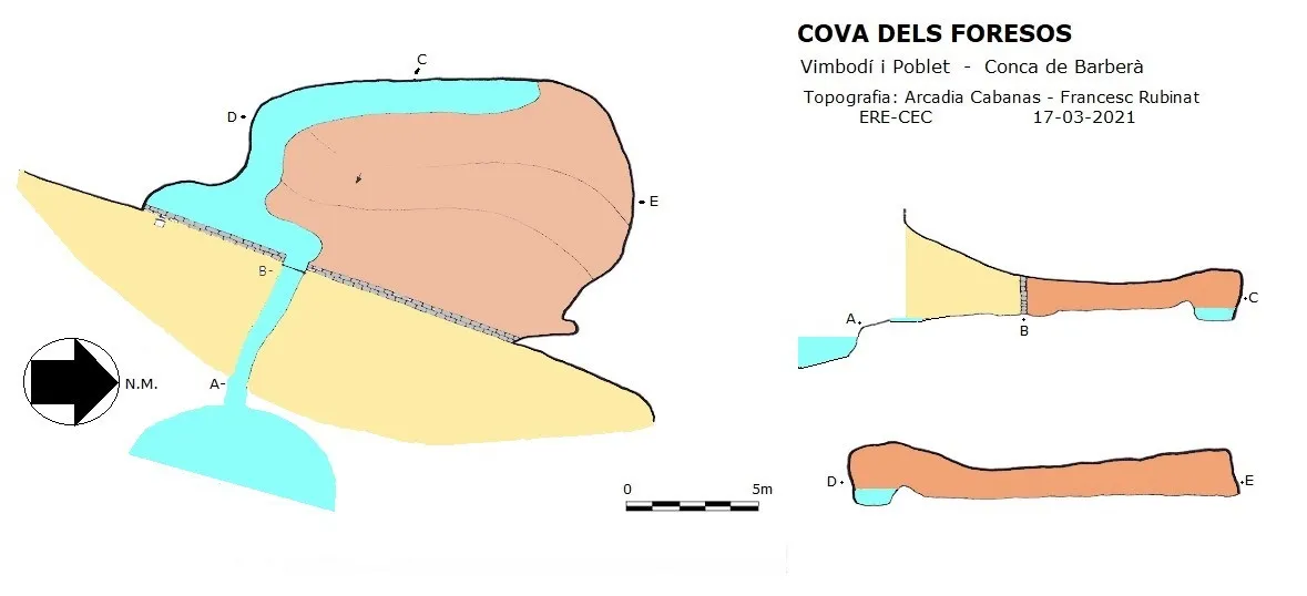

Espeleoindex · CC BY-NC 4.0, https://creativecommons.org/licenses/by-nc/4.0/ · Image © its author.
Photos

Espeleoindex · CC BY-NC 4.0, https://creativecommons.org/licenses/by-nc/4.0/ · Image © its author.
Description
Morphology
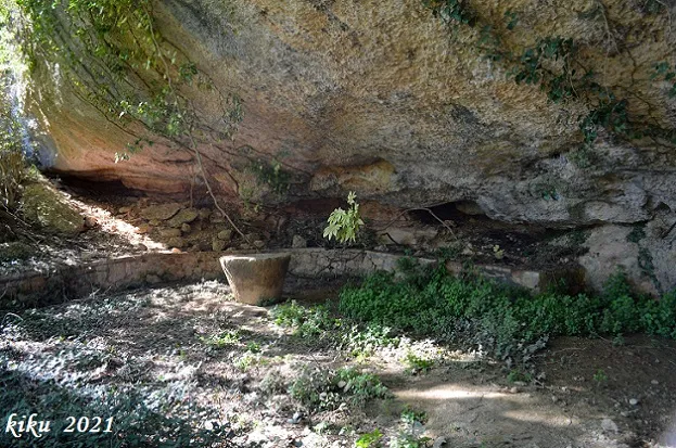
At the head of the valley of the barranc de la Cova we find a landscaped area with a table and seats, but currently in a state of abandonment, inside a rock shelter 27 metres wide, 4.40 metres deep and 3.66 metres high, which closes this valley. At the back of the rock shelter we find a stone wall with a barred gate, badly damaged by rust, through which the water flows out. Once inside, we find ourselves in a chamber of 15x9 metres and a height of between 0.90 and 1.67 metres.
The front of the cave where the gate is has been artificially walled up, probably to retain the water and prevent animals from entering.
Hydrology
From the back wall the water gushes out, forming a river 1.5 metres wide and 0.40 metres deep; it runs along the entire contour of the chamber on the left-hand side until it exits through the gate. This channelling seems to have been made expressly in order to maintain a constant water level.
On the outside, but within the rock shelter and to the left of the gate, we find a manual hydraulic pump with a ground-level gauge that allows the water level inside the cave to be seen. In front of the rock shelter a large pool of water forms.
Progression
The total route is 17 metres (4.40 of the rock shelter + 12.60 of the cave), while the river that skirts the chamber has a route of 20 metres.
History
The current farmhouse is still habitable and has bastions at the front and back; the date carved on the keystone of the main portal is 1801. Beneath the current house the old Mas de la Cova had existed, which was a rock-shelter farmhouse, since it used a large rock shelter as the rear part of the dwelling. The holes where the wooden rafters that would have supported the roof of the old farmhouse were fitted can still be seen.
Speleologically, the first report of this cavity is provided by Juan Abad, who published it in 1973 in the Comunicacions del III Simpòsium d'Espeleologia held in Mataró. However, we think he gets confused with the name of the cave, probably due to the limited cartography of the area existing at that time, since he goes on to call it Cova de la Balma de la Cova, locating it in a place called la Cova and 50 metres from the Pla de Cogullas. In reality, the Pla de Cogullades (Vinaixa), since that is the correct name, and la Cova (Vallclara) are two toponyms that exist; moreover, at this point there is indeed a cave that has nothing to do with the cova dels Foresos (Vimbodí i Poblet), which is located 1.3 kilometres away to the East at the Mas dels Foresos, also known as Mas de la Cova, which already appears documented in the 19th century.
It also gives rise to confusion the fact of having located it in the municipality of Vallclara, when in reality it belongs to the municipality of Vimbodí i Poblet; on the other hand, the place known as la Cova does belong to Vallclara.
User Comments (0)
No comments yet.
Be the first to share your experience!
Registered Explorations (0)
No explorations registered yet.
Register your visit to this cave!
Bibliography
- Abad Burgos, Juan.(1973).-”Estudio de dos pequeñas cavidades con interesante sistema hidrológico en la sierra la Llena y Prades”. Comunicacions III Simposium Espeleologia pp:(136-141). Agrupació Cientifico Excursionista Mataró/Escola Catalana d'Espeleologia (CCBE). Mataró.
- Manel Martínez (blocs.tinet.cat/lt/blog/manel-martinez/category/masos-i-molins) post del dia 3-12-2010.
- Totes les dades, coordenades topografia i fotografies han estat facilitades per Arcadia Cabanas i Francesc Rubinat (ERE-CEC).
Nearby caves
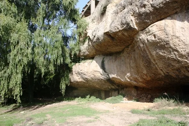
Balma dels Foresos
0.0 km · NE
Vimbodí i Poblet (Conca de Barberà)
1 topo.8 photos
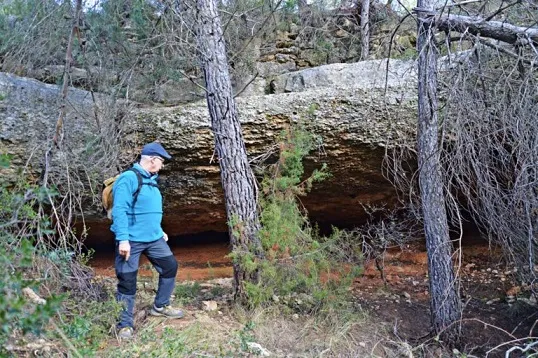
Cova del Xisto
0.8 km · S
Vallclara (Conca de Barberà)
1 topo.2 photos
Foradada dels Avellaners
1.2 km · SW
Vallclara (Conca de Barberà)
1 topo.3 photos
la Cova
1.3 km · SW
Vallclara (Conca de Barberà)
1 topo.6 photos
Source: Espeleoindex (espeleoindex.com), modified. CC BY-NC 4.0, https://creativecommons.org/licenses/by-nc/4.0/