
Cova de Vallmajor
Cova d'Albinyana (Baix Penedès), 67 m deep and 395 m long, known since ancient times and protected in 1998 as a World Heritage Site.
EspeleoWorld
Cova de Vallmajor
Cova d'Albinyana (Baix Penedès), 67 m deep and 395 m long, known since ancient times and protected in 1998 as a World Heritage Site.
Albinyana · Baix Penedès
Length: 395 m · Depth: 67 m
Updated record
https://espeleoworld.com/en/c/cova-de-vallmajor
Information can change. Always verify coordinates, access, weather, and cave conditions before setting out.
Cova d'Albinyana (Baix Penedès), 67 m deep and 395 m long, known since ancient times and protected in 1998 as a World Heritage Site.
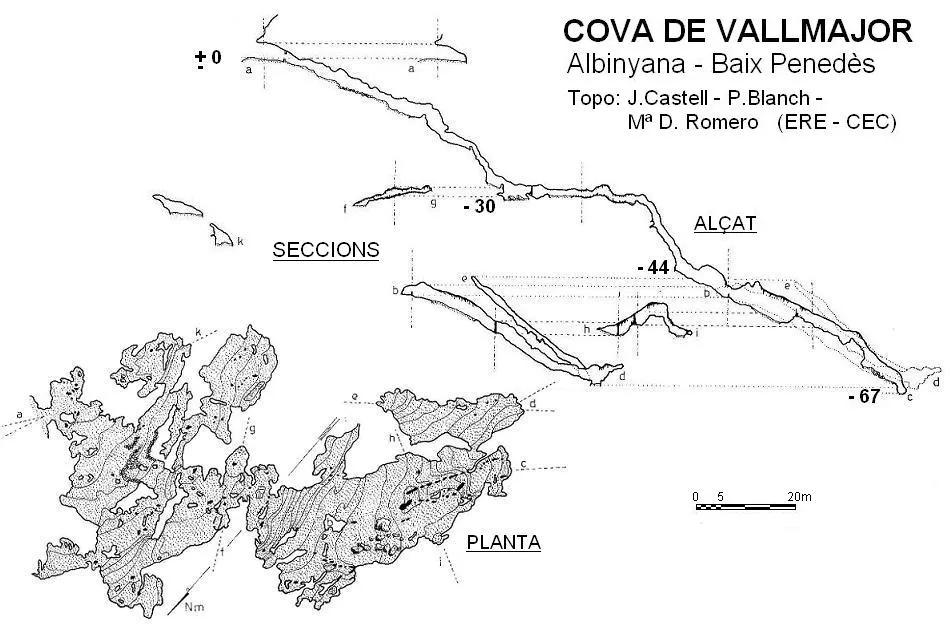
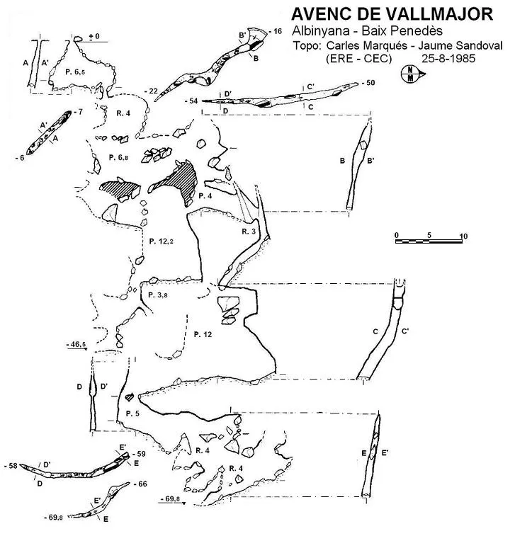
Topographic
Espeleoindex · CC BY-NC 4.0, https://creativecommons.org/licenses/by-nc/4.0/ · Image © its author.
Photos
Espeleoindex · CC BY-NC 4.0, https://creativecommons.org/licenses/by-nc/4.0/ · Image © its author.
Description
Morphology
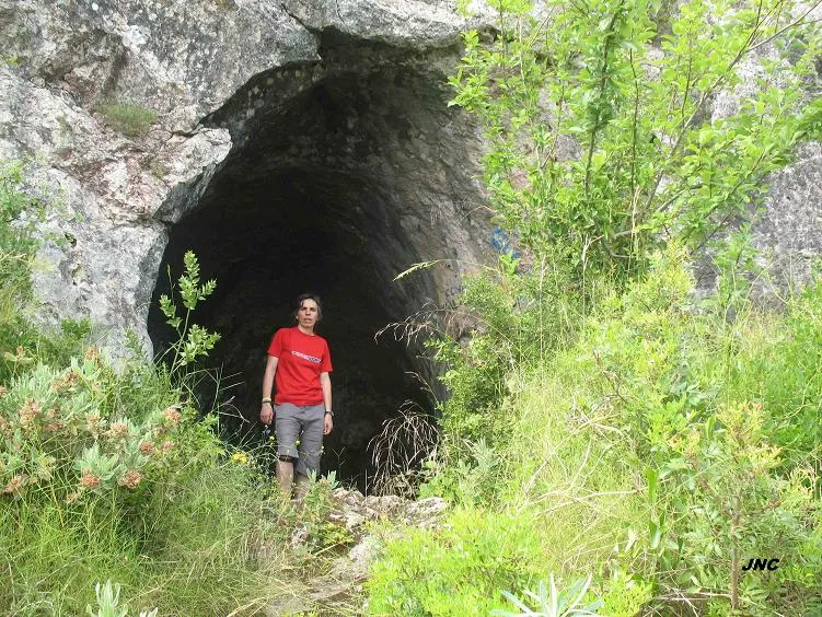
The entrance portal, about 3 metres high by 5 wide, gives rise to the galleries of the cavity with their general character, that is, a steep gradient with very varied inclinations. In the first galleries different branches leave which lead to separate chambers with no continuation; along what we may call the general gallery one continues descending until the roof loses height and one reaches a side recess with a plunge pool. At this point begins a shaft with subvertical walls and a drop of about 15 metres, which connects with the largest chamber of the cavity, divided into several parts by different stalagmitic barriers. The final part of this chamber is more reduced and by means of a series of steps one reaches the point of maximum depth. Shortly before this final stretch and at the S end of the chamber, there is another connection with another chamber almost parallel to the former and in an ascending direction for about 30 metres, ending filled with sediments.
It seems to be an ancient sinkhole of the former torrent, whose waters excavated along a network of joints established on bedding planes with a general dip of about 45º. Subsequently a series of important clastic and lithogenic processes developed which have shaped the present appearance of the cavity, today suspended above the current thalweg.
Speleothems
The largest chamber of the cavity is divided into several parts by different stalagmitic barriers.
Hydrology
In a side recess one reaches a plunge pool. It seems to be an ancient sinkhole of the former torrent, whose waters excavated along a network of joints established on bedding planes with a general dip of about 45º.
Progression
The entrance portal gives rise to the galleries, with a steep gradient. In the first galleries different branches leave which lead to separate chambers with no continuation; along the general gallery one continues descending until the roof loses height and one reaches a side recess with a plunge pool. At this point begins a shaft with subvertical walls and a drop of about 15 metres, which connects with the largest chamber. The final part of this chamber is more reduced and by means of a series of steps one reaches the point of maximum depth. Shortly before this final stretch and at the S end of the chamber, there is another connection with another chamber almost parallel to the former and in an ascending direction for about 30 metres, ending filled with sediments.
Other details
Very well-known cave, 67 m deep and 395 m long, at Albinyana (Baix Penedès).
History
Known since time immemorial. The first to mention the cavity is N. Font i Sagué in his Catàlech (1897), saying: Hi ha grans filtracions d'aigua, lo qual, unit a una pendent molt ràpida, fa que la seva baixada sia una mica perillosa.
There is record of some sporadic visits that go no further than the first sloping galleries of the cave. In the autumn of 1951, the GES – CMB make their first visit to the cave and choose it for one of the outings of the II Curs Oficial d'Exploracions Subterrànies.
Little more is known until the year 1952, when a small group of excursionists from el Vendrell, led by the brothers Salvador, Lluís and Joan Viñas, reach the end known until then and locate a narrow passage through which they reach some small chambers and the shaft that leads them to the lower chambers. In October of that same year, they accompany members of the GES and carry out the complete exploration and a study that is published in the journal Speleon, a work with an excess of the scientism of the period and with serious errors, especially in the survey, which calculates for the cavity a depth of 139 metres! (practically double the real one).
During those explorations various ceramic remains were collected and later, on 2-11-1961, the scholar Josep Mª Solé discovered a small side chamber and in it some schematic-type rock paintings, which were studied that same year. The cave was protected by a grille, but it soon fell into disuse. The cavity was included in 1998 in the list of caves of the Mediterranean arc of the Peninsula, declared a World Heritage Site by UNESCO.
User Comments (0)
No comments yet.
Be the first to share your experience!
Registered Explorations (0)
No explorations registered yet.
Register your visit to this cave!
Bibliography
- Agüera, A. (1977).- “El macizo cavernoso de Albinyana”. Més Avall (1): 14-102. SES – Club Esquí Puigmal. Barcelona.
- Borràs, J.; Miñarro,JM.; Talavera, F. (1978).- Catàleg Espeleològic de Catalunya. Vol. 2 (l'Alt Camp, la Conca de Barberà,el Baix Penedès i el Tarragonès):246 pp. Ed. Poliglota. Barcelona.
- Suñer, E.; Vicente, J.; Boixadera, E. (1959).- “Estudio geoespeleológico de la cueva-sima de Vallmajor” Speleon. T. X (1-2): 3-32. Universidad de Oviedo.
- Vilaseca, S.; Solé, J.Mª; Montserrat, J. (1961).- La Cueva de Vallmajor y sus pinturas rupestres. Instituto Estudios Tarraconenses. Serie Arqueológica nº 27: 35 pp. + láminas. Reus.
- Coordenades i fotografies “JNC” facilitades per Jordi Navarro (Centre Excursionista de Castellar del Vallès).
- Altres dades i fotografies extretes del blog: Espeleobloc (post del 22-1-2010)
Nearby caves
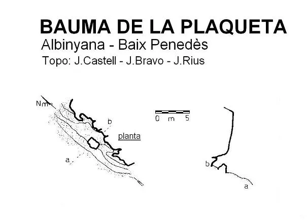


Source: Espeleoindex (espeleoindex.com), modified. CC BY-NC 4.0, https://creativecommons.org/licenses/by-nc/4.0/