
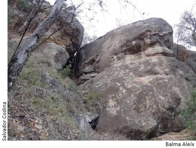
Balma Aleix
Balma de 10 metres de recorregut a Olius
EspeleoWorld
Balma Aleix
Balma de 10 metres de recorregut a Olius
Olius · Solsonès
Length: 10 m
Updated record
https://espeleoworld.com/en/c/balma-aleix
Information can change. Always verify coordinates, access, weather, and cave conditions before setting out.
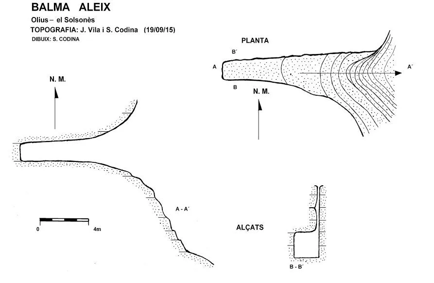
A 10-metre-long rock shelter in Olius, with a floor plan measuring 2X8 metres at its base.
Topographic
Espeleoindex · CC BY-NC 4.0, https://creativecommons.org/licenses/by-nc/4.0/ · Image © its author.
Photos
Espeleoindex · CC BY-NC 4.0, https://creativecommons.org/licenses/by-nc/4.0/ · Image © its author.
Description
Morphology
It has a floor plan measuring 2X8 metres at its base, with a height of one and a half metres at the back and more than 2 metres at the entrance. It has a notable peculiarity: the rock has been eroded and is separated into two blocks on one side.
Other details
It is worth noting that on each side of the rock shelter, on the rock, there are some small climbing routes, nowadays abandoned.
History
The name of the rock shelter has been taken from the name engraved at the foot of the rock of one of the climbing routes.
User Comments (0)
No comments yet.
Be the first to share your experience!
Registered Explorations (0)
No explorations registered yet.
Register your visit to this cave!
Bibliography
- Totes les dades han estat extretes del blog de Jordi de Valles, Catalunya subterrània (www.cavitatsdecatalunya.blogspot.com.es) post del dia 21-6-2016. Text, topografia i fotografies de Salvador Codina (CE Solsonès).
Nearby caves


Source: Espeleoindex (espeleoindex.com), modified. CC BY-NC 4.0, https://creativecommons.org/licenses/by-nc/4.0/