
Avenc del Penya-segat de la Falconera
An 80-metre-deep pit in the Garraf, in Sitges, with access from the C-31 road and a large entrance above the cliff.
EspeleoWorld
Avenc del Penya-segat de la Falconera
An 80-metre-deep pit in the Garraf, in Sitges, with access from the C-31 road and a large entrance above the cliff.
Sitges · Garraf
Length: 105 m · Depth: 80 m
Updated record
https://espeleoworld.com/en/c/avenc-del-penya-segat-de-la-falconera
Information can change. Always verify coordinates, access, weather, and cave conditions before setting out.
An 80-metre-deep pit in the Garraf, in Sitges, with access from the C-31 road and a large entrance above the cliff.
Topographic
Espeleoindex · CC BY-NC 4.0, https://creativecommons.org/licenses/by-nc/4.0/ · Image © its author.
Photos
Espeleoindex · CC BY-NC 4.0, https://creativecommons.org/licenses/by-nc/4.0/ · Image © its author.
Description
Morphology
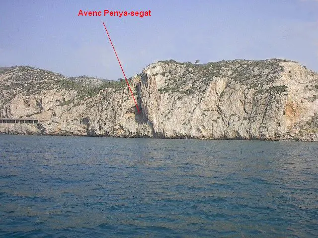
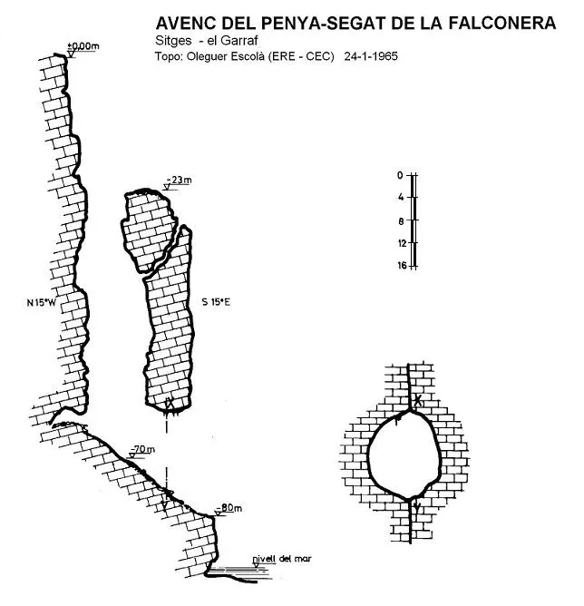
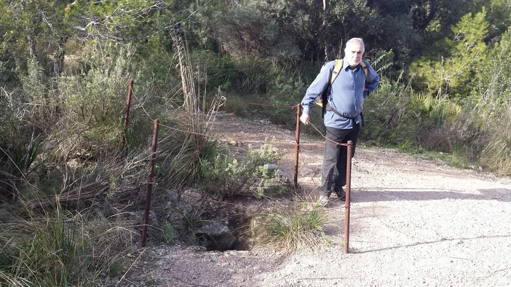
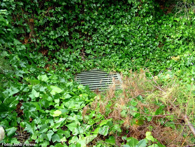
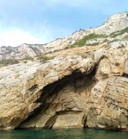
25 metres below the highest point of the cliff, we find a platform full of scrub and dwarf palms, where the entrance of a fairly inclined shaft opens, in which we find several ledges, and which after descending 35 metres ends in a large, steeply sloping floor, where after a drop of about 20 metres it meets the cliff again through a large portal 20x30 metres, located 16 metres above sea level.
A good part of the entrance and the first section of the original cavity have been dismantled by erosion, the same process that gave rise to the large opening of the lower portal.
According to Escolà (1965), it would be an ancient sinkhole that drained the waters of a previous epigean relief. Structured on an important fault, visible throughout the cliff, inclined and with a gently undulating plane. On the friction surface large fault mirrors can be seen as well as significant crushing of the nearby materials. The cavity seems to have constituted an isolated complex without a probable relationship with the spring of la Falconera.
Topographic considerations: The two known surveys are almost identical with a single difference, the maximum depth level. Escolà (1965) places it at -80 metres (at the end of the lower ramp before discharging into the sea). Lloret et al. (1973) take it to -99 metres, but they place this level on the seabed.
History
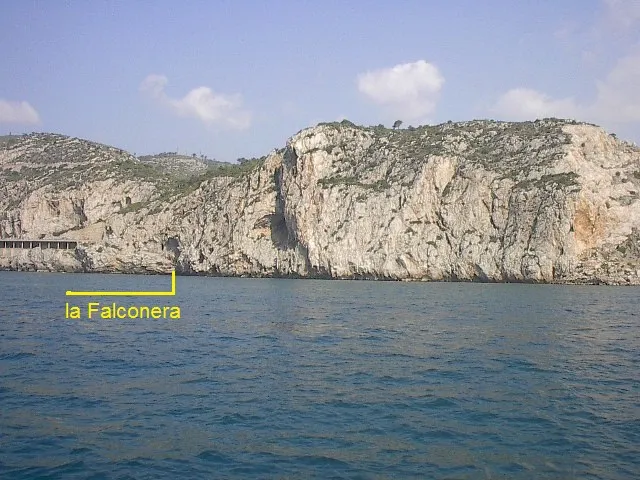
This cavity had never been mentioned in the old catalogues. Faura, in a geological work, accompanies a photo of the coast of la Falconera where the large chasm halfway up the cliff can be seen and which he calls Bauma del Penya-segat de la Falconera. Faura himself, in 1923, in the Memòria explicativa del full nº 39 (Vilanova i la Geltrú) del Servei del Mapa Geològic de Catalunya, publishes two photos taken by Lluís Estasen where the entrance of the pit can be seen from below and the bauma with a person on the final ramp.
It is not until the end of 1964 that Esteve Petit (ERE-CEC) locates the entrance of the pit. With other companions from the group: Raventós, Ferrer, Bergas and Escolà, they explore and survey it on 24 January 1965. It should be noted that during this exploration they found a completely rusted wire ring at the entrance of the cavity and at the bottom, in the section that gives onto the sea, there were some small iron bars driven into the rock. Had someone been down before? Or perhaps they had climbed from the sea? Could they have been some of the mining workers who took part in the works of la Falconera at the end of the 19th century? Could it have been Lluís Estasen (CEC) who climbed from the sea? For the moment the question remains open.
User Comments (0)
No comments yet.
Be the first to share your experience!
Registered Explorations (0)
No explorations registered yet.
Register your visit to this cave!
Bibliography
- Borràs, J. (1973).- Catálogo espeleológico del macizo de Garraf. Vol. III . 207 pp. Barcelona.
- Escolà, O. (1965).- “El 'avenc' i la 'bauma' del 'Penya-segat' de la Falconera”. Montaña (101): 27-31. Centre Excursionista de Catalunya. Barcelona.
- Faura i Sans, M. (1923).- Servei del Mapa Geològic de Catalunya. Explicació de la fulla nº 39 (Vilanova i la Geltrú). Junta de Ciències Natural de Barcelona. Mancomunitat de Catalunya.
- Ferrer, V. (2006).- Avencs de Garraf i d’Ordal. 152 pp. + llibret fitxes i topografies. Edició de l’autor. Barcelona.
- Situació i fotografies extretes del blog “www.espeleobloc.com.es” post del dia 25/3/2013.
Nearby caves


Source: Espeleoindex (espeleoindex.com), modified. CC BY-NC 4.0, https://creativecommons.org/licenses/by-nc/4.0/