
Avenc A.1 d'Aulà
Petit avenc de 13 m. de fondària a l'Alt Àneu
EspeleoWorld
Avenc A.1 d'Aulà
Petit avenc de 13 m. de fondària a l'Alt Àneu
Alt Àneu · Pallars Sobirà
Length: 35 m · Depth: 13 m
Updated record
https://espeleoworld.com/en/c/avenc-a-1-d-aula
Information can change. Always verify coordinates, access, weather, and cave conditions before setting out.
Small 13 m deep pit in Alt Àneu, located and marked by S.C.T. Annecy in 1971 and explored and surveyed in July 1975.
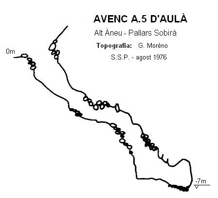
Topographic
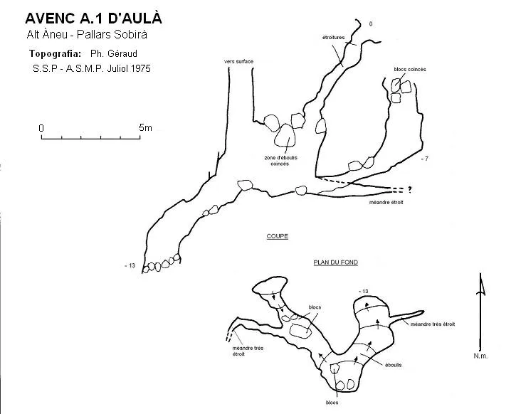
Espeleoindex · CC BY-NC 4.0, https://creativecommons.org/licenses/by-nc/4.0/ · Image © its author.
Description
Morphology
Small 13 m deep pit in Alt Àneu.
Different entrances join at the -10 level. By a short ramp one can descend to -13, where it is blocked by rockfalls.
History
Located and marked by S.C.T. Annecy in 1971. Explored and surveyed during the S.S.P. and A.S.M.P. campaign in July 1975.
User Comments (0)
No comments yet.
Be the first to share your experience!
Registered Explorations (0)
No explorations registered yet.
Register your visit to this cave!
Bibliography
- Lesage, B.; Géraud, Ph.; Gratté, L. (1977).- “Les Cuns d'Aula”. Ouarnède (8): 25-32. G.S.Pyrenées. Toulouse.
- Géraud, Ph. (1984).- “Les Cuns d'Aula”. L'Echo des Ténébres (15): 42-57. S.S.Plantaurel. Lavelanet.
- S.S.Plantaurel.- Memòries i documents inèdits
Nearby caves

Source: Espeleoindex (espeleoindex.com), modified. CC BY-NC 4.0, https://creativecommons.org/licenses/by-nc/4.0/