
Grotta GIS
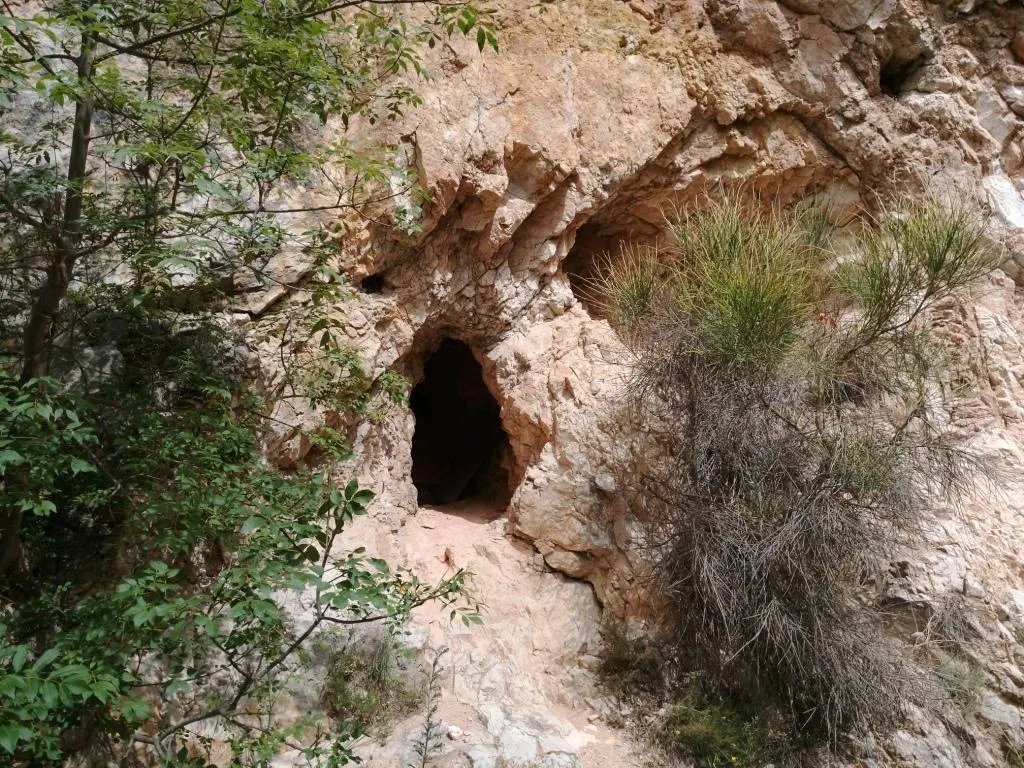
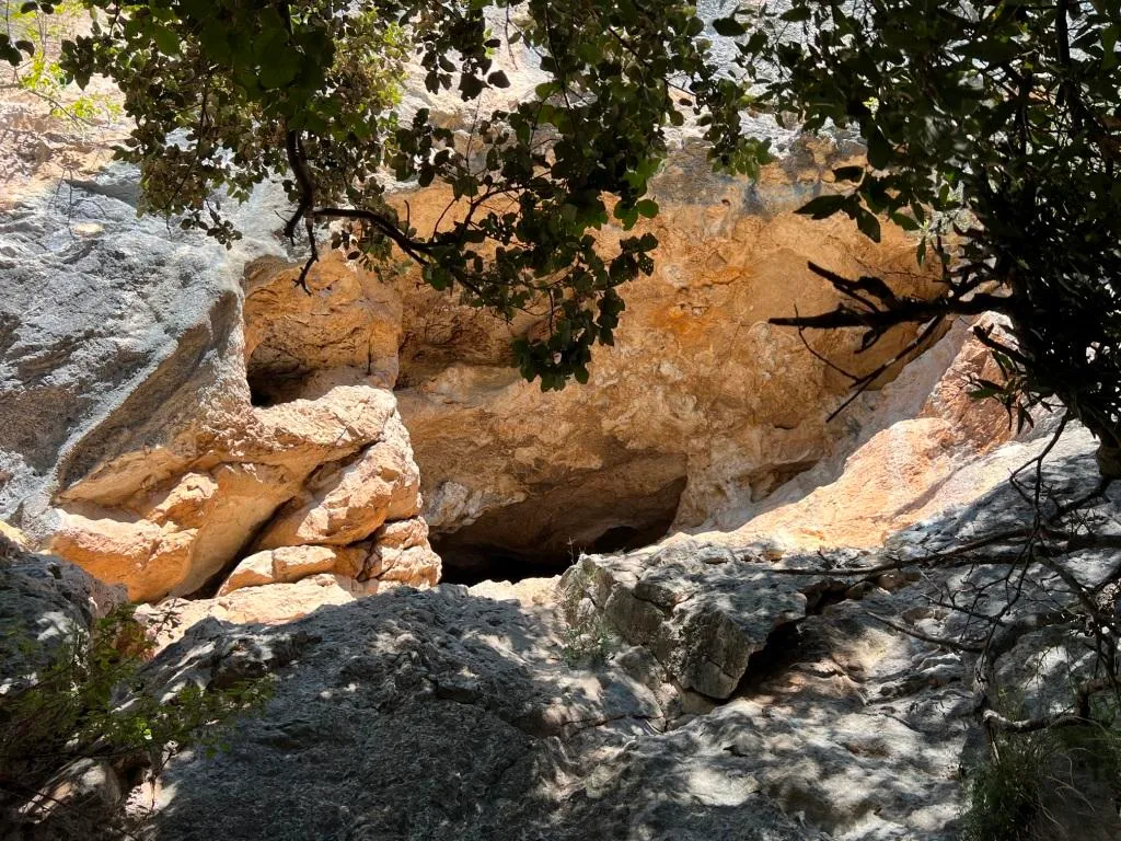
Cave at the base of the wall of a disused quarry at Cesi, Colle Zannuto, with an entrance 1.5x1 m and a brick wall just inside.
EspeleoWorld
Grotta GIS
Cave at the base of the wall of a disused quarry at Cesi, Colle Zannuto, with an entrance 1.5x1 m and a brick wall just inside.
Terni
Länge: 800 m · Tiefe: 70 m
Aktueller Datensatz
https://espeleoworld.com/de/c/grotta-gis-terni-terni
Informationen können sich ändern. Koordinaten, Zugang, Wetter und Höhlenbedingungen vor dem Aufbruch immer prüfen.
Cave at the base of the wall of a disused quarry at Cesi, Colle Zannuto, with an entrance 1.5x1 m and a brick wall just inside.
Fotos
© Luca Bussolati · LicenseRef-FUGS-media-per-item · Federazione Umbra Gruppi Speleologici (FUGS), Catasto Speleologico dell'Umbria · https://catasto.fugs.it/index.php?mod=caves&op=view&id=860
Beschreibung
Morphologie
Trend: Ascending/Descending.
Geology: MAS Limestone Massiccio - Lower-Upper Jurassic (Sinemurian-Pliensbachian); massive limestones; massive.
Hydrologie
Blows when hot; internal temperature 13 °C; humidity 98 %; air flows 6 m/s, flow rate 0.5 mc/sec. Measurements on 29/06/2024 at about 10.00, outside clear, temperature 28 °C, humidity 61%, strong cold blowing current.
Befahrung
Traversability: Demanding; recommended period all year round.
Progression difficulty: pits, slides, narrow passages.
Weitere Einzelheiten
Owner of the land: Calce San Pellegrino Spa Str. Amerina Loc. San Pellegrino 05035 Narni.
Bio
Other hypogean fauna: troglobitic beetle Carabidae: Duvalius virginiae Magrini-Vanni & Cirocchi, 1996; troglobitic beetle Curculionidae: Otiorrhynchus (Lixorrhynchus) virginiae Magrini-Abbazzi & Cirocchi, 2001; troglophilic beetle Carabidae: Laemostenus latialis Leoni, 1907; troglophilic orthopteran Rhaphidophoridae: Dolichopoda laetitiae Menozzi, 1920.
Bait trapping reveals the presence of two endemic and specialized species and one troglophilic species.
Studies and monitoring: entomological.
Benutzerkommentare (0)
Noch keine Kommentare.
Seien Sie der Erste, der seine Erfahrung teilt!
Registrierte Erkundungen (0)
Noch keine Erkundungen registriert.
Registrieren Sie Ihren Besuch in dieser Höhle!
Höhlen in der Nähe

Quelle: Catasto Cavità Umbria (Federazione Umbra Gruppi Speleologici, FUGS) (catasto.fugs.it), verändert. LicenseRef-FUGS-no-licence-stated Federazione Umbra Gruppi Speleologici (FUGS), Catasto Speleologico dell'Umbria · https://catasto.fugs.it/index.php?mod=caves&op=view&id=860 · Datenstand 2025 · Quelle: Catasto Cavità Umbria (Federazione Umbra Gruppi Speleologici, FUGS) (catasto.fugs.it), verändert. LicenseRef-FUGS-media-per-item Federazione Umbra Gruppi Speleologici (FUGS), Catasto Speleologico dell'Umbria · Datenstand 2025