
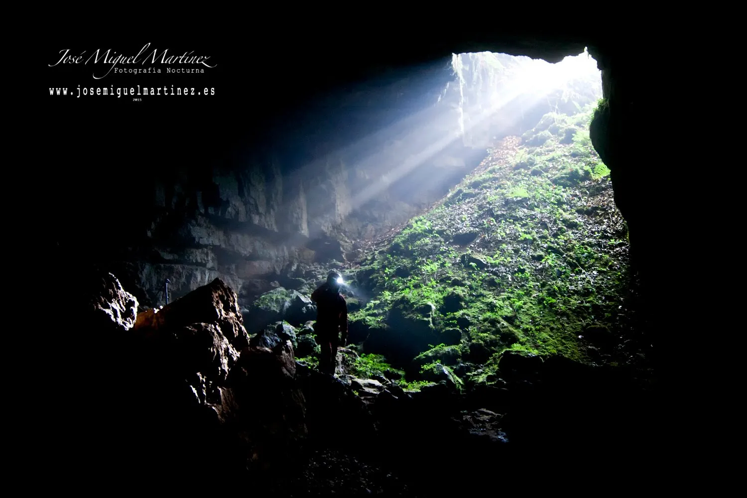
Cueva de Rescaño
Cueva de Rescaño, also called Cueva de Udías, is a large river cave in Cantabria, about 35 km long with 216 m of vertical extent.
EspeleoWorld
Cueva de Rescaño
Cueva de Rescaño, also called Cueva de Udías, is a large river cave in Cantabria, about 35 km long with 216 m of vertical extent.
Udías
Länge: 35196 m · Tiefe: 216 m
Aktueller Datensatz
https://espeleoworld.com/de/c/cueva-de-rescano-udias
Informationen können sich ändern. Koordinaten, Zugang, Wetter und Höhlenbedingungen vor dem Aufbruch immer prüfen.
Cueva de Rescaño, also called Cueva de Udías, is a large river cave in Cantabria, about 35 km long with 216 m of vertical extent.
Fotos
© José Miguel Martínez · none-stated · José Miguel Martínez (Fotografía Nocturna), with CCES cavers · https://misfotosdecantabria.blogspot.com/2016/01/cueva-del-cobijon-sistema-karstico-de.html
Beschreibung
Morphologie
It is a very large cave, with wide galleries and an active canyon whose ceiling exceeds 30 m in height. The overall survey, made by the SESS group in 1983 and completed by the Club Cántabro de Exploraciones Subterráneas up to 2015, shows a main axis elongated in a southwest-northeast direction, with named chambers such as the Sala Chechu, the Sala Tortajada, the Gran Sala and the Galería del Vivac, as well as lateral labyrinthine areas such as the Red Emmental, reached from the Sel del Haya mine. The mine galleries cross the massif and connect with the cave by means of ladders.
Speläotheme
There are flowstone of various colours. The gypsum flowers also stand out.
Hydrologie
Rainfall conditions visits: when it is abundant, the current limits progress inside the cave.
The water is that of the Suvia river, in the Udías valley. It sinks at Cobijón and passes through a first short stretch of the cave. It emerges for a while at the surface and re-enters the main part, where it runs along the floor of the large canyon-shaped passage. It reappears in the La Presa cave, at Novales.
Weitere Einzelheiten
Length figures vary by source. The municipal guide gives 13.5 km, from old studies, and the Cantabrian catalogue of large cavities gives 15 km. A 2016 report indicated 26.9 km and 216 m of vertical extent for the Cobijón entrance. The FEE catalogue of large cavities (2024) lists Cueva de Udías at about 35.2 km, dated October 2021 and based on the 2020 exploration report. Here 35.2 km of length and 216 m of depth are used.
The Sel del Haya to Cobijón traverse is considered one of the most attractive in the region.
In May 2025 the cave was closed because mining activity resumed in the area. As closure measures, a gate and a surveillance camera were installed.
Geschichte
The cave was found in 1912 by a foreman of the mining company working in the area. From that time, visible remains survive along the mining route: wagons, winches and tubs.
Specialised study began long after the discovery. The SESS group published the first monograph on the Udías karst massif in 1983. The Club Cántabro de Exploraciones Subterráneas explores and surveys this karst and has published updated maps of the cave and neighbouring cavities. In 2013 the club was reviewing unresolved questions in the southern sector of the so-called Emmental Rojo.
Nearby is the Sima de la Luna Llena, catalogued as a separate cavity. The sources consulted do not confirm its connection with the system.
Benutzerkommentare (0)
Noch keine Kommentare.
Seien Sie der Erste, der seine Erfahrung teilt!
Registrierte Erkundungen (0)
Noch keine Erkundungen registriert.
Registrieren Sie Ihren Besuch in dieser Höhle!
Höhlen in der Nähe

Enthält Informationen aus Grottocenter (Wikicaves), grottocenter.org, bereitgestellt unter der Open Database License (ODbL 1.0, https://opendatacommons.org/licenses/odbl/1-0/), verändert. · https://grottocenter.org/ui/entrances/168704 · Datenstand 2026 · Quelle: Grottocenter (Association Wikicaves), worldwide collaborative cave database (grottocenter.org), verändert. CC BY-SA 3.0, https://creativecommons.org/licenses/by-sa/3.0/ Grottocenter (Wikicaves) · Text von Biboc (Cueva de Rescaño) · https://grottocenter.org/ui/entrances/168704 · Datenstand 2026 · Text von Espeleoworld aus öffentlichen Quellen verfasst. Bitte frag uns, bevor du ihn weiterverwendest. · Text von José Luis Membrado Julián (Grandes Cavidades Españolas 2024), Ayuntamiento de Udías (Cavidades (Udías)), Rameffes II (blog) (Cueva de Udías - Sel del Haya (Mina Hermosa)), Club Cántabro de Exploraciones Subterráneas (Planos cavidades), Espeleoclub Viana (Cantabria), Club Cántabro de Exploraciones Subterráneas (Exploración en Udías 09/02/2013: Pasitos olé), José Miguel Martínez (Blog de www.Fotografía Nocturna.net: Cueva de Udías) · bearbeitet von Espeleoworld (normalisiert, übersetzt); die Bearbeitung steht unter der Lizenz Our own text, written from public sources. Please ask us before reusing it. · Die abgeleiteten Daten sind auf Anfrage unter der ODbL erhältlich: [email protected]