
Ofnethöhlen
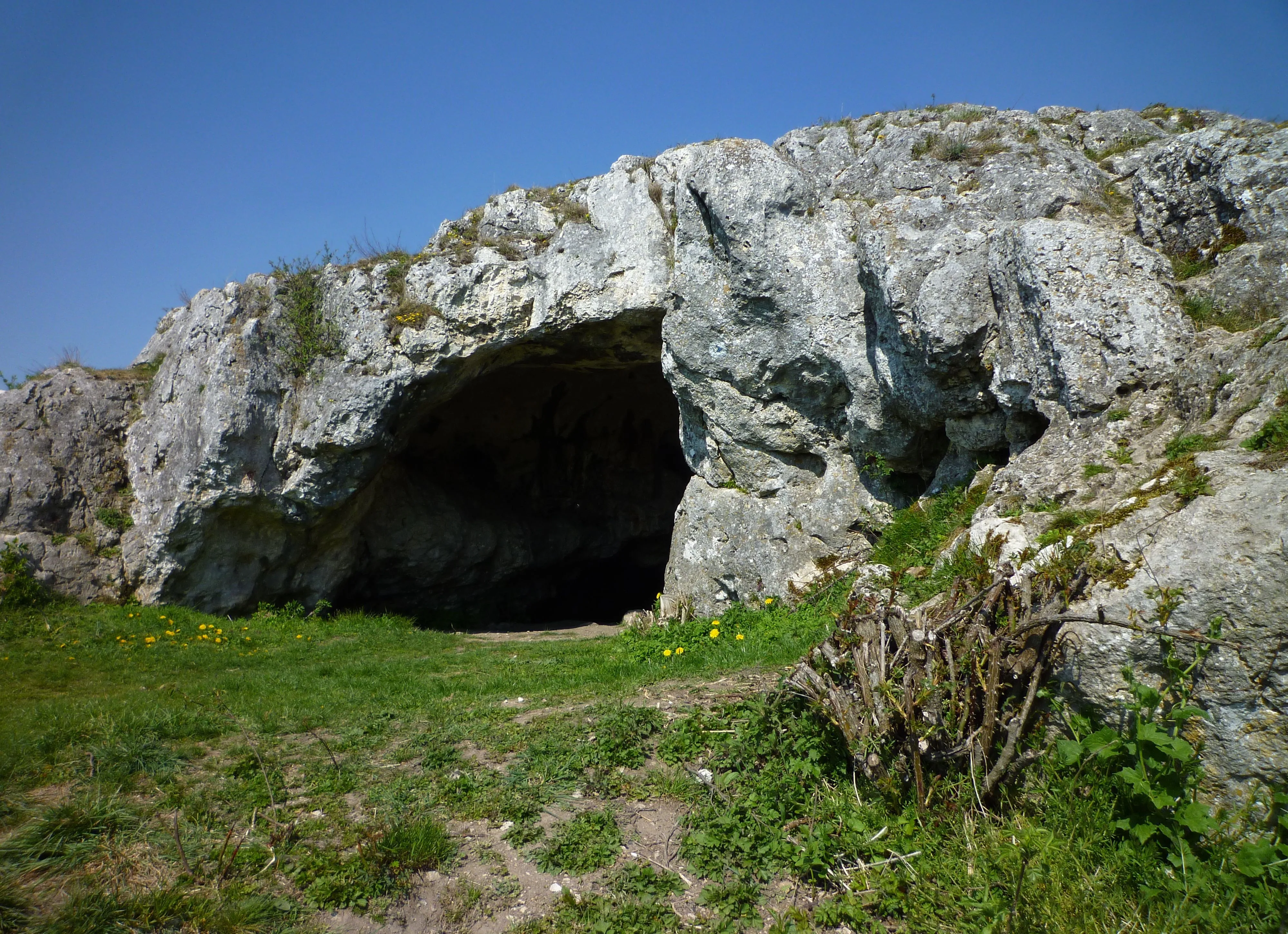
The Ofnethöhlen are natural karst caves near Holheim, a district of Nördlingen in the Donau-Ries district of Bavaria.
EspeleoWorld
Ofnethöhlen
The Ofnethöhlen are natural karst caves near Holheim, a district of Nördlingen in the Donau-Ries district of Bavaria.
Nördlingen
最新资料
https://espeleoworld.com/zh/c/ofnethoehlen-noerdlingen
信息可能会变化。出发前请务必核对坐标、通行情况、天气和洞穴状况。
The Ofnethöhlen are natural karst caves near Holheim, a district of Nördlingen in the Donau-Ries district of Bavaria.
照片

© Franzfoto · CC BY-SA 3.0, https://creativecommons.org/licenses/by-sa/3.0/ · Wikimedia Commons · https://commons.wikimedia.org/wiki/File:N%C3%B6rdlingen_-_Ofneth%C3%B6hle_auf_dem_Riegelberg_02.jpg
描述
形态
The Ofnethöhlen are the remains of an underground karst system on the crater rim of the Nördlinger Ries. In the cave register Fränkische Alb (HFA) they are registered as M 7 (Große Ofnethöhle) and M 8 (Kleine Ofnethöhle). The caves, including the immediate surroundings (a total of approx. 8 hectares), are also classified as the nature reserve „Ofnethöhlen bei Holheim“.
其他详情
The origin of the term „Ofnet“ is not documented.
历史
Archaeological finds indicate that the caves were inhabited from the Middle Paleolithic to the Mesolithic. The Ofnethöhlen gained supraregional significance when Stone Age skull burials were discovered in the year 1908.
用户评论 (0)
暂无评论。
成为第一个分享体验的人!
已记录的探索 (0)
暂无探索记录。
记录您对这个洞穴的访问!
附近洞穴
来源:Geotopkataster Bayern (Bayerisches Landesamt für Umwelt)(www.umweltatlas.bayern.de),已修改。 CC BY 4.0, https://creativecommons.org/licenses/by/4.0/ Datenquelle: Bayerisches Landesamt für Umwelt, www.lfu.bayern.de · https://www.umweltatlas.bayern.de/mapapps/resources/reports/sb_geotope/generateBericht.pdf?additionallayerfieldvalue=779H001 · 2026年数据 · 包含来自 © OpenStreetMap contributors(www.openstreetmap.org)的信息,依据开放数据库许可协议(Open Database License,ODbL 1.0, https://opendatacommons.org/licenses/odbl/1-0/)提供,已修改。 · 名称 · 获取于 2026-11-13 · https://www.openstreetmap.org/node/356052506 · 2026年数据 · 来源:Wikidata – cave items (Germany)(www.wikidata.org),已修改。 CC0 1.0, https://creativecommons.org/publicdomain/zero/1.0/ Wikidata (CC0 1.0) · 名称 · 获取于 2026-11-13 · 2026年数据 · 来源:German Wikipedia – article leads (cave descriptions)(de.wikipedia.org),已修改。 CC BY-SA 4.0, https://creativecommons.org/licenses/by-sa/4.0/ Wikipedia contributors (de.wikipedia.org), CC BY-SA 4.0 · 文本作者:Wikipedia contributors (Ofnethöhlen) · 由 Espeleoworld 改编(规范化、翻译);改编内容依据 CC BY-SA 4.0, https://creativecommons.org/licenses/by-sa/4.0/ 许可 · 描述 · 获取于 2026-11-13 · https://de.wikipedia.org/wiki/Ofneth%C3%B6hlen · 2026年数据 · 衍生数据可应要求依据 ODbL 提供: [email protected]