

Veledahöhle
South of Velmede, in an elongated cliff belt of Middle Devonian Sparganophyllum limestone, lies the entrance to the Veleda Höhle.
EspeleoWorld
Veledahöhle
South of Velmede, in an elongated cliff belt of Middle Devonian Sparganophyllum limestone, lies the entrance to the Veleda Höhle.
Bestwig
Длина: 243 m
Актуальная запись
https://espeleoworld.com/ru/c/veledahoehle-bestwig
Информация может меняться. Перед выходом всегда проверяйте координаты, доступ, погоду и состояние пещеры.
South of Velmede, in an elongated cliff belt of Middle Devonian Sparganophyllum limestone, lies the entrance to the Veleda Höhle.
Фотографии
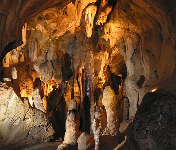
© DonGatley · CC BY-SA 3.0, https://creativecommons.org/licenses/by-sa/3.0/ · Wikimedia Commons · https://commons.wikimedia.org/wiki/File:Veleda-H%C3%B6hle_westlicher_Eingang.JPG
Описание
Другие сведения
In the western part of the cliff belt, the limestones were formerly quarried, but the excavation has been backfilled. At the westernmost point, next to the road, there was formerly a lime kiln, parts of which are still preserved today.
Комментарии пользователей (0)
Комментариев пока нет.
Станьте первым, кто поделится своим опытом!
Зарегистрированные исследования (0)
Зарегистрированных исследований пока нет.
Зарегистрируйте свое посещение этой пещеры!
Ближайшие пещеры


Источник: Geotopkataster Nordrhein-Westfalen (Geologischer Dienst NRW) (ogc-api.nrw.de), с изменениями. Data licence Germany – attribution – version 2.0 (dl-de/by-2-0), https://www.govdata.de/dl-de/by-2-0 Geowissenschaftliche Daten: INSP-GeotopeinNRW @ Geologischer Dienst NRW · данные на 2026 г. · Содержит информацию из Grottocenter (Wikicaves), grottocenter.org, предоставленную по лицензии Open Database License (ODbL 1.0, https://opendatacommons.org/licenses/odbl/1-0/), с изменениями. · длина · получено 2026-11-13 · https://grottocenter.org/ui/entrances/23707 · данные на 2026 г. · Данные о местоположении: © OpenStreetMap contributors, ODbL 1.0, https://opendatacommons.org/licenses/odbl/1-0/. · https://www.openstreetmap.org/node/418797628 · Производные данные доступны по запросу на условиях ODbL: [email protected]