
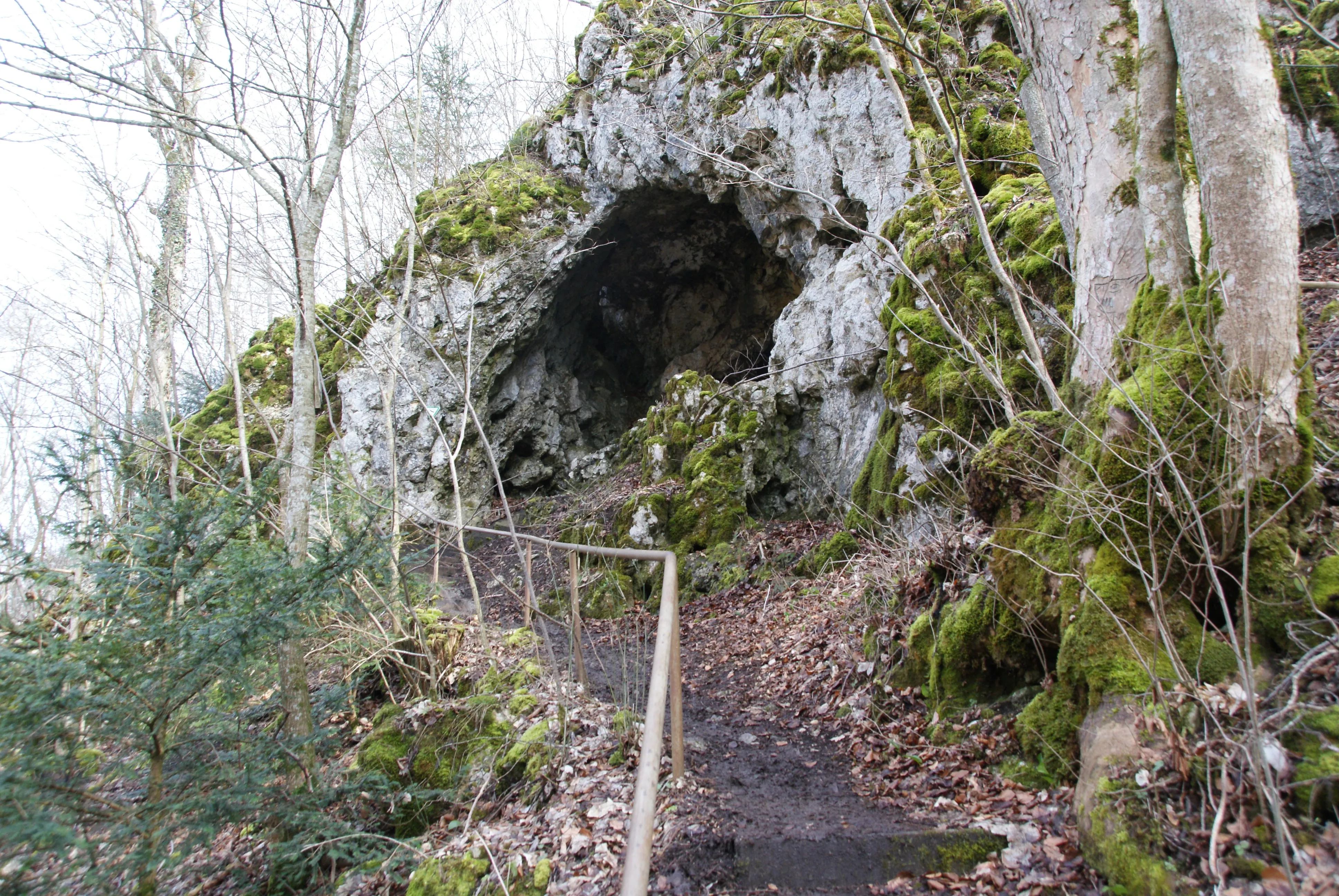
Höhle Kätherenküche
The Käthra Kuche is a half-cave (abri) east of Briel on the southern edge of the Swabian Alb.
EspeleoWorld
Höhle Kätherenküche
The Käthra Kuche is a half-cave (abri) east of Briel on the southern edge of the Swabian Alb.
Ehingen (Donau)
Актуальная запись
https://espeleoworld.com/ru/c/hoehle-kaetherenkueche-ehingen-donau
Информация может меняться. Перед выходом всегда проверяйте координаты, доступ, погоду и состояние пещеры.
The Käthra Kuche is a half-cave (abri) east of Briel on the southern edge of the Swabian Alb.
Фотографии
© Karle3 · CC BY-SA 4.0, https://creativecommons.org/licenses/by-sa/4.0/ · Wikimedia Commons · https://commons.wikimedia.org/wiki/File:Kd3_20200308_04664_kaethra_kuche.jpg
Описание
Морфология
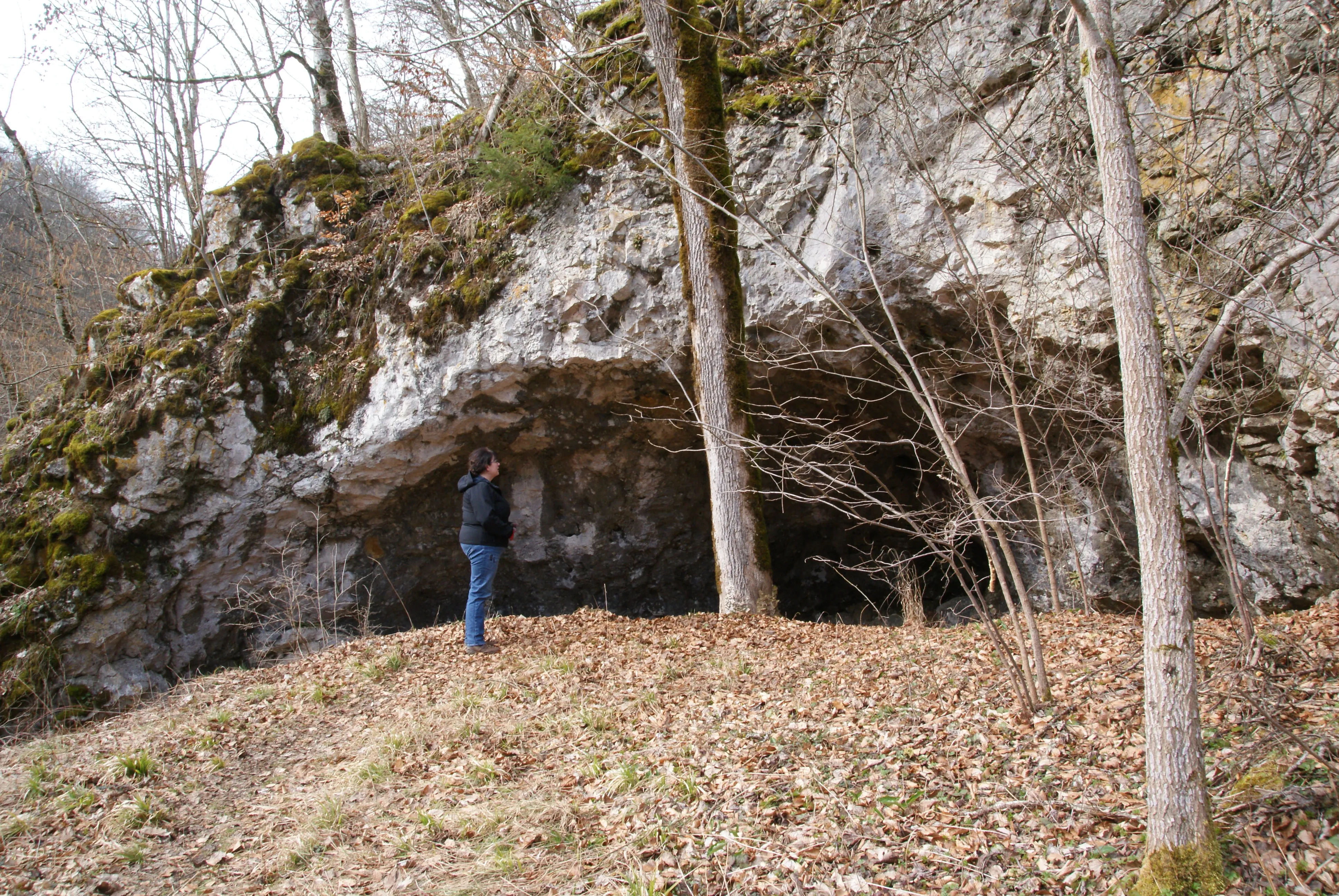
The Käthra Kuche (also Kätheren Küche, the „Küche der Katharina“) is a half-cave (abri). The rock and the cave are protected under the name Fels mit Höhle „Kätheren Küche“ as natural monument no. 84250330172.
История
The cave is said to have served a Katharina Schunter as a Wohnhöhle (dwelling cave) around 1800. She came from the Schunter family, which inhabited the nearby Schunterhöhle. During her stay in the cave she is said to have made fires for cooking. The rising smoke led the inhabitants of the nearby village of Briel to exclaim „D’ Käther kocht“ – Katharina is cooking. Hence the naming Kätheren Küche (= Käthra Kuche).
Комментарии пользователей (0)
Комментариев пока нет.
Станьте первым, кто поделится своим опытом!
Зарегистрированные исследования (0)
Зарегистрированных исследований пока нет.
Зарегистрируйте свое посещение этой пещеры!
Ближайшие пещеры

Источник: Geotopkataster Baden-Württemberg (Regierungspräsidium Freiburg – LGRB) (services.lgrb-bw.de), с изменениями. Data licence Germany – attribution – version 2.0 (dl-de/by-2-0), https://www.govdata.de/dl-de/by-2-0 Datenquelle: Regierungspräsidium Freiburg - LGRB, www.lgrb-bw.de · данные на 2026 г. · Содержит информацию из © OpenStreetMap contributors, www.openstreetmap.org, предоставленную по лицензии Open Database License (ODbL 1.0, https://opendatacommons.org/licenses/odbl/1-0/), с изменениями. · названия · получено 2026-11-13 · https://www.openstreetmap.org/node/1788403407 · данные на 2026 г. · Источник: Wikidata – cave items (Germany) (www.wikidata.org), с изменениями. CC0 1.0, https://creativecommons.org/publicdomain/zero/1.0/ Wikidata (CC0 1.0) · данные на 2026 г. · Источник: German Wikipedia – article leads (cave descriptions) (de.wikipedia.org), с изменениями. CC BY-SA 4.0, https://creativecommons.org/licenses/by-sa/4.0/ Wikipedia contributors (de.wikipedia.org), CC BY-SA 4.0 · Текст: Wikipedia contributors (Käthra Kuche) · адаптировано Espeleoworld (нормализовано, переведено); адаптация распространяется по лицензии CC BY-SA 4.0, https://creativecommons.org/licenses/by-sa/4.0/ · описание · получено 2026-11-13 · https://de.wikipedia.org/wiki/K%C3%A4thra_Kuche · данные на 2026 г. · Производные данные доступны по запросу на условиях ODbL: [email protected]