
Forat de la Roqueta
A 71-metre-deep pit at Boumort, in Conca de Dalt, with an entrance 10 metres in diameter.
EspeleoWorld
Forat de la Roqueta
A 71-metre-deep pit at Boumort, in Conca de Dalt, with an entrance 10 metres in diameter.
Conca de Dalt · Pallars Jussà
Sviluppo: 225 m · Profondità: 71 m
Scheda aggiornata
https://espeleoworld.com/it/c/forat-de-la-roqueta
Le informazioni possono cambiare. Verifica sempre coordinate, accesso, meteo e condizioni della cavità prima di partire.
A 71-metre-deep pit at Boumort, in Conca de Dalt, with an entrance 10 metres in diameter.
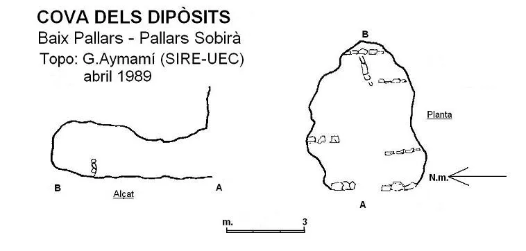
Topografia
Espeleoindex · CC BY-NC 4.0, https://creativecommons.org/licenses/by-nc/4.0/ · Immagine © del suo autore.
Foto
Espeleoindex · CC BY-NC 4.0, https://creativecommons.org/licenses/by-nc/4.0/ · Immagine © del suo autore.
Descrizione
Morfologia
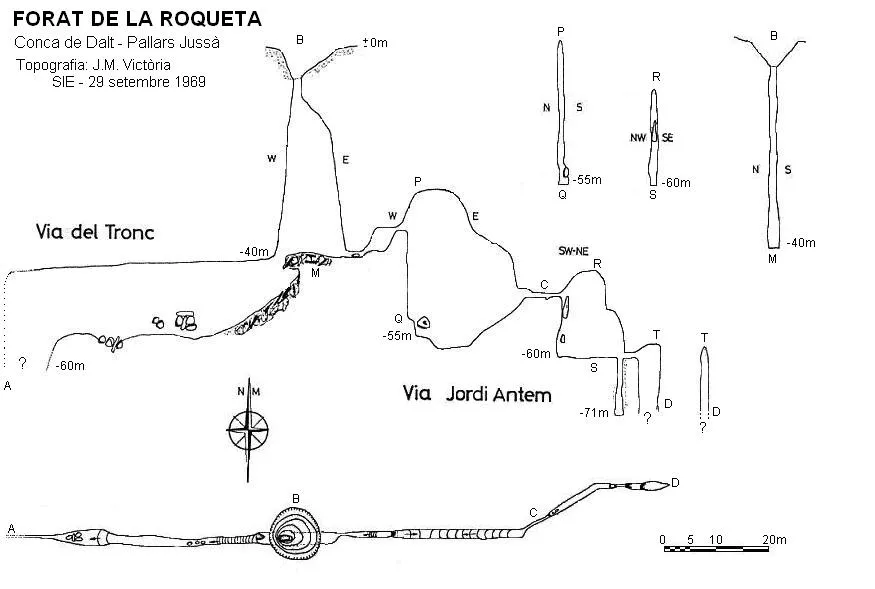
The entrance, 10 metres in diameter, is shaped like an earth funnel; at its bottom (level -6) we find, already in rock, an opening of 2x1 metres that drops us into a pit of about 40 metres. Along the pit we keep finding trunks and stones with large accumulations of earth wedged in the walls, forming rather unstable ledges. Once at the base, towards the W we find a small pit of 10 metres that is sometimes collapsed due to the fall of trunks and branches together with mud. The ramp base places us in a tall joint; some 30 metres further on a small pit ends the gallery with large accumulations of mud both at the base and on the walls. Back at the base of the entrance pit, on the E side we pass a narrow squeeze by climbing and find a long joint where a 20-metre vertical drop must be descended; once at the base, the gallery climbs up a ramp to a narrow conduit about 8 metres long that gives way to a pit with a 10-metre drop; at the E end of its base a new and narrow pit places us at -71 metres depth. Back at the head of this last pit, the joint continues towards the E, where we find a new pit that appears, according to a dive, to descend more than 40 metres but which becomes impracticable due to its narrowness and at this point seems to reach the fault plane where all the walls are formed by the typical breccia conglomerate, making exploration very dangerous from this point on.
Concrezioni
At the ramp base, in a tall joint, we find some spectacular stalagmitic formations in the shape of plates.
Progressione
The entrance, 10 metres in diameter, is shaped like an earth funnel; at its bottom (level -6) we find, already in rock, an opening of 2x1 metres that drops us into a pit of about 40 metres. Once at the base, towards the W we find a small pit of 10 metres. Back at the base of the entrance pit, on the E side we pass a narrow squeeze by climbing and find a long joint where a 20-metre vertical drop must be descended; once at the base, the gallery climbs up a ramp to a narrow conduit about 8 metres long that gives way to a pit with a 10-metre drop; at the E end of its base a new and narrow pit places us at -71 metres depth.
Storia
Explored by the SIE del CEA between 1964 and 1965; they themselves returned in 1969 to carry out the survey, which gives somewhat exaggerated dimensions since it includes a dive that reaches -120 metres, but which could not be descended due to the instability of the materials of the last pit. At Easter 1978 it was explored by GEFOMA after spending two days clearing trunks and branches from the 10 metres of the pit entrance; they themselves returned in October of the same year to carry out the topographic revision, confirming that it is not possible to descend beyond 70 metres without risking one's life. In 1985 the Espéléo Club Lasallien de Nimes (France) carried out a speleological campaign in the Boumort massif where they renamed several already known cavities, as is the case of the Forat de la Roqueta, which they named (L85.4), as well as baptising the first pit as “Pou dels Bombers”, since it was the volunteer firefighters of la Pobla de Segur and specifically the colleague “Tunica” who informed them of the existence of this cavity; they also obtained information about the massif through Jordi Monerris of the càmping Collegats.
Note biospeleologiche
Speophilus fonti Jeann. Subsp. Schüttei Españ. Data from J.M. Victoria (1965).
Commenti degli utenti (0)
Nessun commento ancora.
Sii il primo a condividere la tua esperienza!
Esplorazioni registrate (0)
Nessuna esplorazione registrata.
Registra la tua visita a questa grotta!
Bibliografia
- Senent, J.; Victoria, JM.(1965).-“Datos para el conocimiento espeleológico del macizo del Boumort”. Montaña (100):269-281 Centre Excursionista de Catalunya. Barcelona.
- Borràs, J; Miñarro, J.M.; Talavera, F.(1979).-Catàleg Espeleològic de Catalunya (Vol.3). ed. Políglota. Barcelona.
- Spéleo Club Lasallien.(1986).-”Lerida.85” Bulletin S.C.L. (13):49-71. Spéleo Club Lasallien. Nimes.
Grotte vicine



Fonte: Espeleoindex (espeleoindex.com), modificato. CC BY-NC 4.0, https://creativecommons.org/licenses/by-nc/4.0/