
Cova Gran de la Font Freda
A rising cave with a 44 m route in the Serra de l'Obac, formerly known as the cave or rock shelter of la Tudona.
EspeleoWorld
Cova Gran de la Font Freda
A rising cave with a 44 m route in the Serra de l'Obac, formerly known as the cave or rock shelter of la Tudona.
Mura · Bages
Sviluppo: 44 m · Profondità: 14 m
Scheda aggiornata
https://espeleoworld.com/it/c/cova-gran-de-la-font-freda
Le informazioni possono cambiare. Verifica sempre coordinate, accesso, meteo e condizioni della cavità prima di partire.
A rising cave with a 44 m route in the Serra de l'Obac, formerly known as the cave or rock shelter of la Tudona.
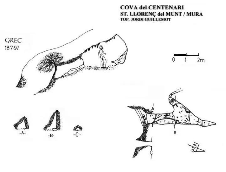
Topografia
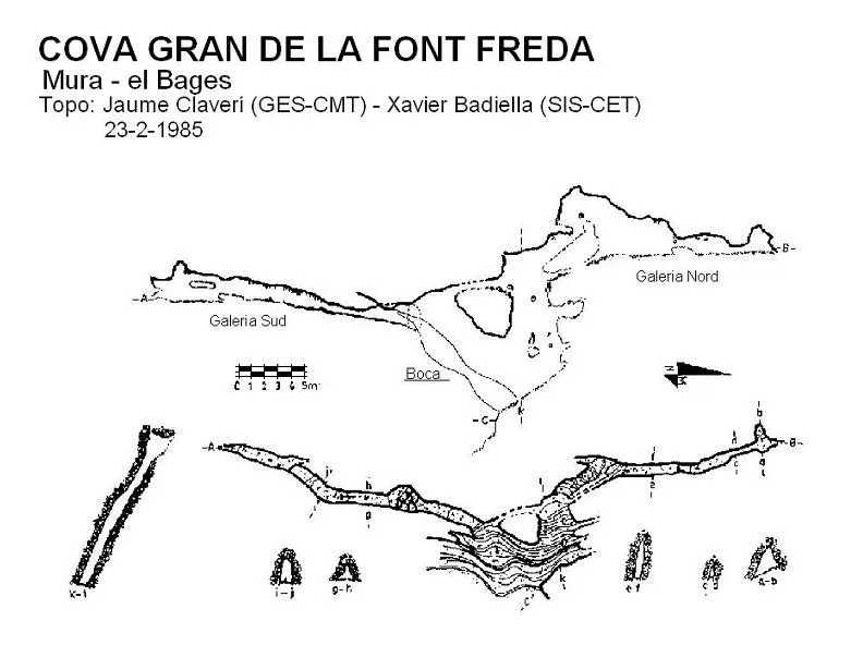
Espeleoindex · CC BY-NC 4.0, https://creativecommons.org/licenses/by-nc/4.0/ · Immagine © del suo autore.
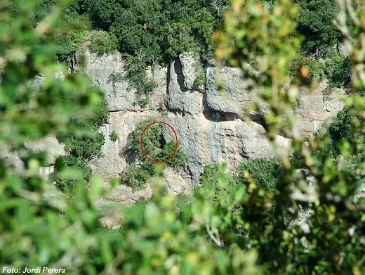
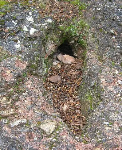
Foto
Espeleoindex · CC BY-NC 4.0, https://creativecommons.org/licenses/by-nc/4.0/ · Immagine © del suo autore.
Descrizione
Morfologia
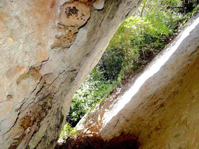
The entrance is very visible, elongated and inclined about 45º, 13 metres long, and appears just as if it were a rock shelter. Once passed, one enters a narrow corridor 6 metres long with a bit of a slope. If we climb up between the walls of the inclined gallery, after 10 metres we can reach a secluded chamber from which another ascending gallery emerges, leading to the head of a new gallery, which is accessed by means of a step that must be easily descended; this continues 5 metres and is not very wide but is tall, and ends in a narrow passage where one must crawl quite a bit, after passing which it continues 8 metres more to a final small chamber where one can almost stand upright.
If from the start of the cave we look at the upper lip of the entrance, we will be able to observe a hole, which can be accessed without much difficulty, and we will find the start of a new gallery that continues in a direction totally opposite to the previous one. At first it is quite tall and wide, but it becomes narrow and low very suddenly. At a scant 2 metres the narrow passage that must be passed becomes difficult (30 x 50 cms.). Once through it, the gallery becomes tall again (1 to 1.5 m.), covered with stalactites and with the floor full of 'gours'; soon it turns slightly, reaching a small step where the gallery has two levels. We will go along the lower one, which is more comfortable, until we once again come upon these two levels where the gallery ends in a corner full of stalagmitic formations.
Concrezioni
In a corner some beautiful stalagmites can be observed that give a little beauty to the chamber.
Storia
Known for a very long time by the woodcutters and charcoal burners who gathered there to have their meals, and it also seems to have been the spot for the discreet recreation of those forest workers. At that time they knew it as the cave or rock shelter of la Tudona, in memory of a lady not very fond of the wood pigeons that hid in the cave and that she went about eliminating with blows of a club.
When the first prospections began (1950's) throughout the torrent de la Font Freda by the GES – CMB, this cave was named Cova nº 2 de la Font Freda and the one that is closer to the spring, of very reduced dimensions and which seems to be currently obstructed, was catalogued as cave nº 1. Years pass and there is almost no news of it, except for being related (and badly located) on the maps of the Editorial Alpina of the time.
In October 1977, members of the Penya Excursionista Guimerà (Barcelona) explore and survey the cavity, wrongly naming it Cova del Topi. We do not know if the upper galleries were already known by the people of the GES or if it was a first exploration by those of the GEPEG. This survey has gone almost unnoticed and was only seen in a collection of works, of internal order of the group and of minimal diffusion.
In 1985, members of the SIS and of the GES-Terrassa explore it, survey it and publish it. The speleometric data of these are less generous than those of the GEPEG.
Commenti degli utenti (0)
Nessun commento ancora.
Sii il primo a condividere la tua esperienza!
Esplorazioni registrate (0)
Nessuna esplorazione registrata.
Registra la tua visita a questa grotta!
Bibliografia
- Badiella, Xavier (1985).- “Les coves de la Font Freda”. Arxiu del Centre Excursionista de Terrassa (40-41): 914-917. Terrassa
- Altres dades i fotografia extreta del blog: trailsantllorenc (de Lluís R. Hernández, de Matadepera)
Grotte vicine


Fonte: Espeleoindex (espeleoindex.com), modificato. CC BY-NC 4.0, https://creativecommons.org/licenses/by-nc/4.0/