
Cova del Pouet
Small cave with a 9-metre passage in Navés, with a funnel-shaped entrance and an oval chamber.
EspeleoWorld
Cova del Pouet
Small cave with a 9-metre passage in Navés, with a funnel-shaped entrance and an oval chamber.
Navès · Solsonès
Sviluppo: 9 m · Profondità: 4 m
Scheda aggiornata
https://espeleoworld.com/it/c/cova-del-pouet
Le informazioni possono cambiare. Verifica sempre coordinate, accesso, meteo e condizioni della cavità prima di partire.
Small cave with a 9-metre passage in Navés, with a funnel-shaped entrance and an oval chamber.
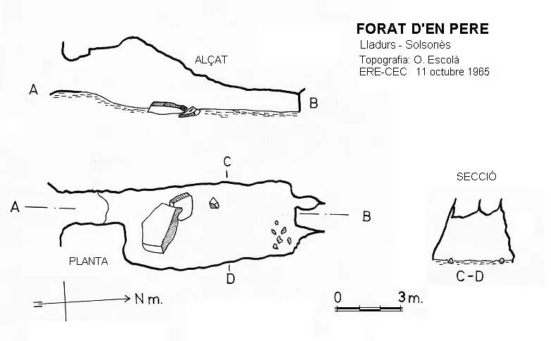
Topografia
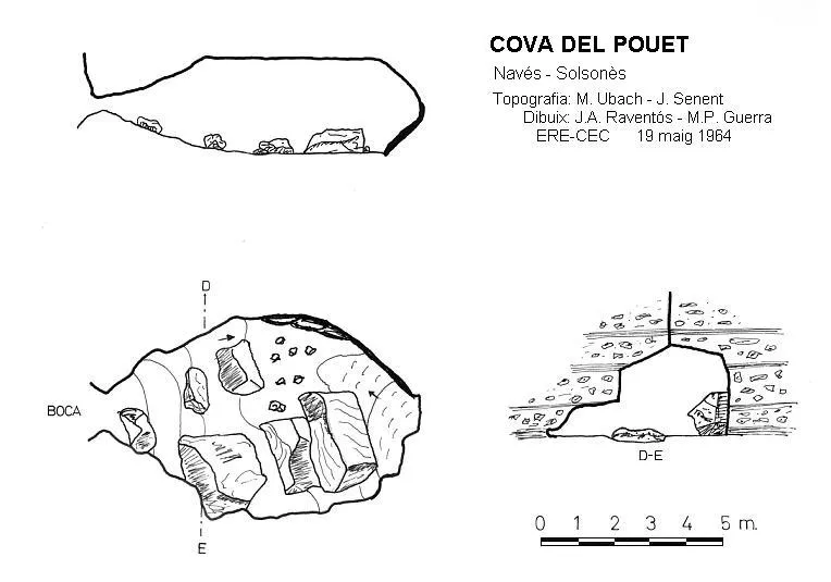
Espeleoindex · CC BY-NC 4.0, https://creativecommons.org/licenses/by-nc/4.0/ · Immagine © del suo autore.
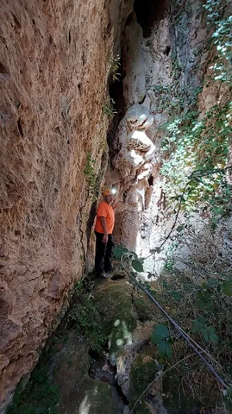
Foto
Espeleoindex · CC BY-NC 4.0, https://creativecommons.org/licenses/by-nc/4.0/ · Immagine © del suo autore.
Descrizione
Morfologia
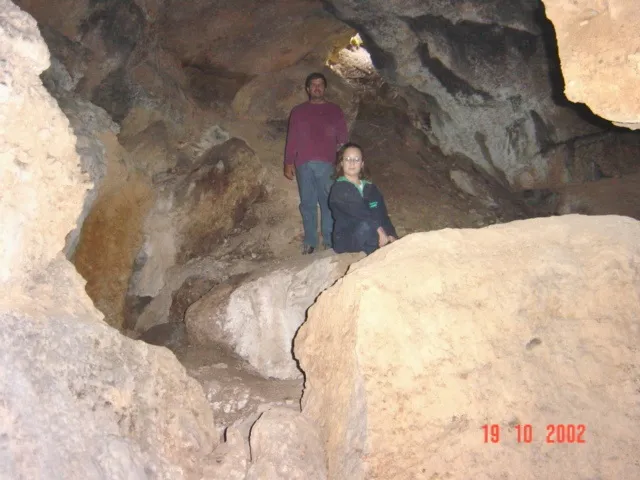
It has a funnel-shaped entrance, with dimensions of approximately 0.50x1.50 metres, followed by a slope that gives way to an oval chamber with a flat ceiling, occupied by blocks of regular dimensions.
Concrezioni
In the deepest part of the chamber a parietal flowstone develops.
Progressione
To access it from the C-462 road from Solsona to the Llosa del Cavall, we will take a track located on the left side just before reaching the Cavall farmhouse, we will follow the track to the left until the first crossroads which we will follow to the right, a little further on we find a new crossroads where we will follow to the left, after a long stretch of track we find another crossroads, we will follow to the right in a sharp bend, a new crossroads which we will follow to the left, the track continues uphill and with sharp bends, passing by an artificial pond, a new crossroads which we will follow to the right, shortly after we will pass under a power line, a sharp bend to the right and we will arrive at a new crossroads where there is an electricity pylon on a rocky spur. We will follow the track on the left, until we reach a bend to the right going uphill, at the end of which along an abandoned path on the left we can climb up to the balma dels Pilans, it is a small rock shelter with a natural pillar that supports the ceiling. Back on the track, this levels out until reaching a wire fence, a few metres further on to the left, we will follow a path kept open by the passing of cows. At about one hundred metres, we will enter the forest on the right, and inside the forest on the slope, we will find the entrance of the cave hidden.
Storia
Explored by the EDES between 14 and 19 April 1963.
Commenti degli utenti (0)
Nessun commento ancora.
Sii il primo a condividere la tua esperienza!
Esplorazioni registrate (0)
Nessuna esplorazione registrata.
Registra la tua visita a questa grotta!
Bibliografia
Borràs,J; Miñarro,J.M; Talavera,F.(1980).-”l'Urgell, el Solsonès, la Segarra i el Berguedà”. Catàleg Espeleològic de Catalunya (vol 5):1-233. Ed. Políglota. Barcelona.
Codina,S.(2004).-”Cova el Pouet”. Corriol (133):14-15. CE Solsonès.
Ubach, Montserrat; Escolà, Oleguer.(1968).-”Operació Solsonès – campanyes 1962 a 1965 (primera etapa). Espeleòleg (5):158-162. ERE-Centre Excursionista de Catalunya.
Valles, Jordi de (2009).-”Alt Urgell, Noguera, Pla d'Urgell, Segarra, Solsonès, Urgell”. Catàleg Espeleològic de Catalunya (vol.2):1-384. EC Gràcia / FCE
Coordenades i fotografia aportades per Salvador Codina. Març de 2024.
Grotte vicine


Fonte: Espeleoindex (espeleoindex.com), modificato. CC BY-NC 4.0, https://creativecommons.org/licenses/by-nc/4.0/